List of maps in Garforth Neighbourhood Plan
|
Map
|
|
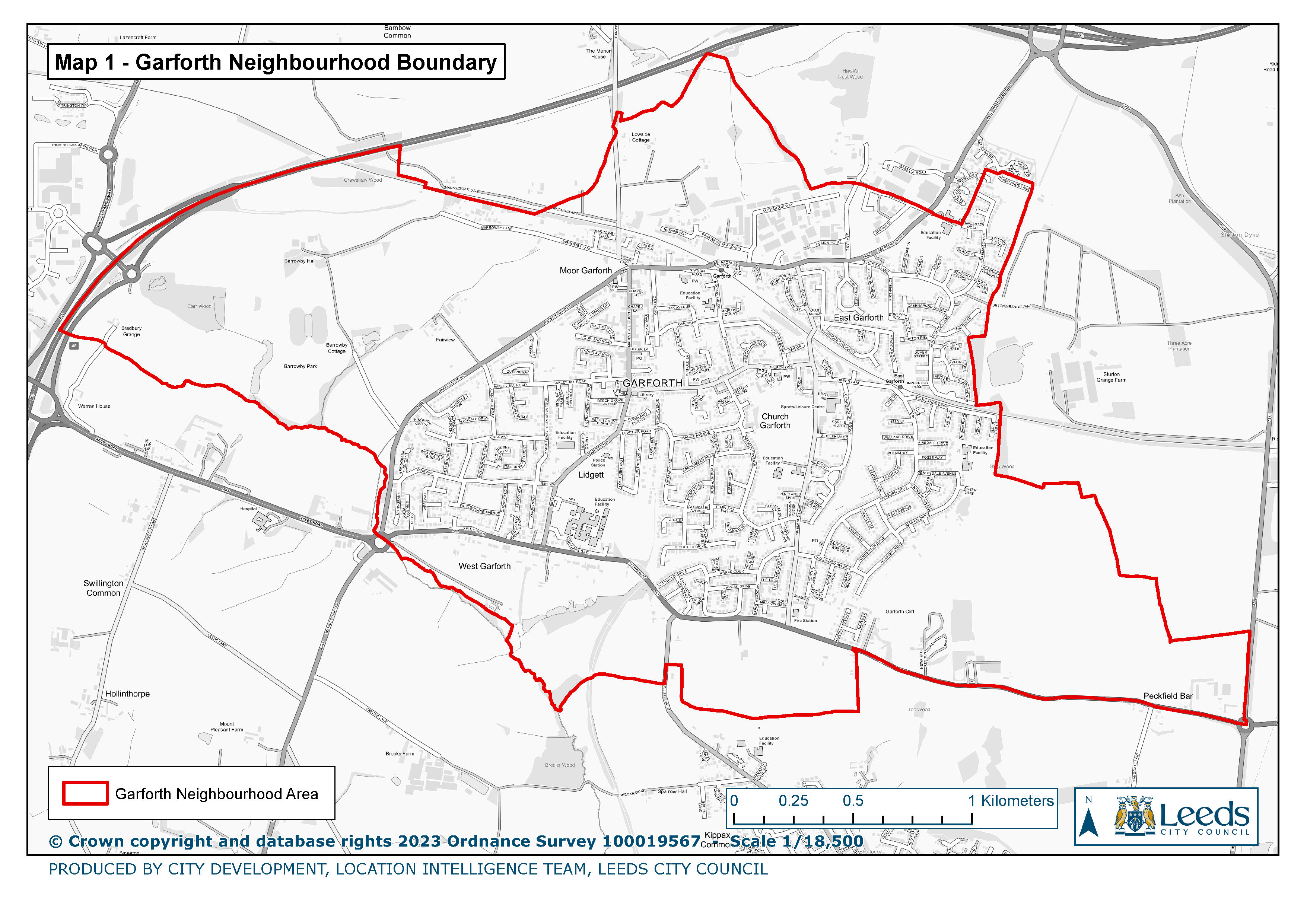
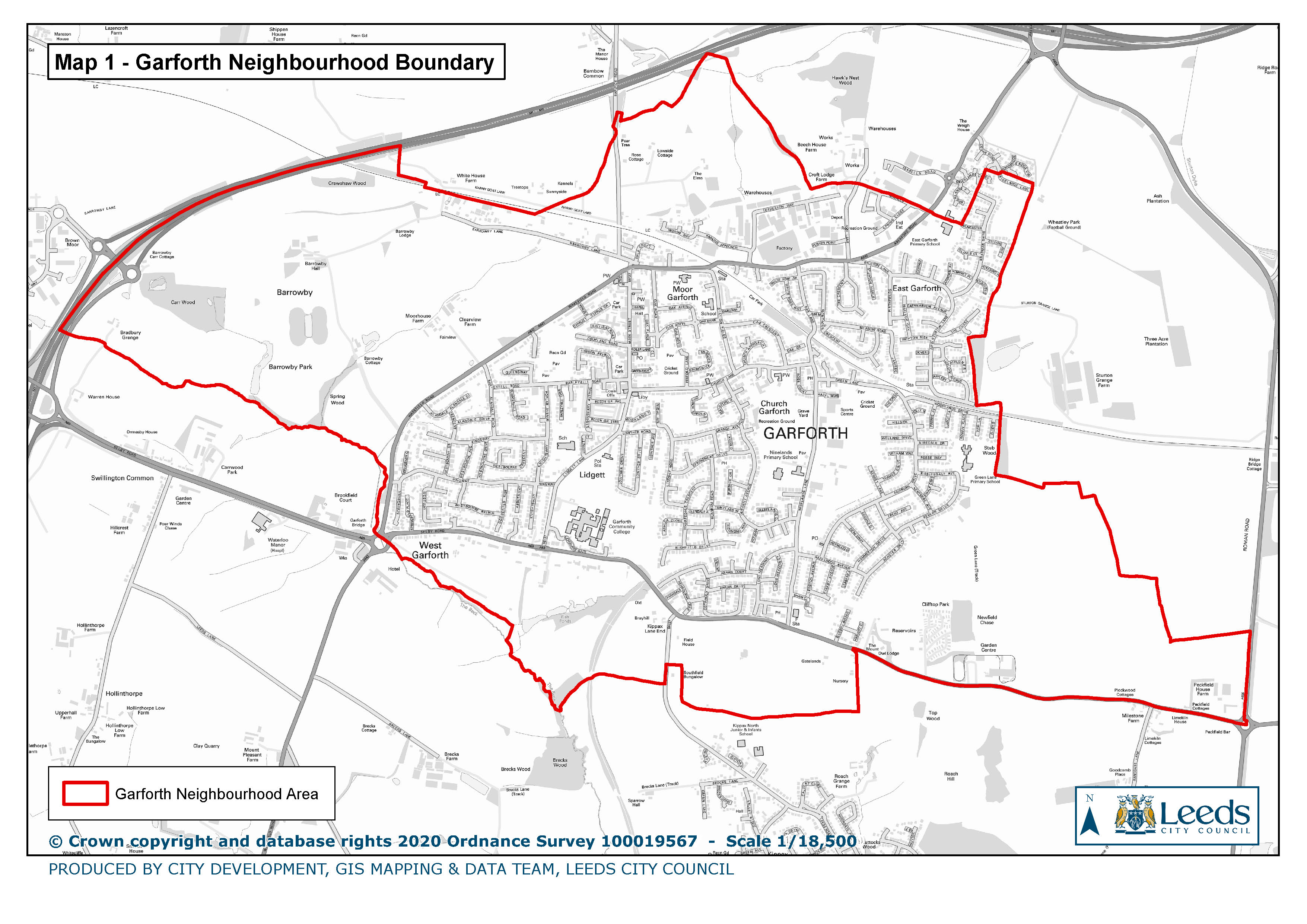
1. Garforth Neighbourhood Boundary
|
|
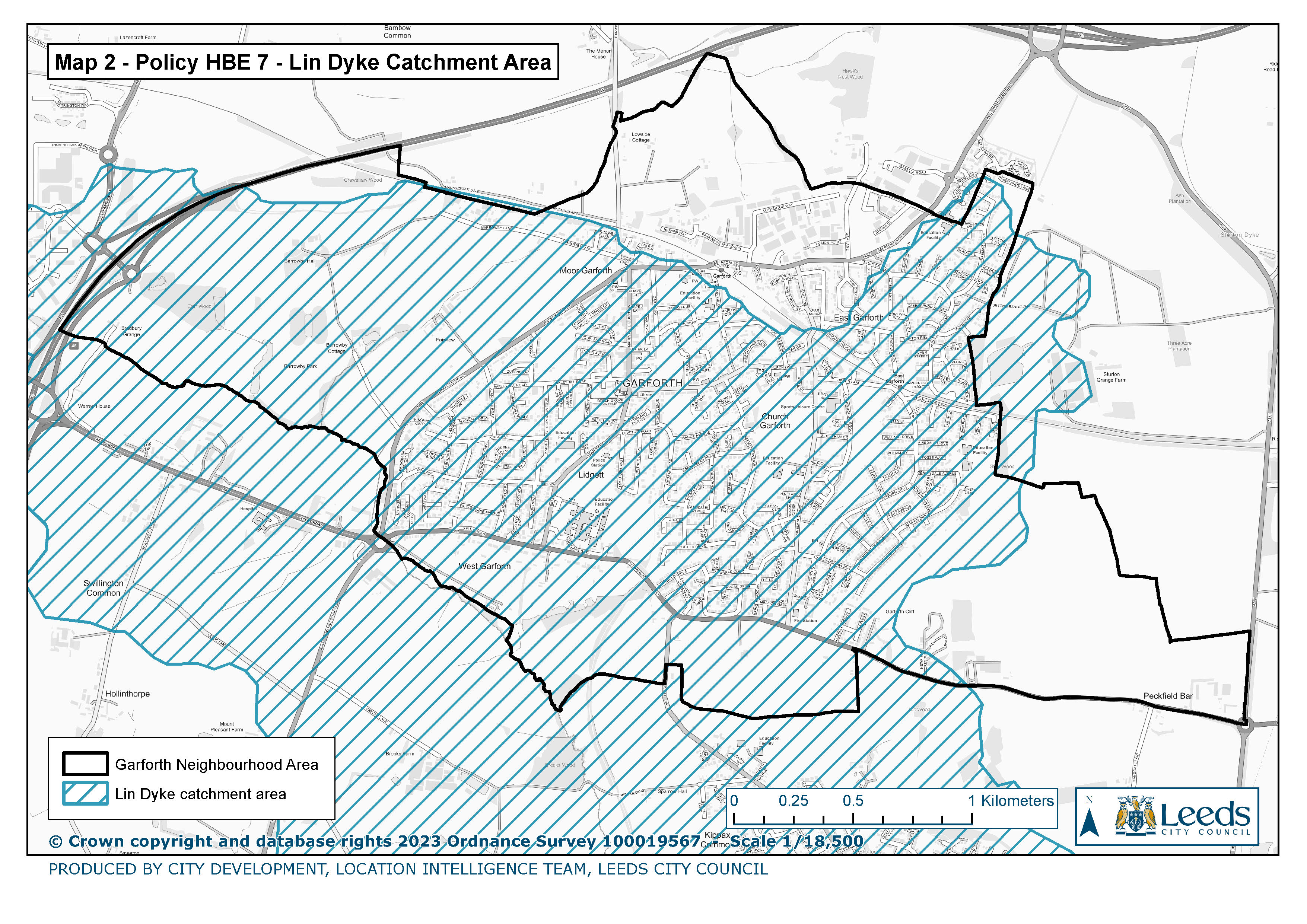
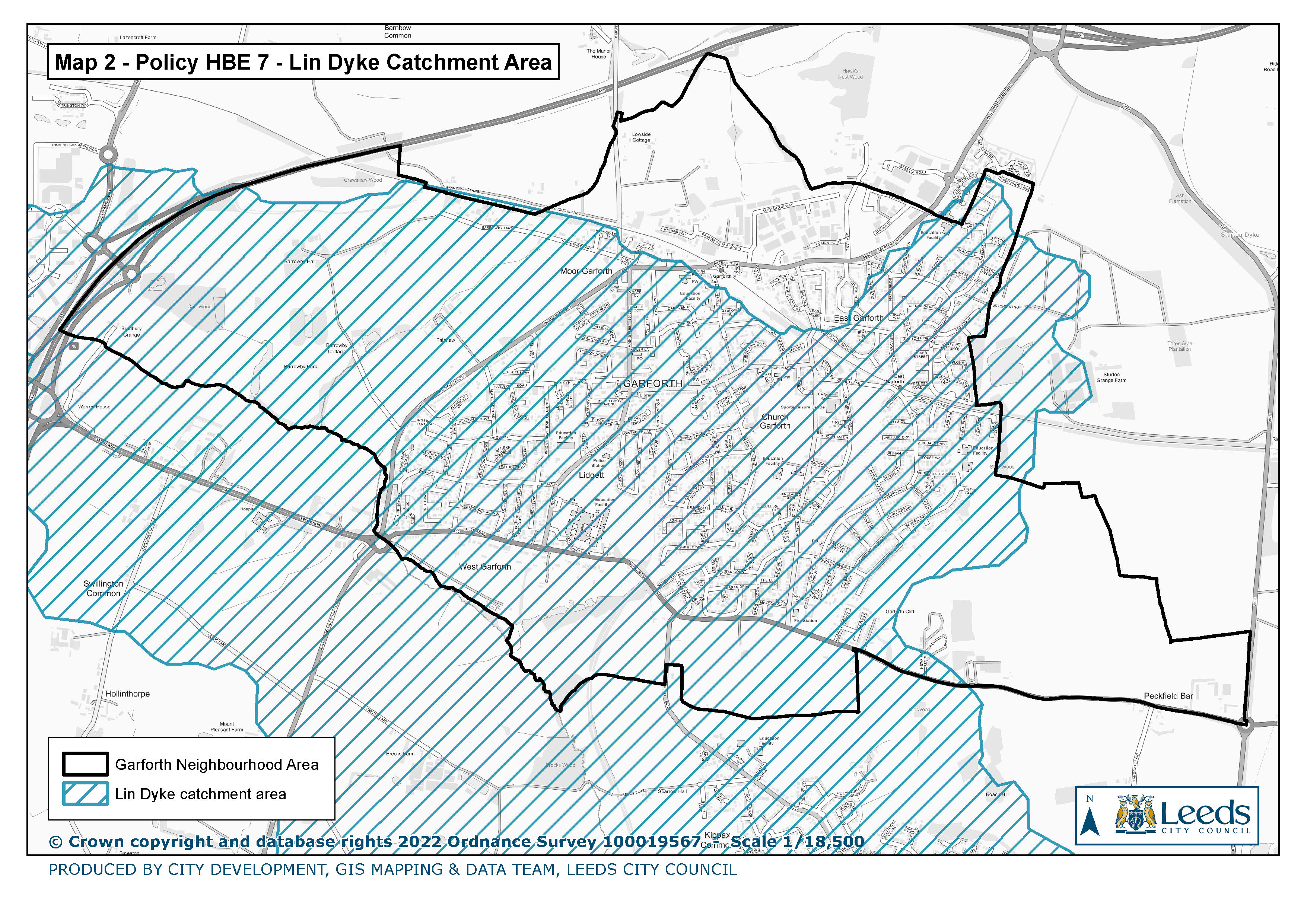
2. Policy HBE 7 Lin Dyke Catchment Area
|
|
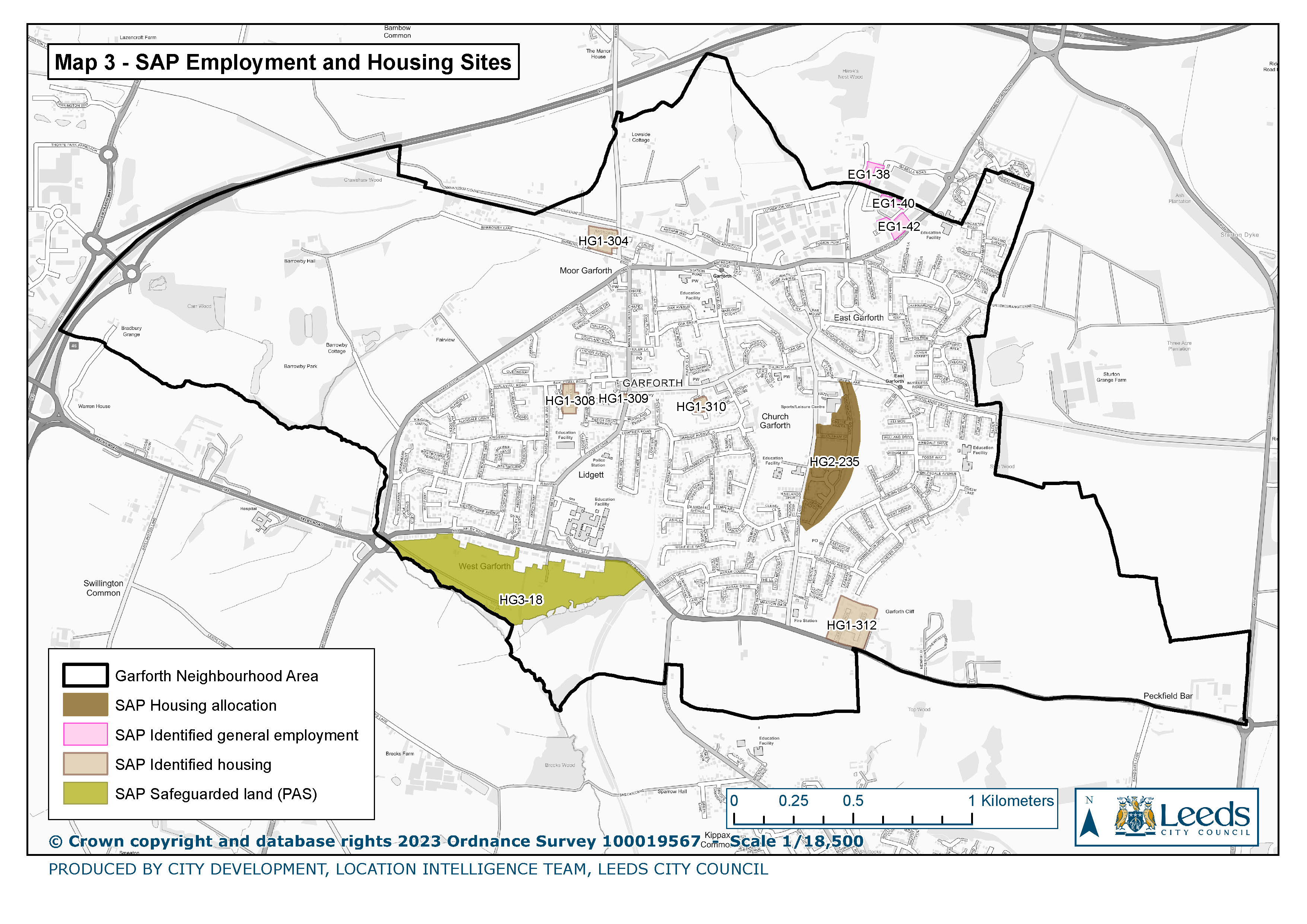
3. SAP Employment and Housing Sites
|
|
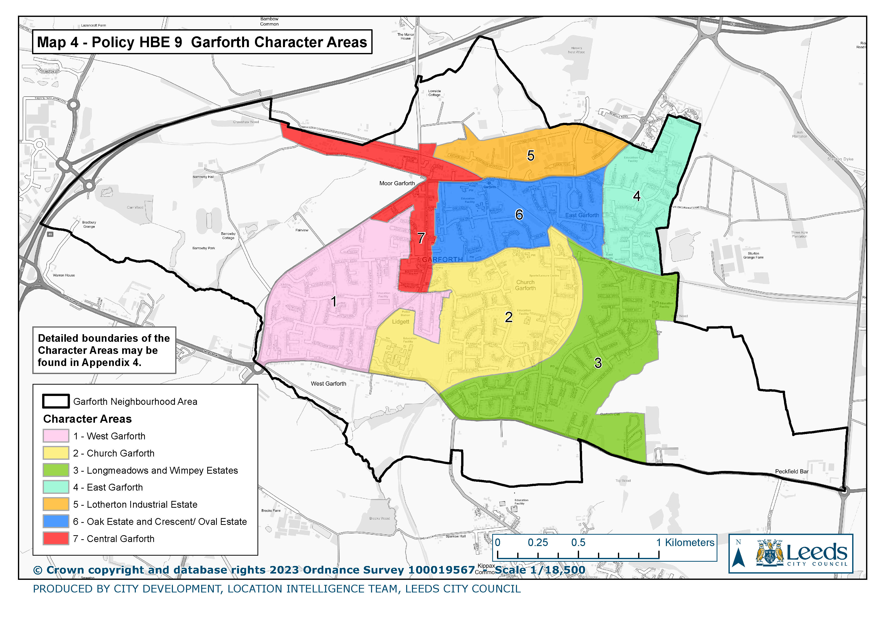
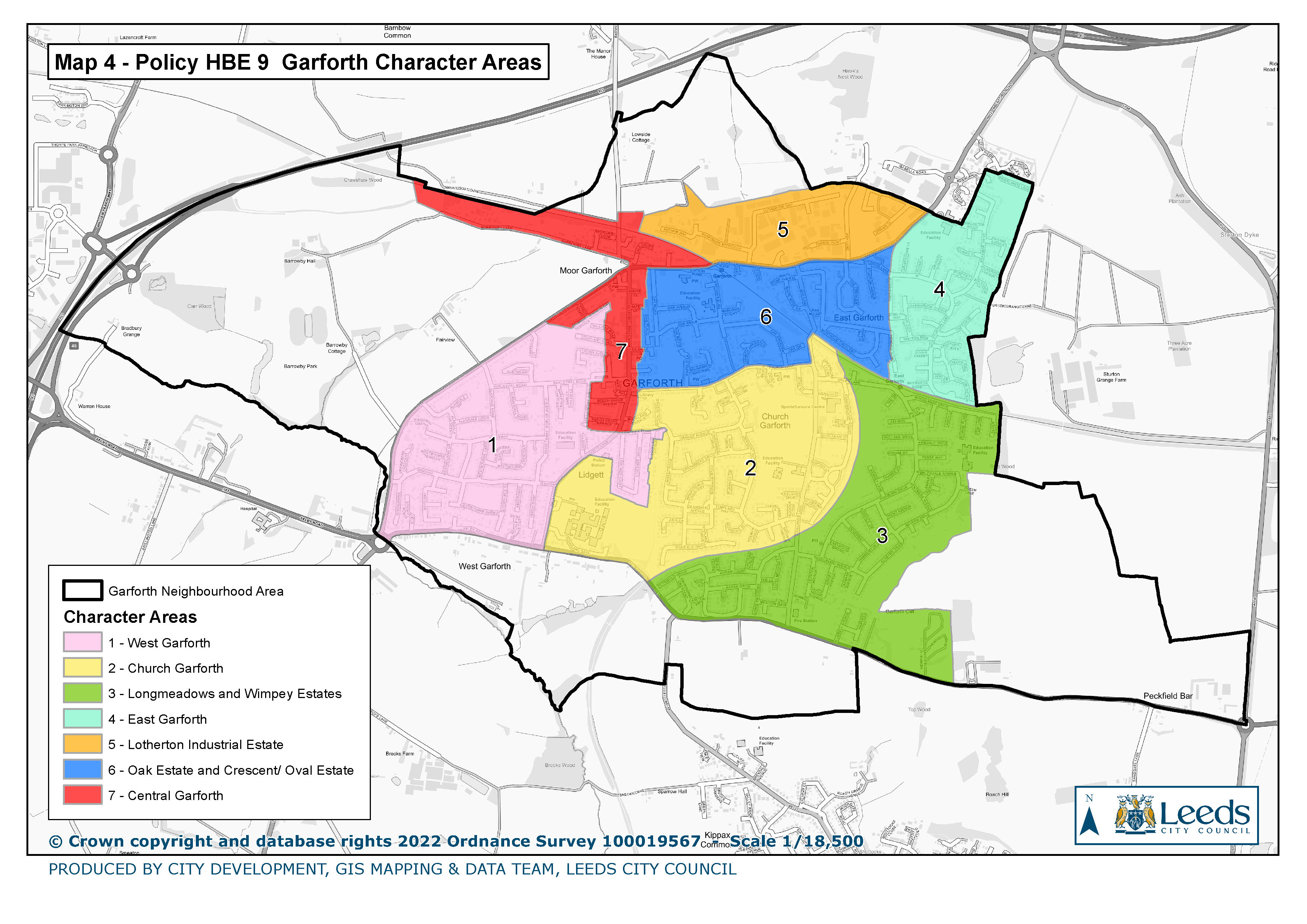
4. Policy HBE 9 Garforth Character Areas
|
|
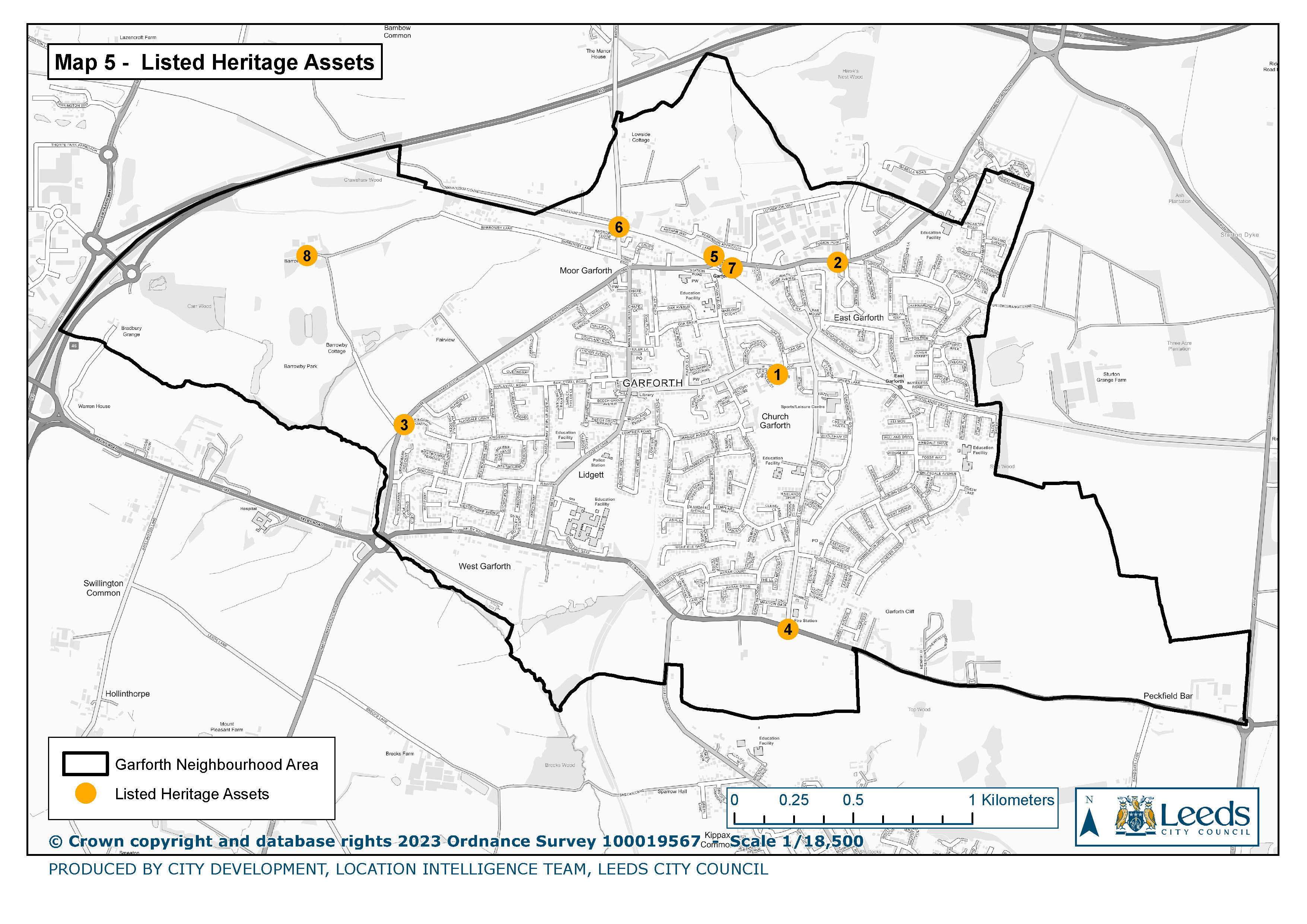
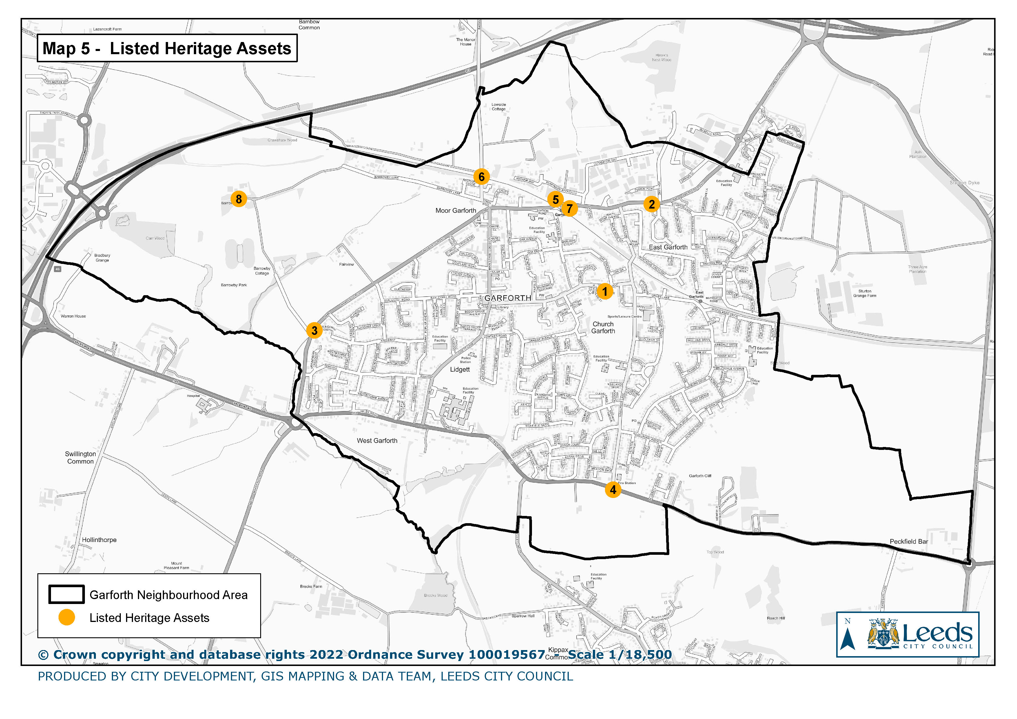
5. Listed Heritage Assets
|
|
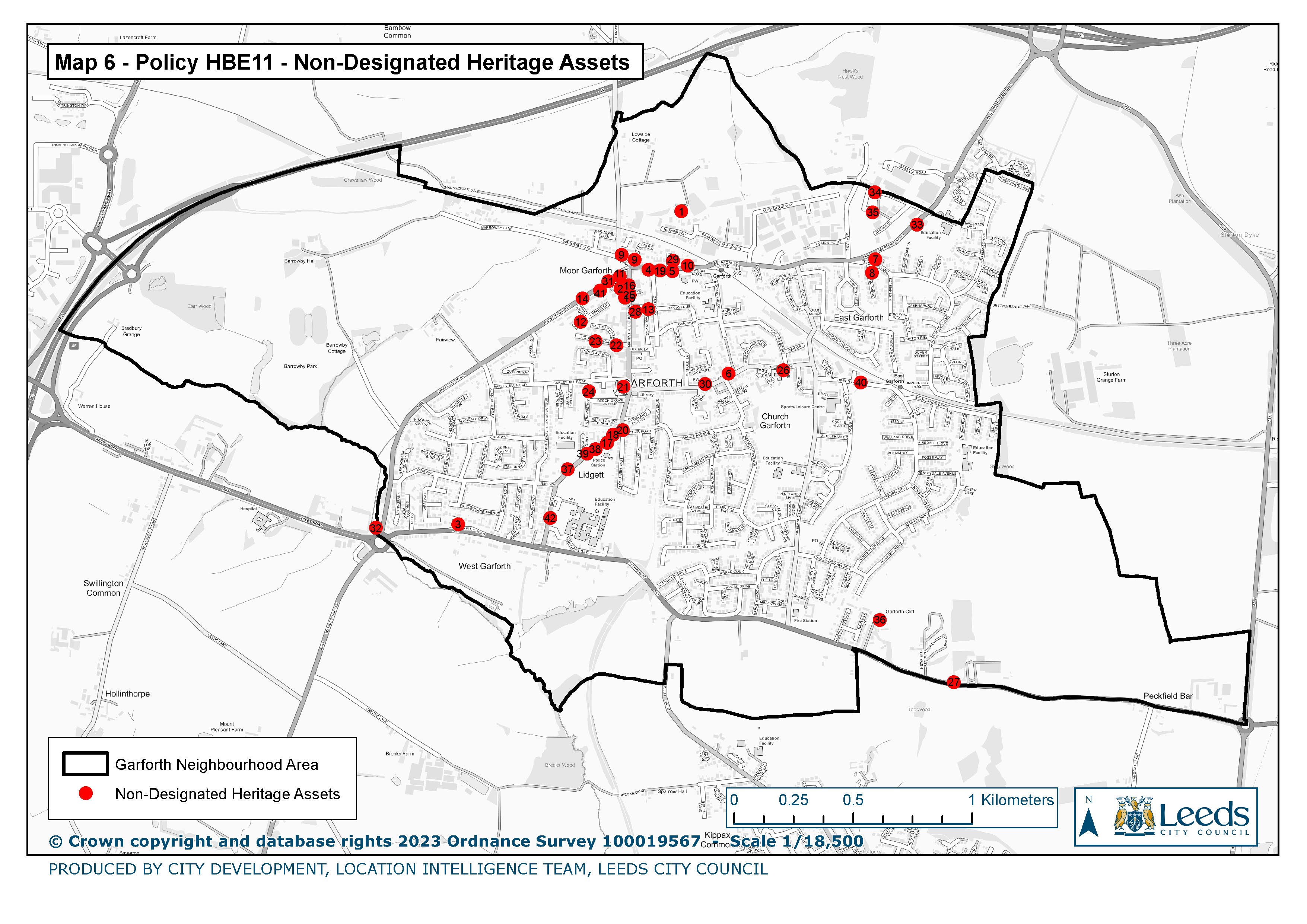
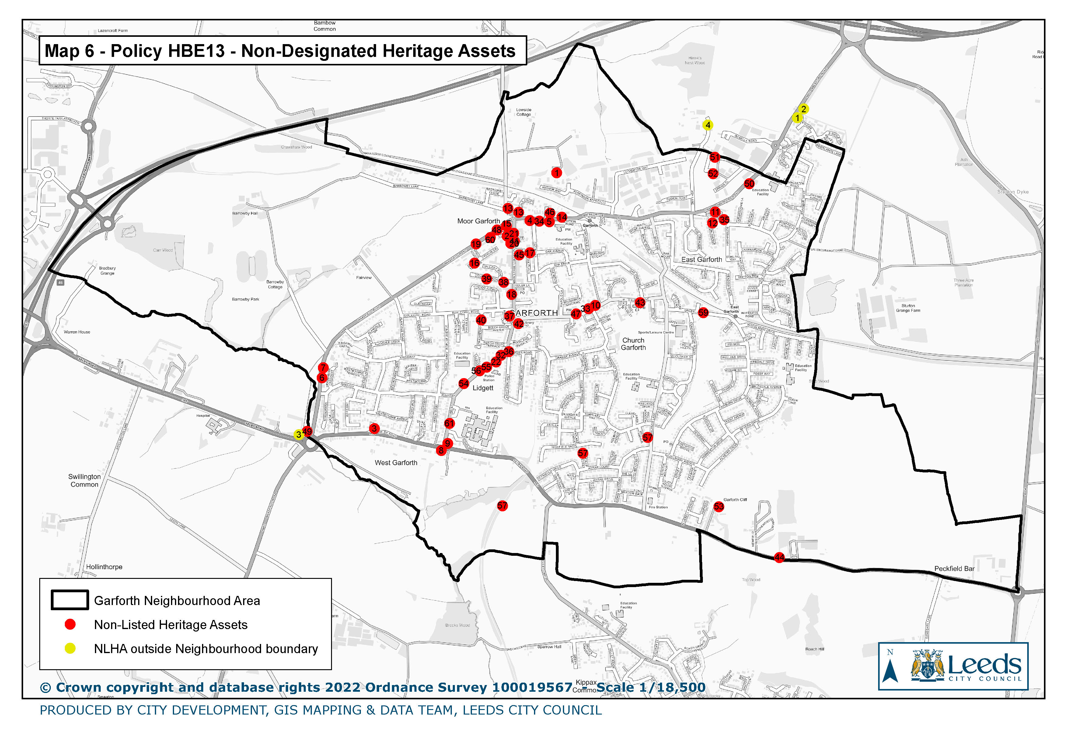
6. Policy HBE 11 Non-designated Heritage Assets
|
|
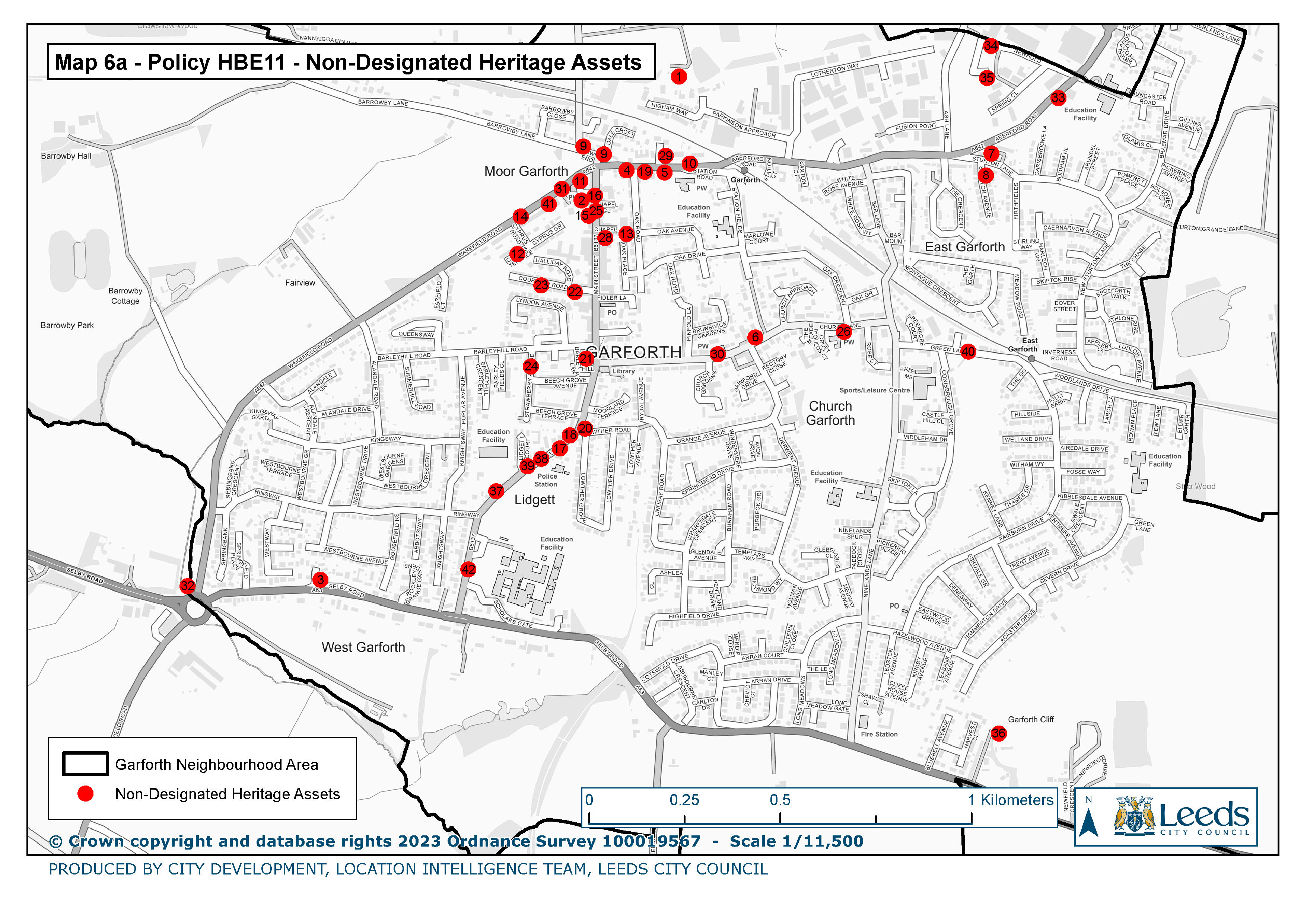
6a Policy HBE 11 Non-designated Heritage Assets
|
|
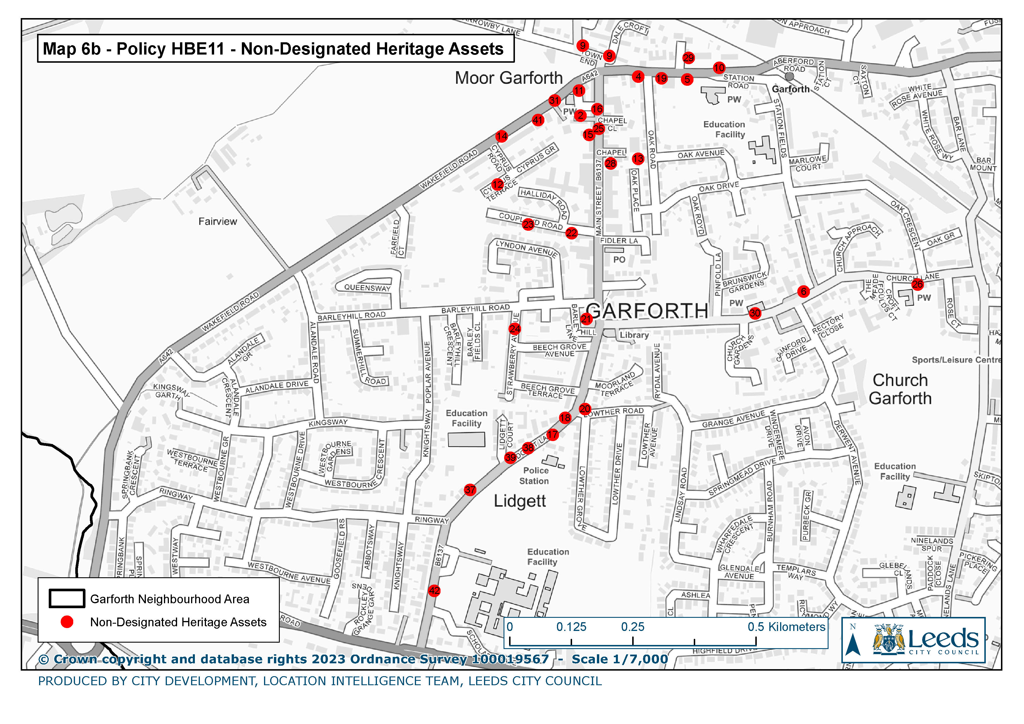
6b Policy HBE 11 Non-designated Heritage Assets
|
|
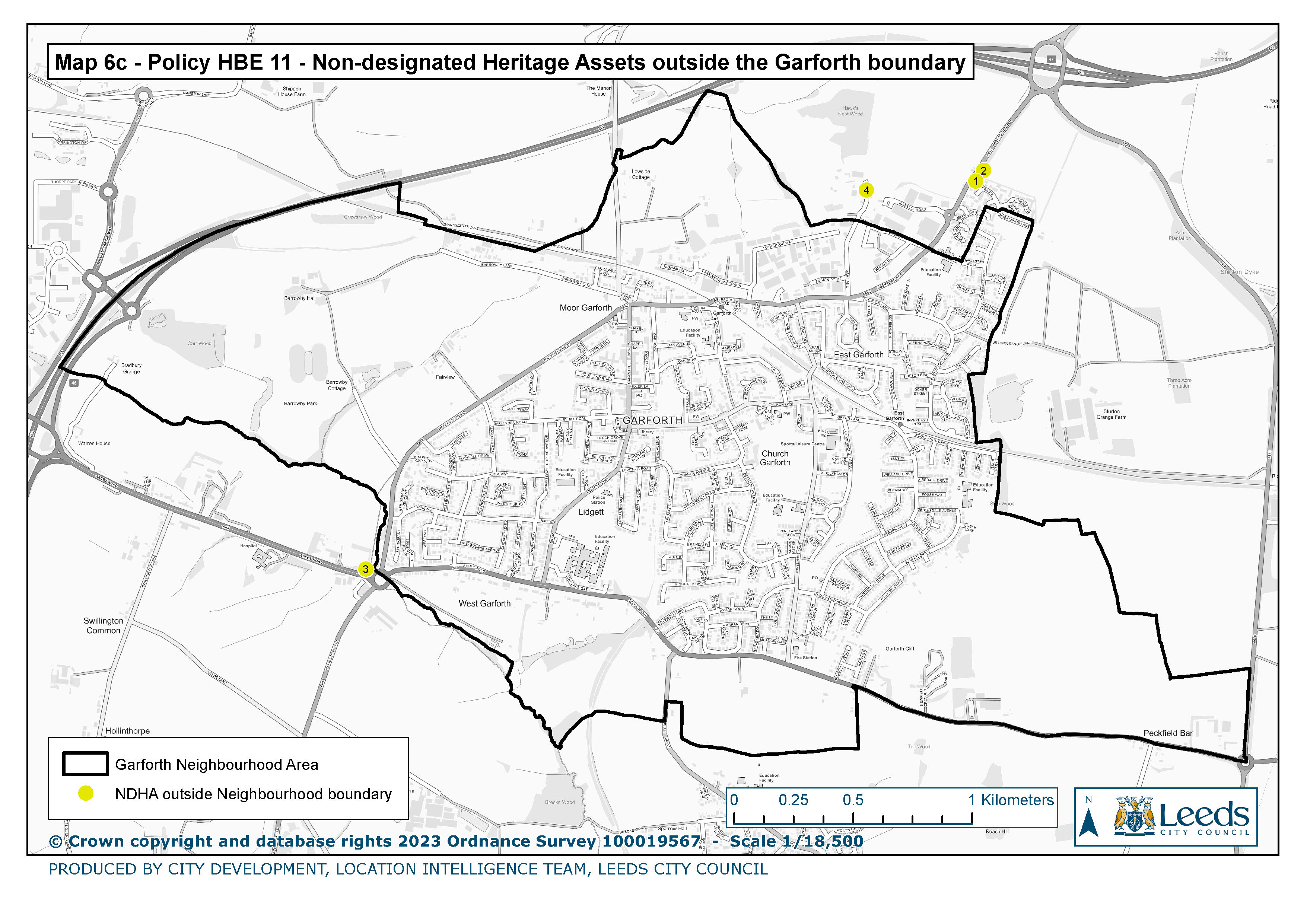
6c Policy HBE 11 Non-designated Heritage Assets outside the Garforth Boundary
|
|
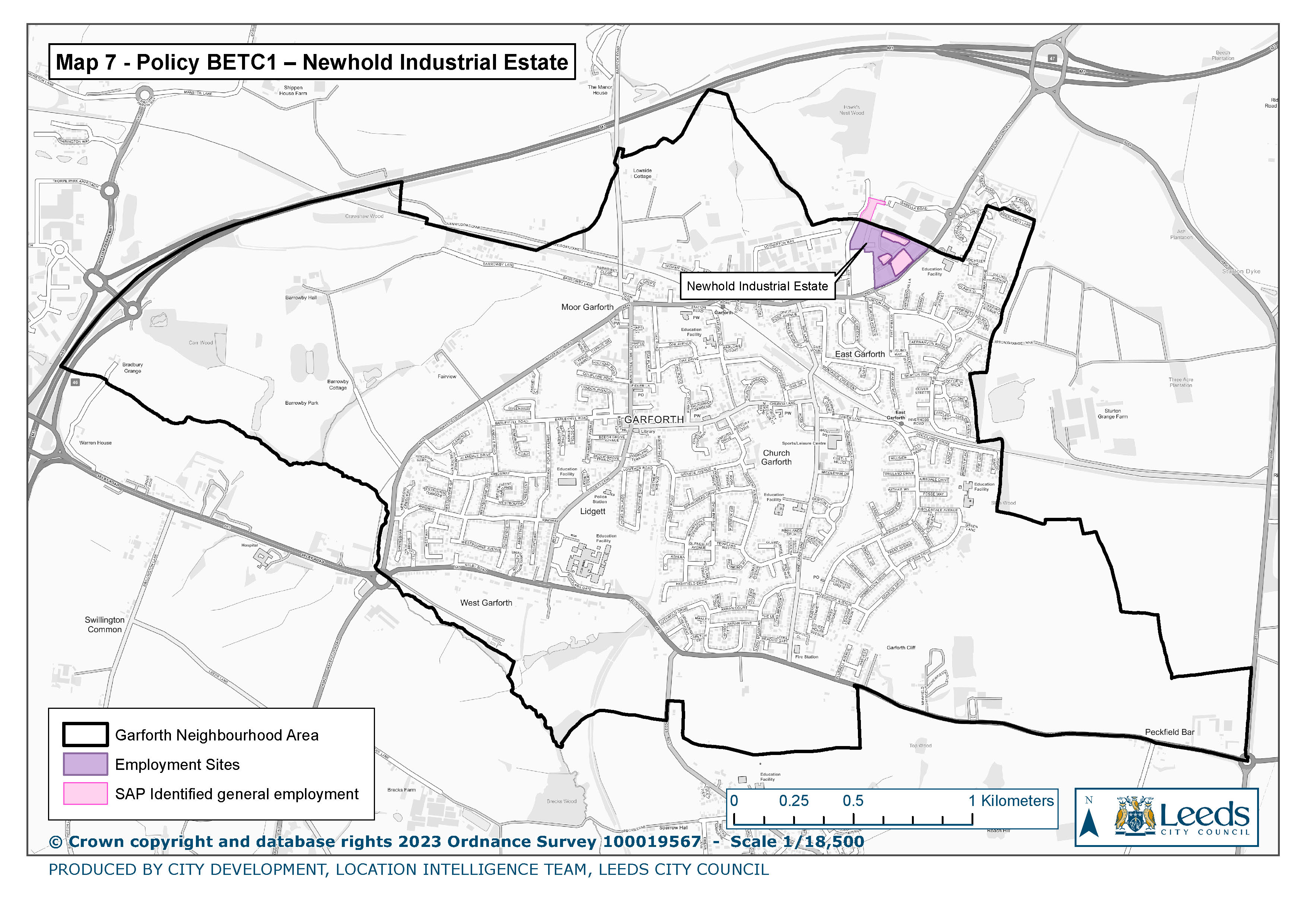
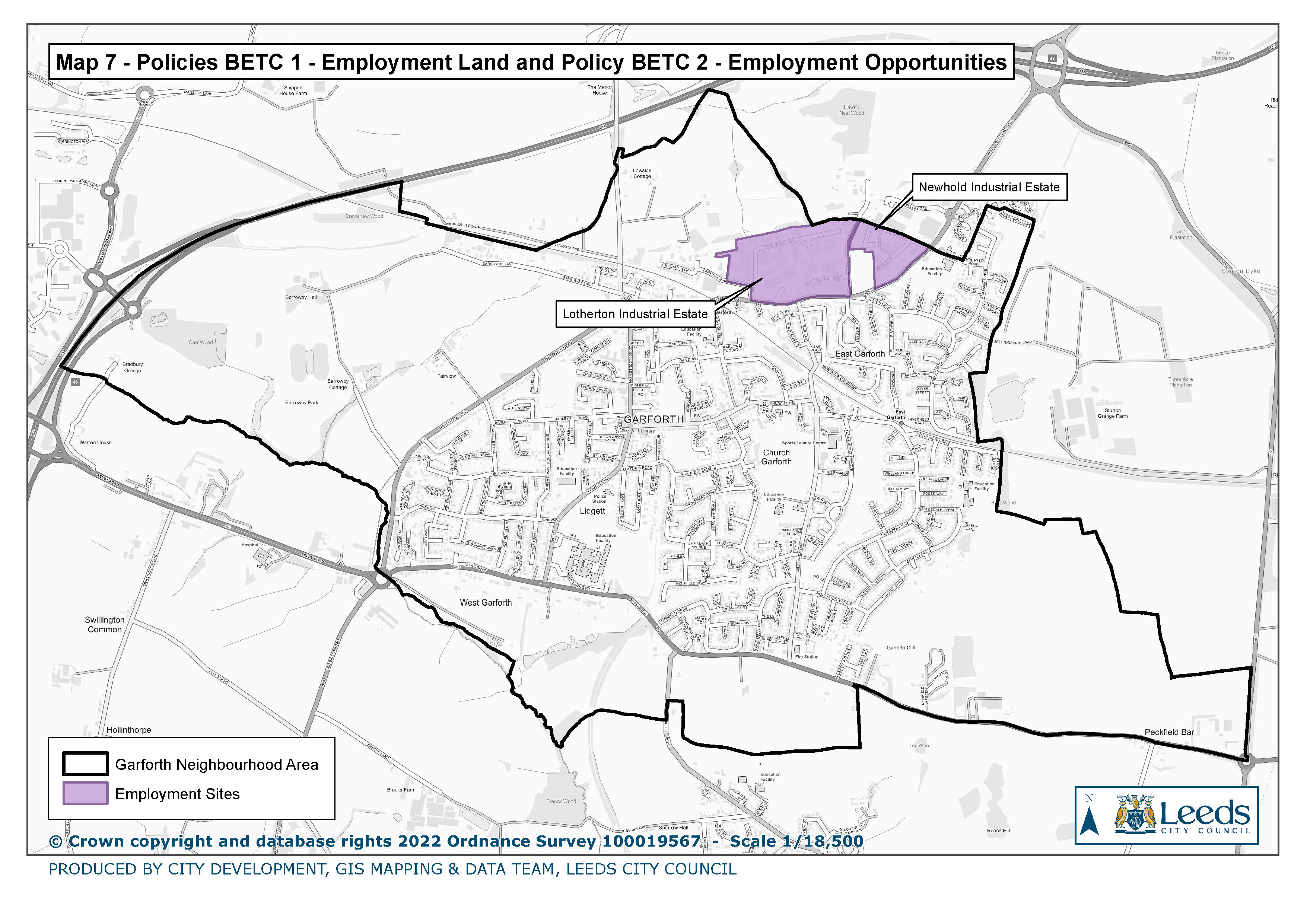
7. Policy BETC 1 Newhold Industrial Estate
|
|
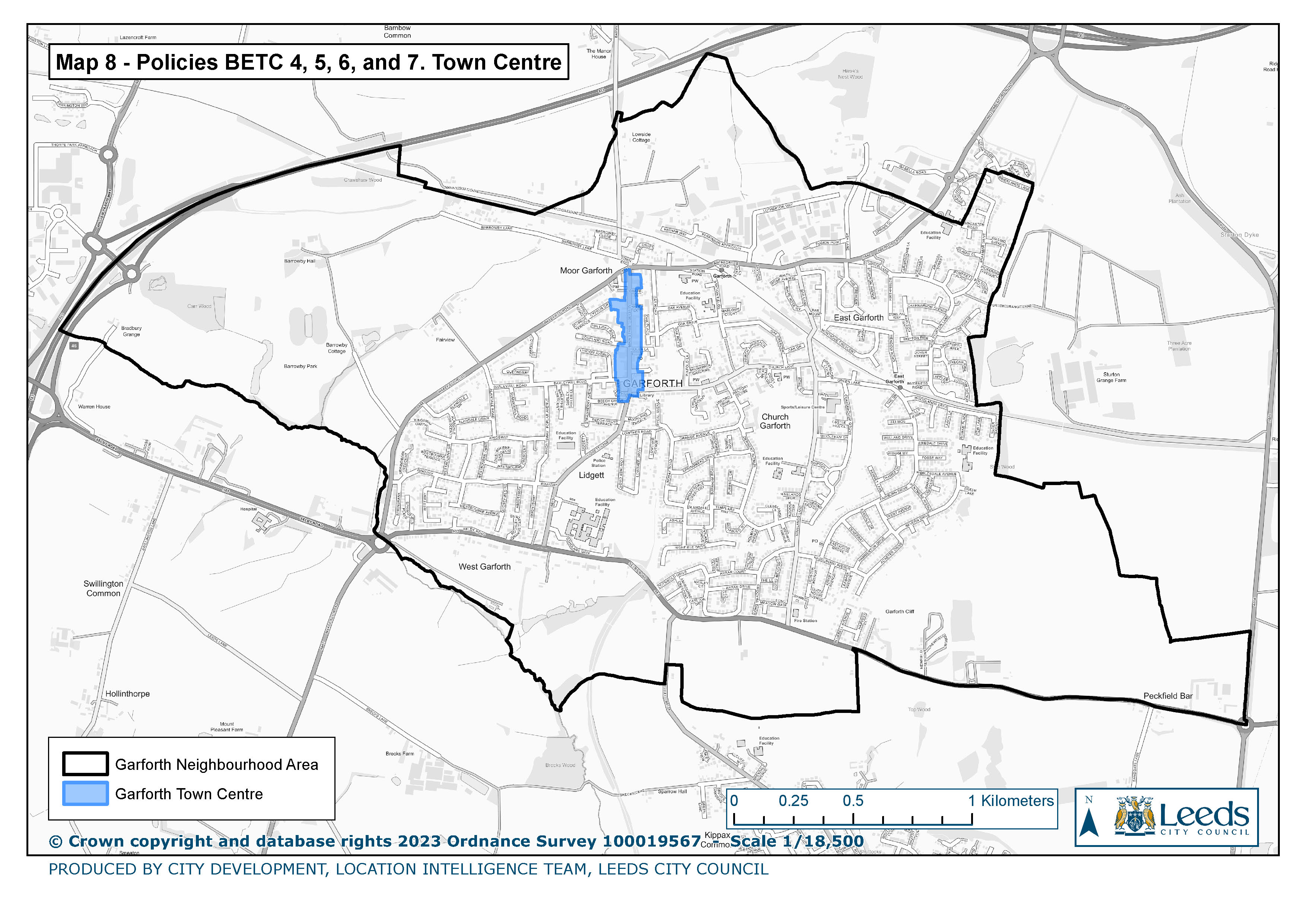
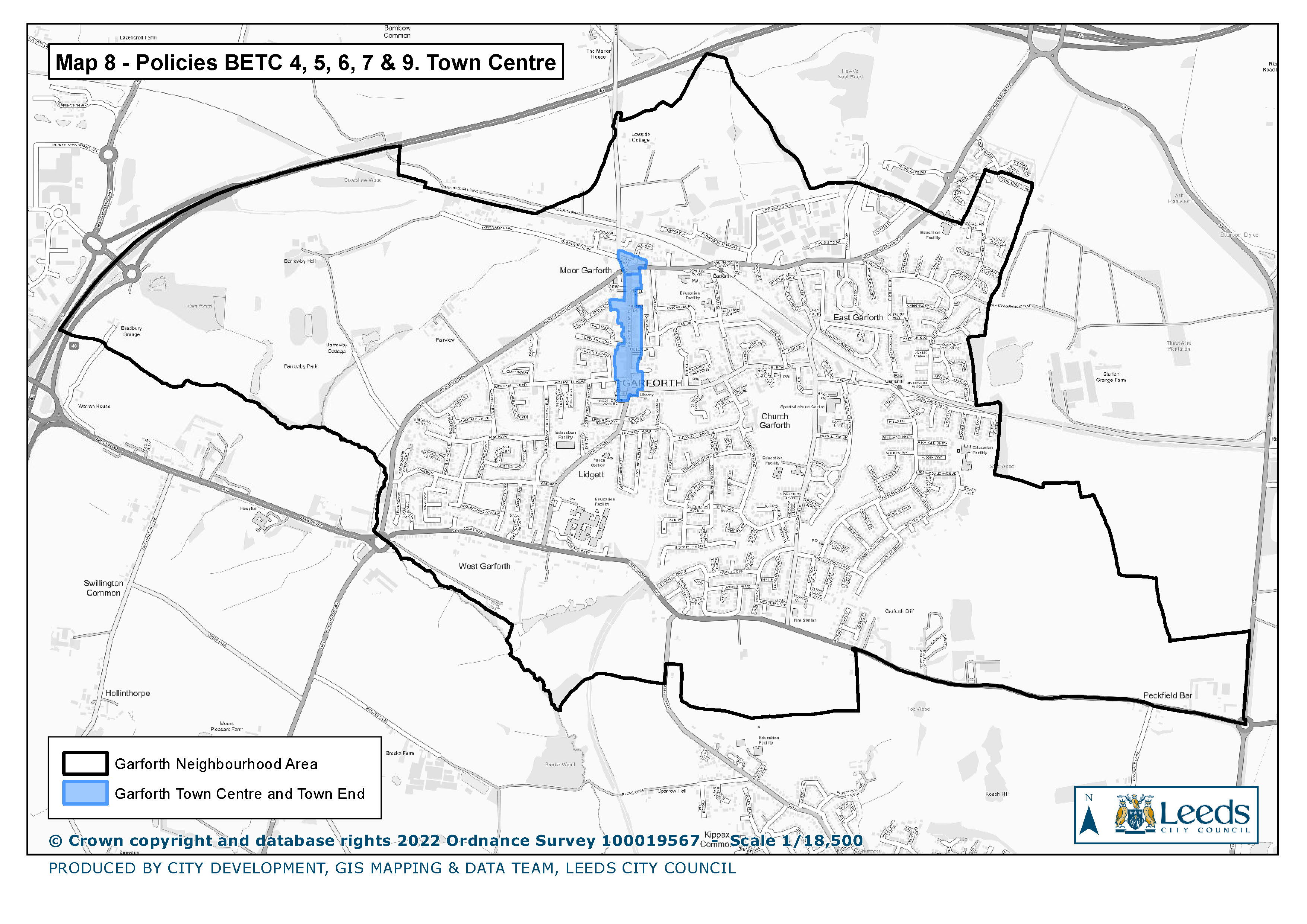
8. Policies BETC 4, 5, 6, & 7. Town Centre
|
|
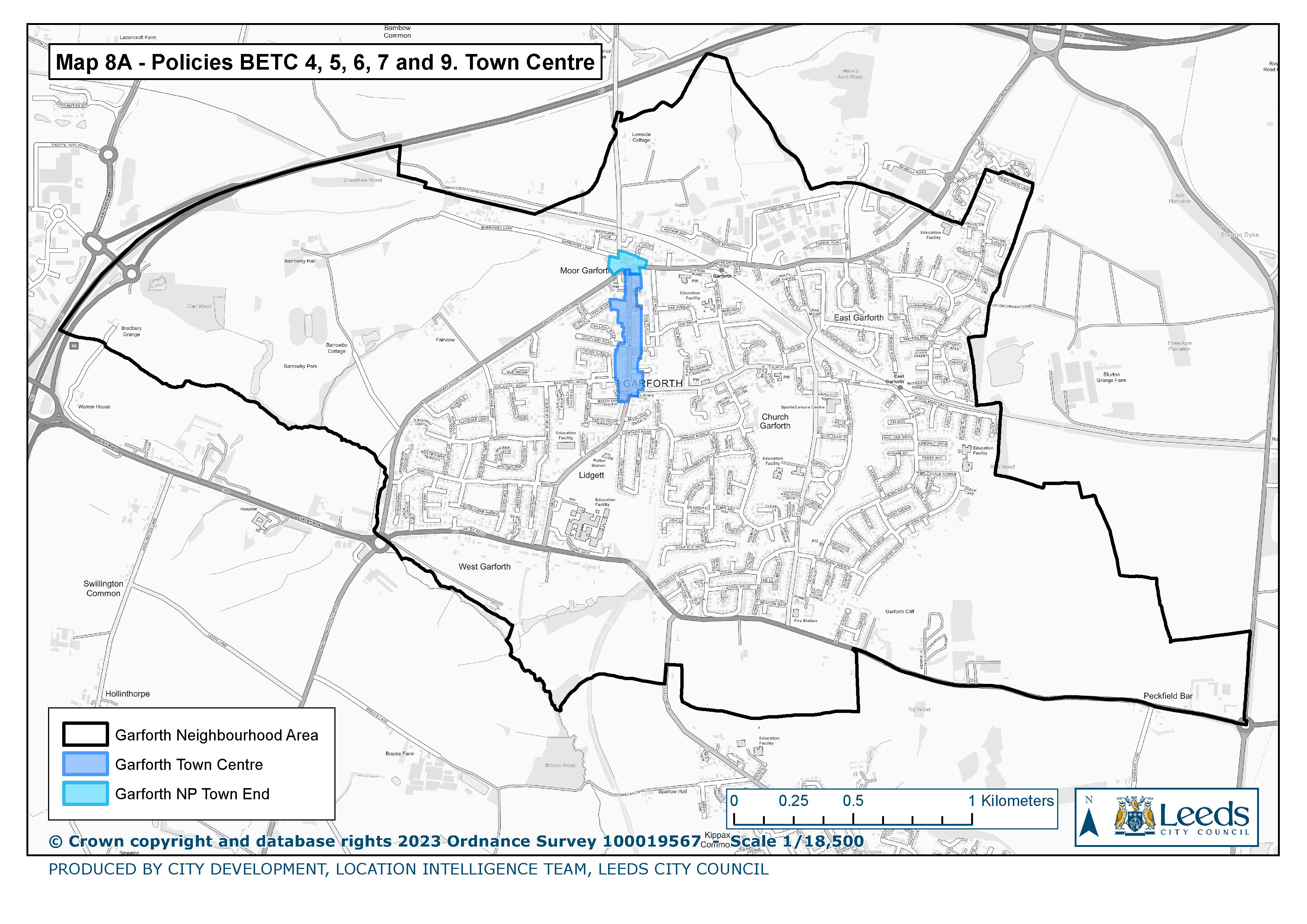
8a Policies BETC 4, 5, 6, 7 & 9. Town Centre
|
|
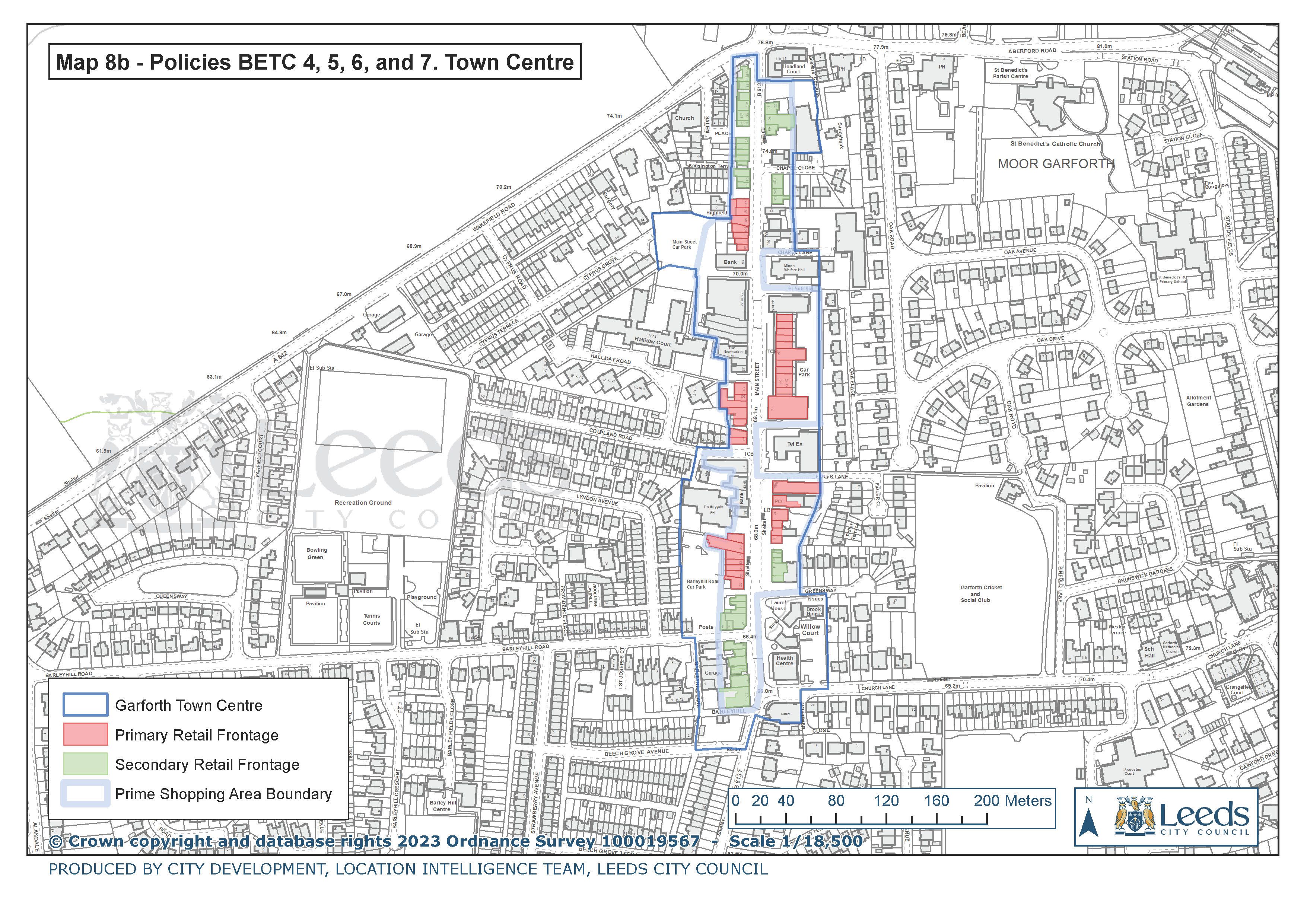
8b Policies BETC 4, 5, 6, & 7. Town Centre
|
|
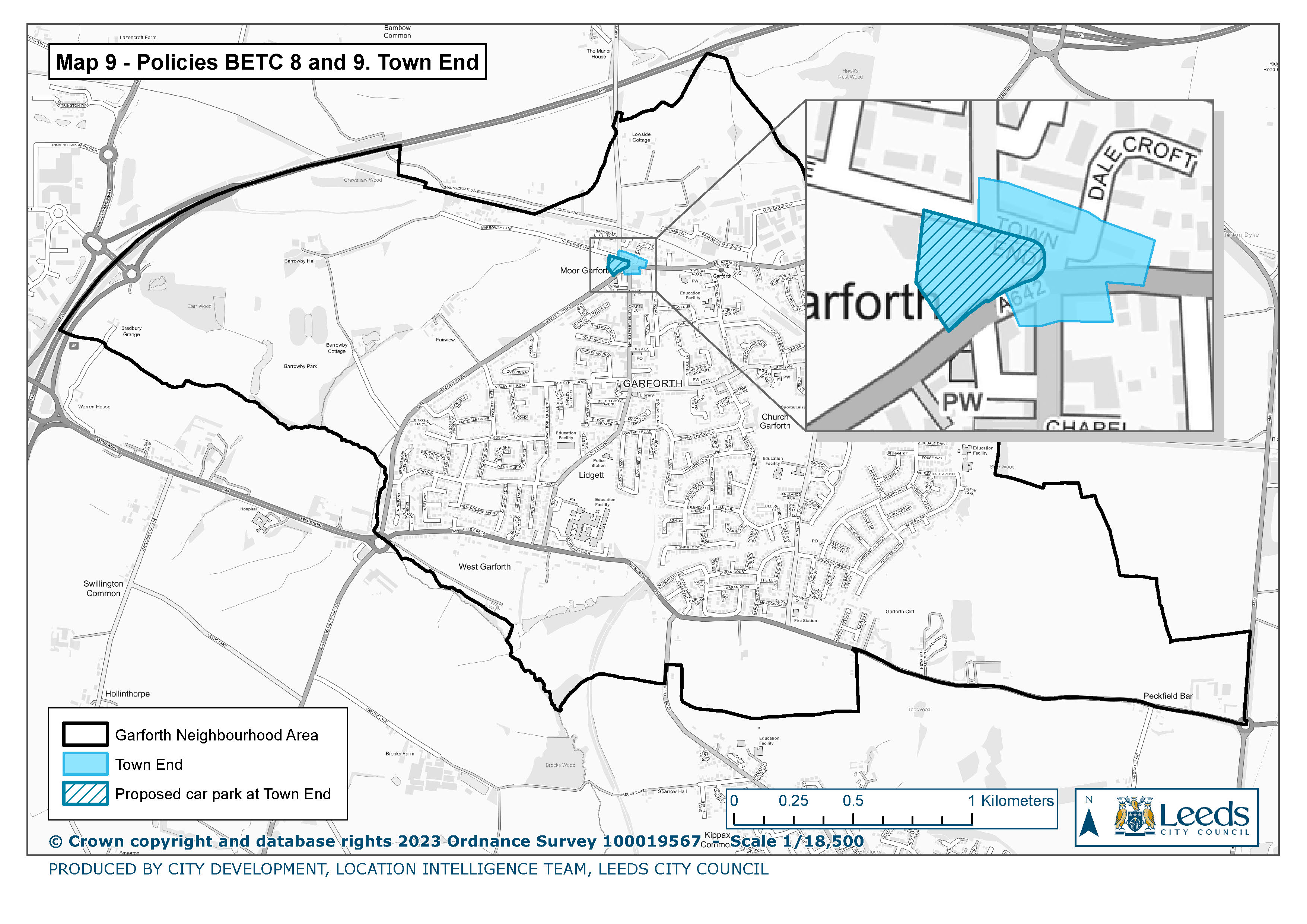
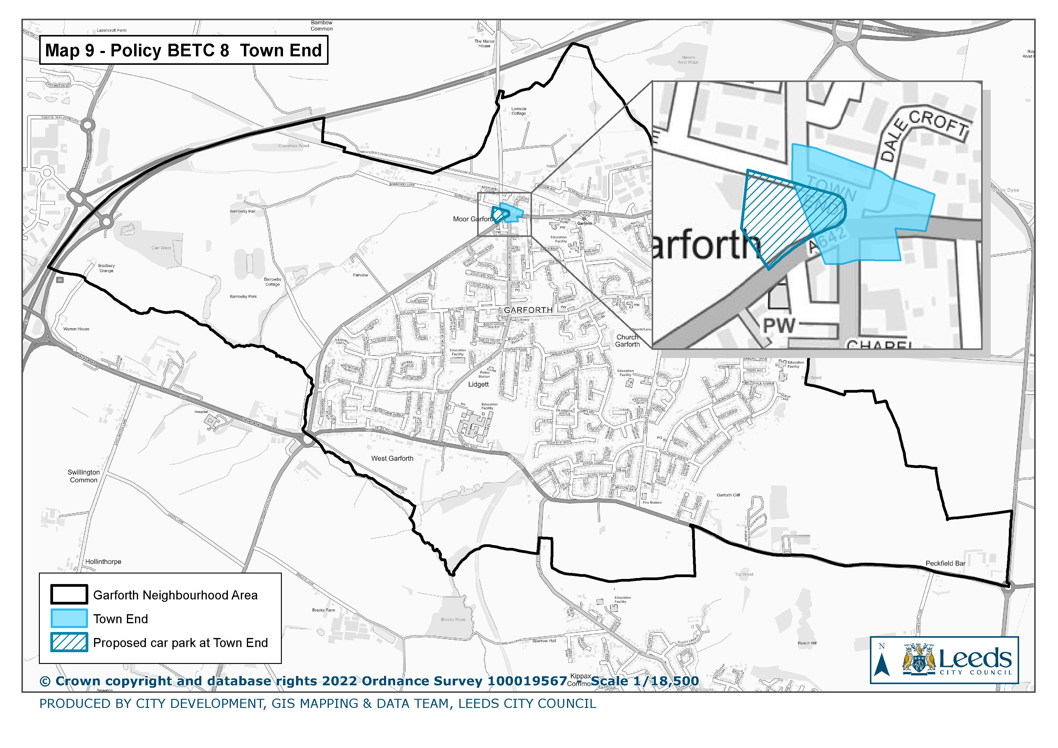
9. Policy BETC 8 & 9. Town End
|
|
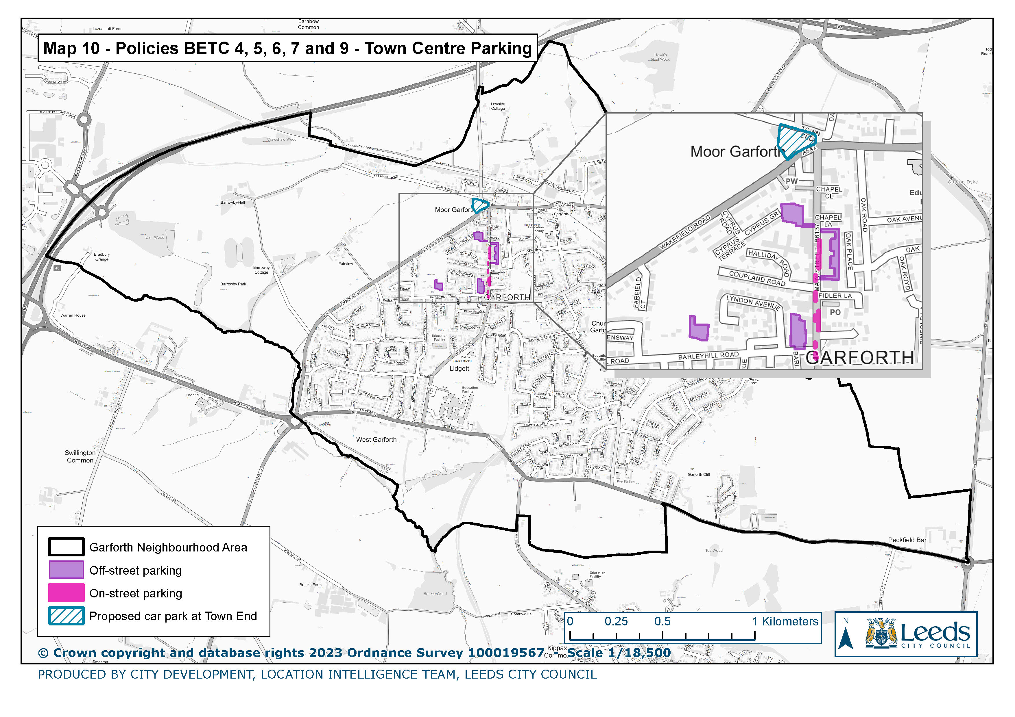
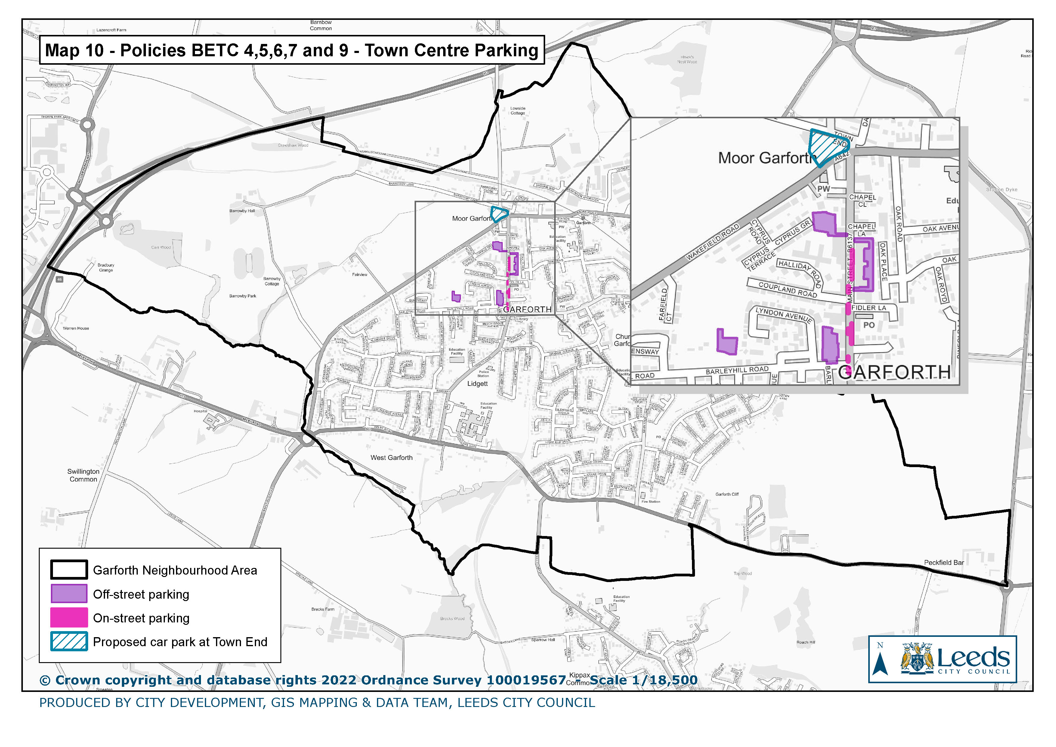
10. Policies BETC 4, 5, 6, 7 & 9. Town Centre Parking
|
|
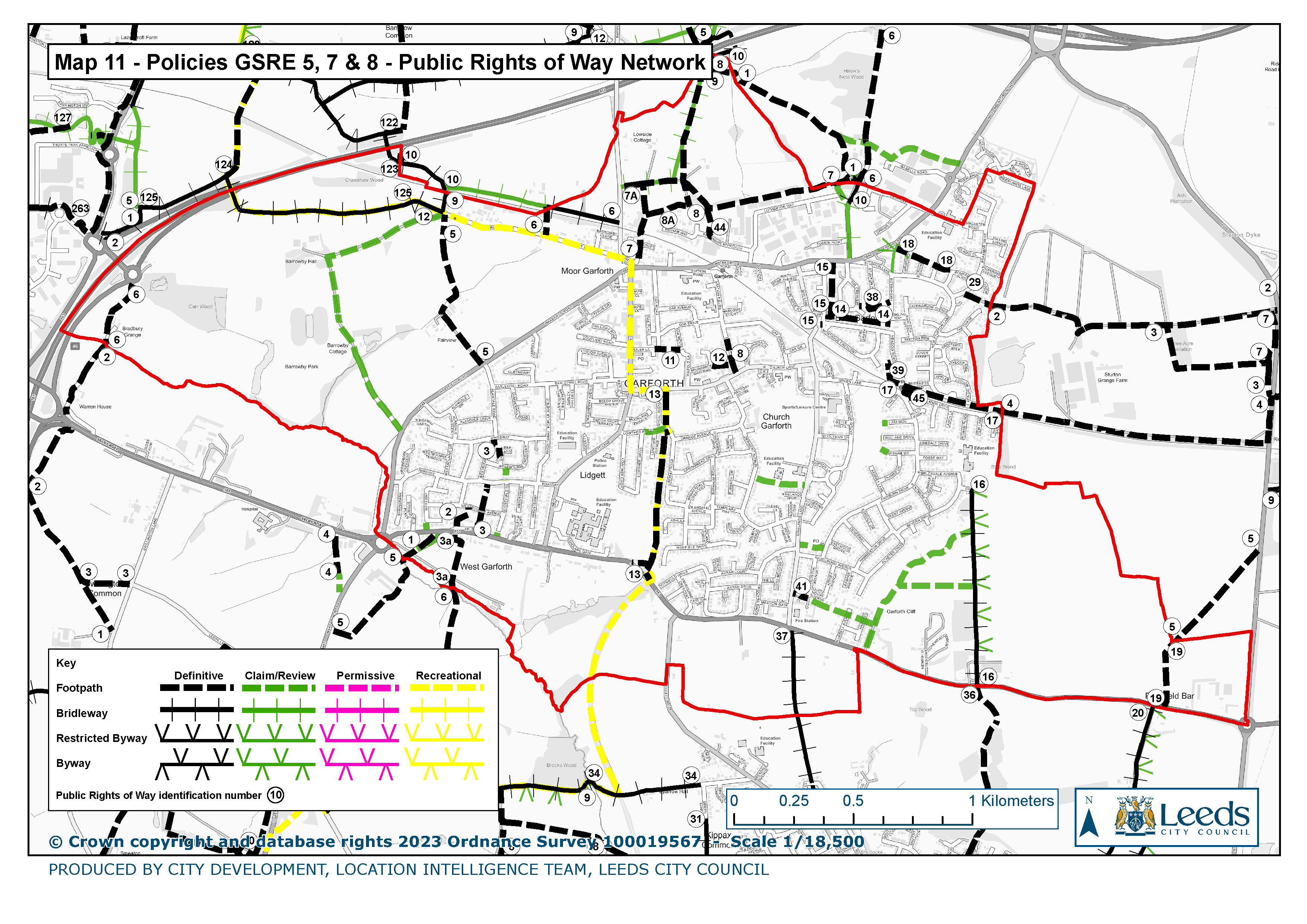
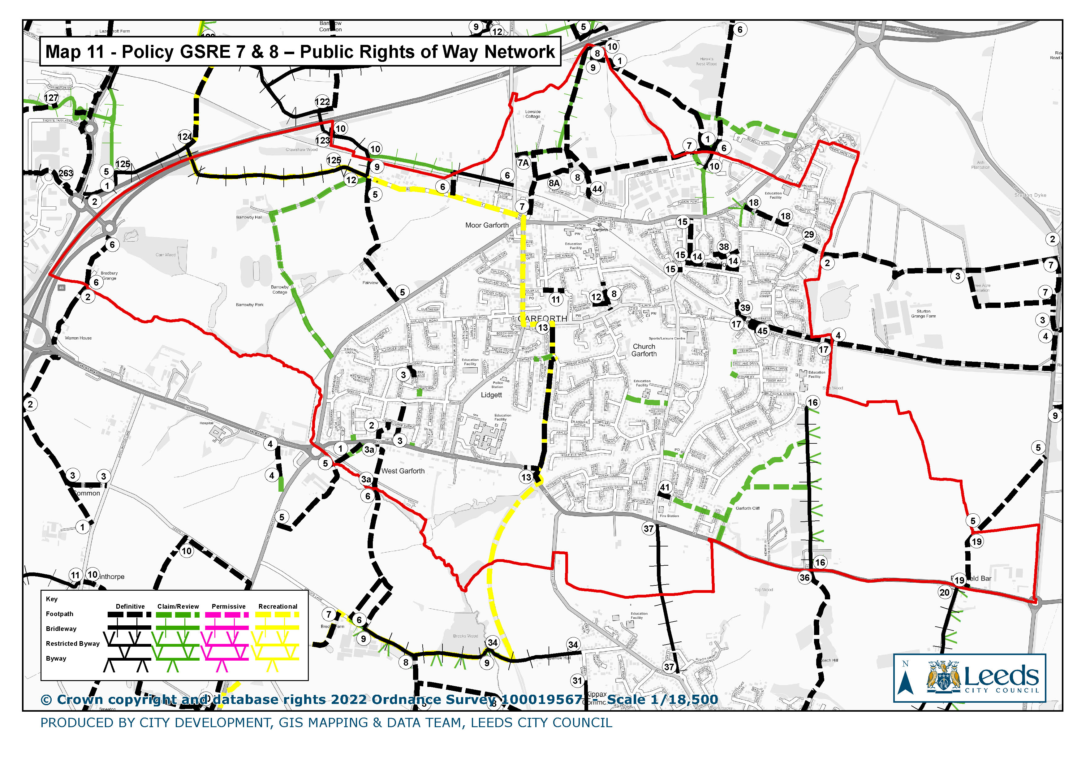
11. Policies GSRE 7 & 8 Public Rights of Way Network
|
|
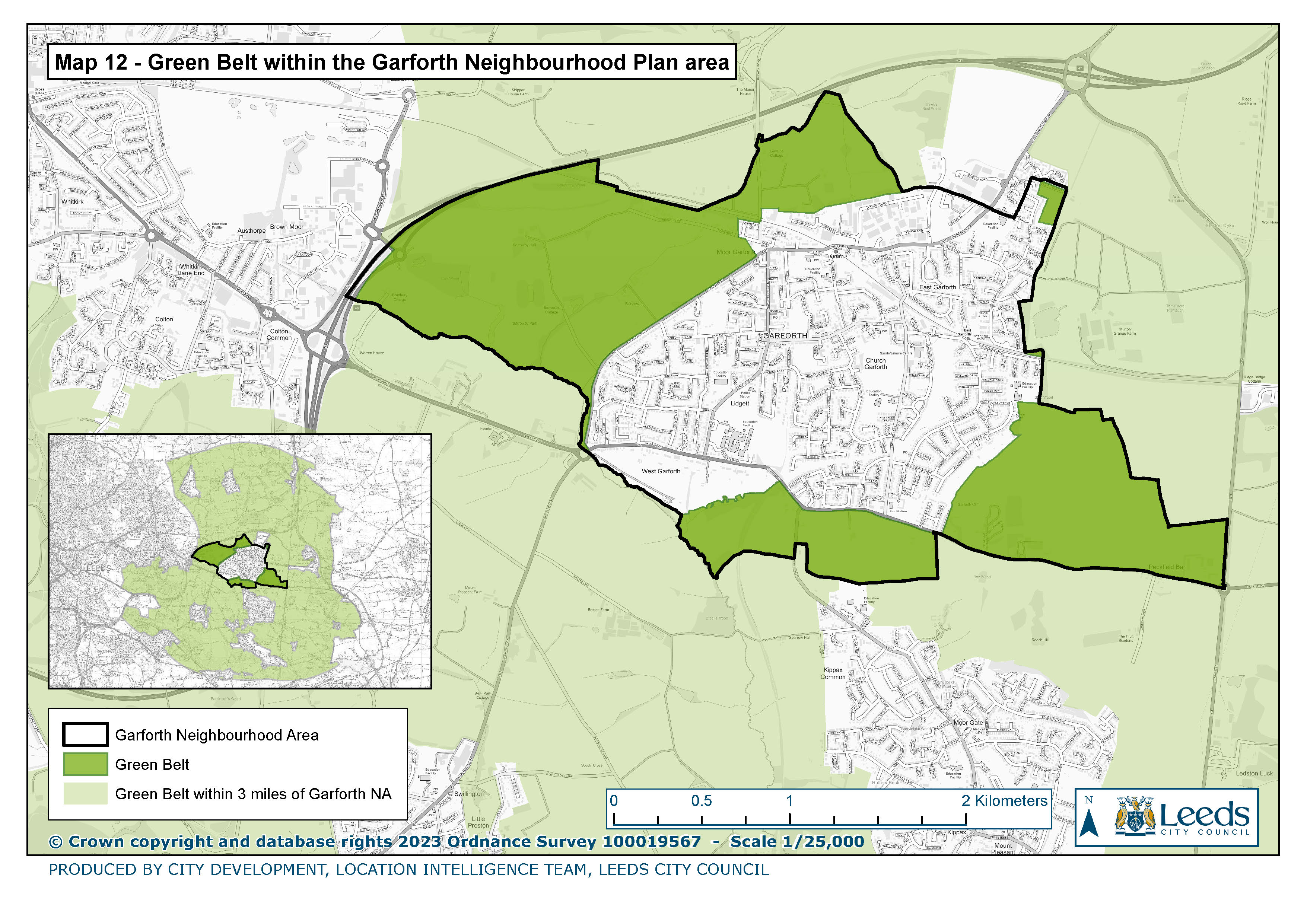
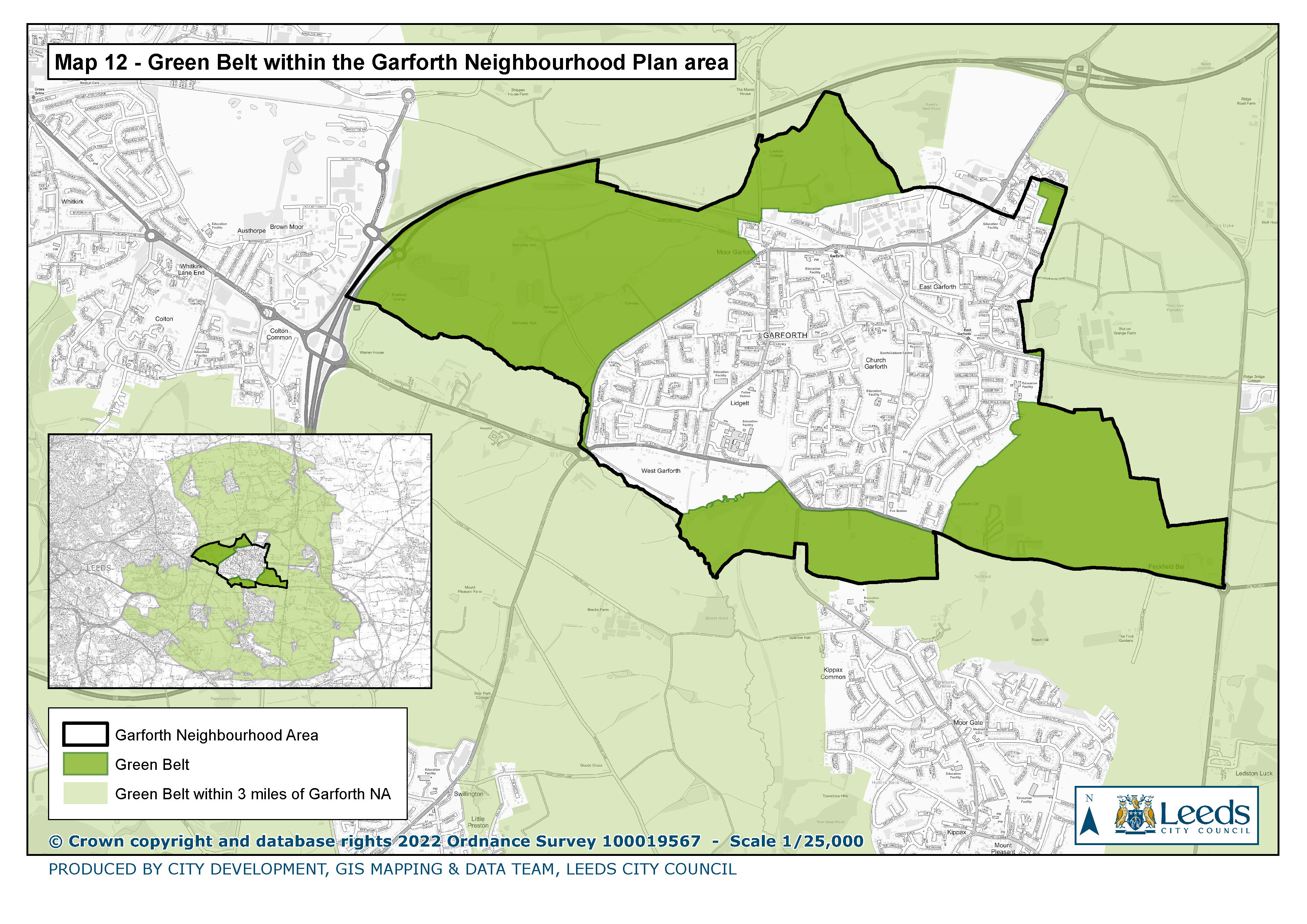
12. Green belt within the Garforth Neighbourhood Plan area
|
|
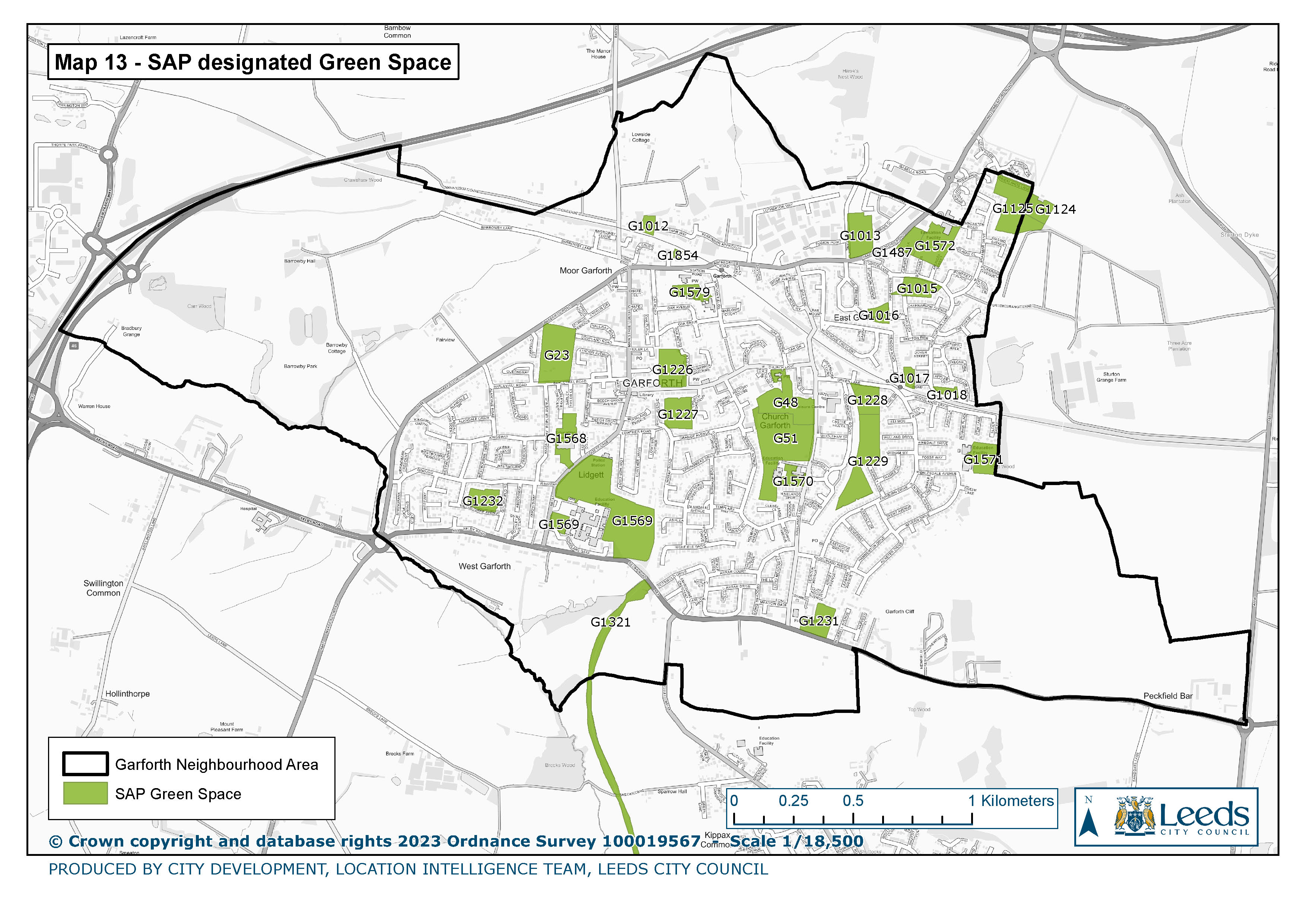
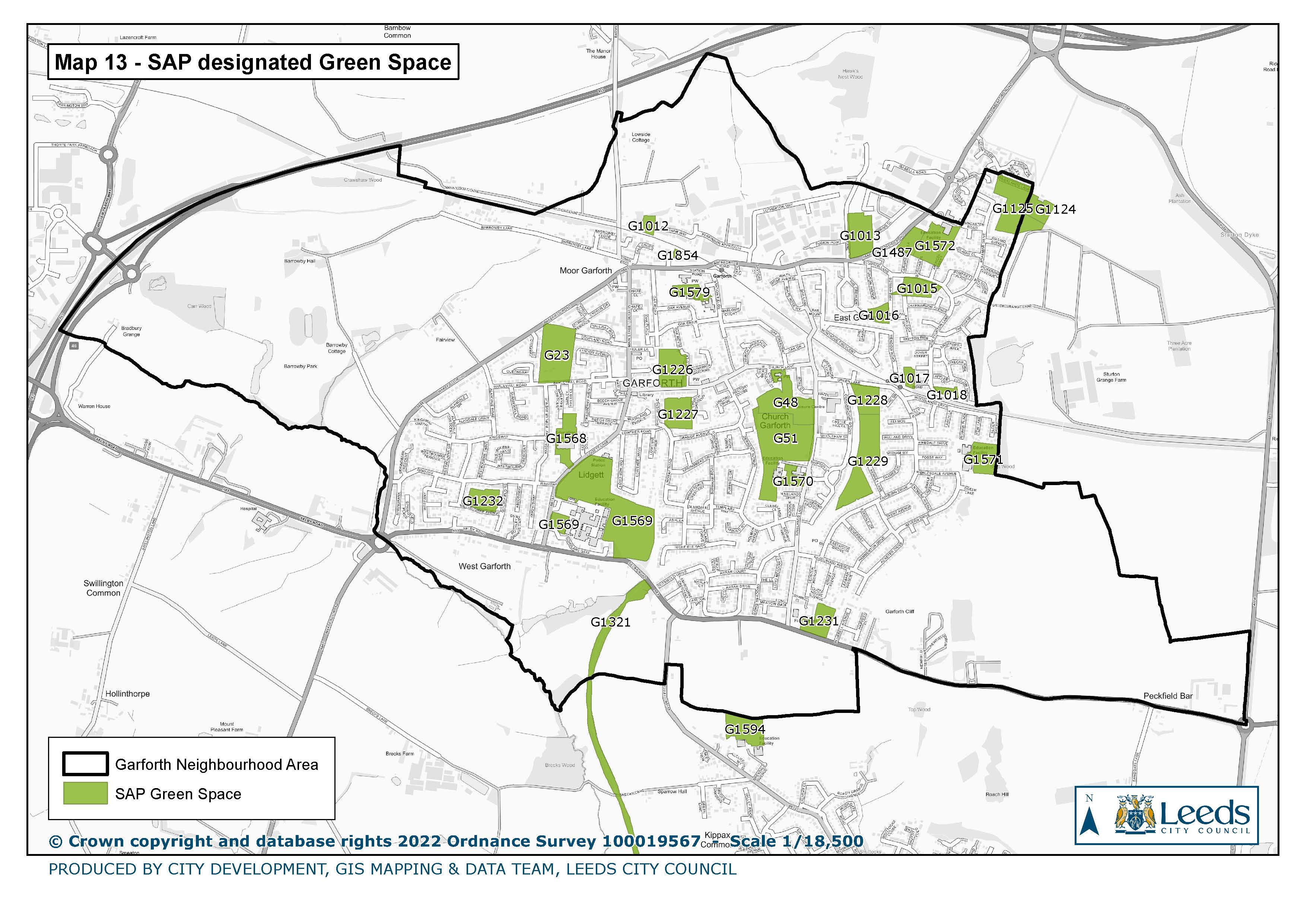
13. SAP Designated Green Space
|
|
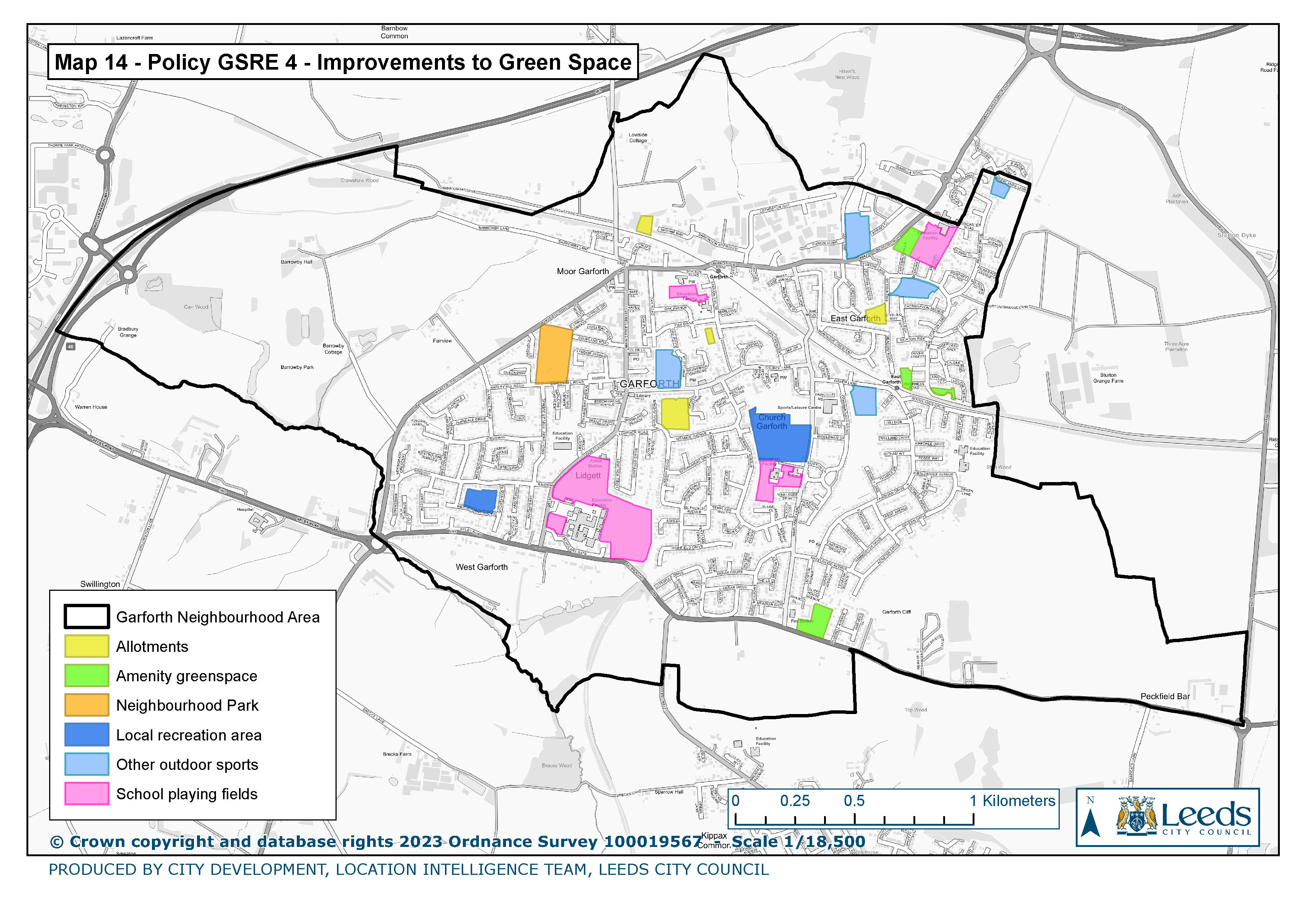
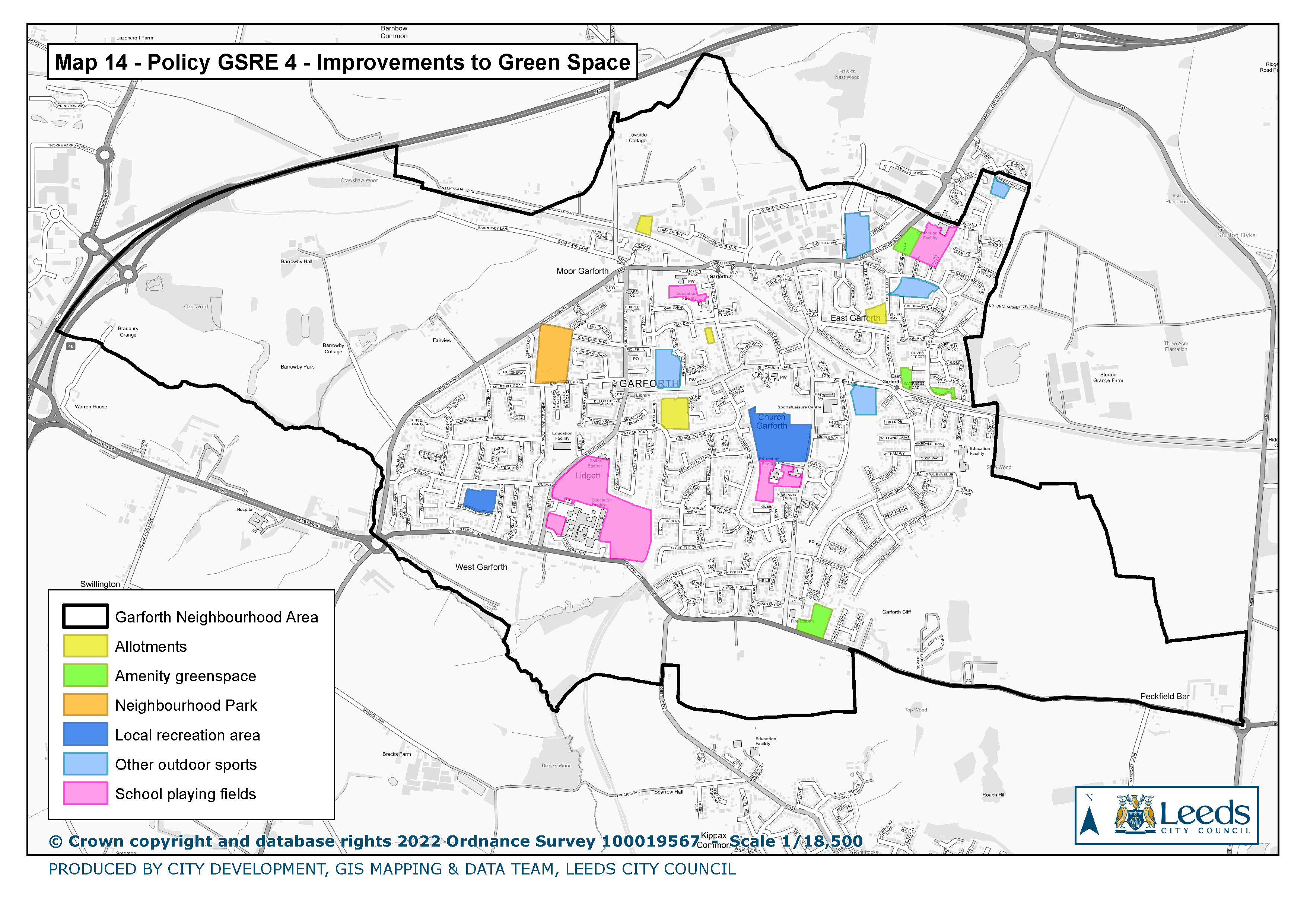
14. Policy GSRE 4 Improvements to Green Spaces
|
|
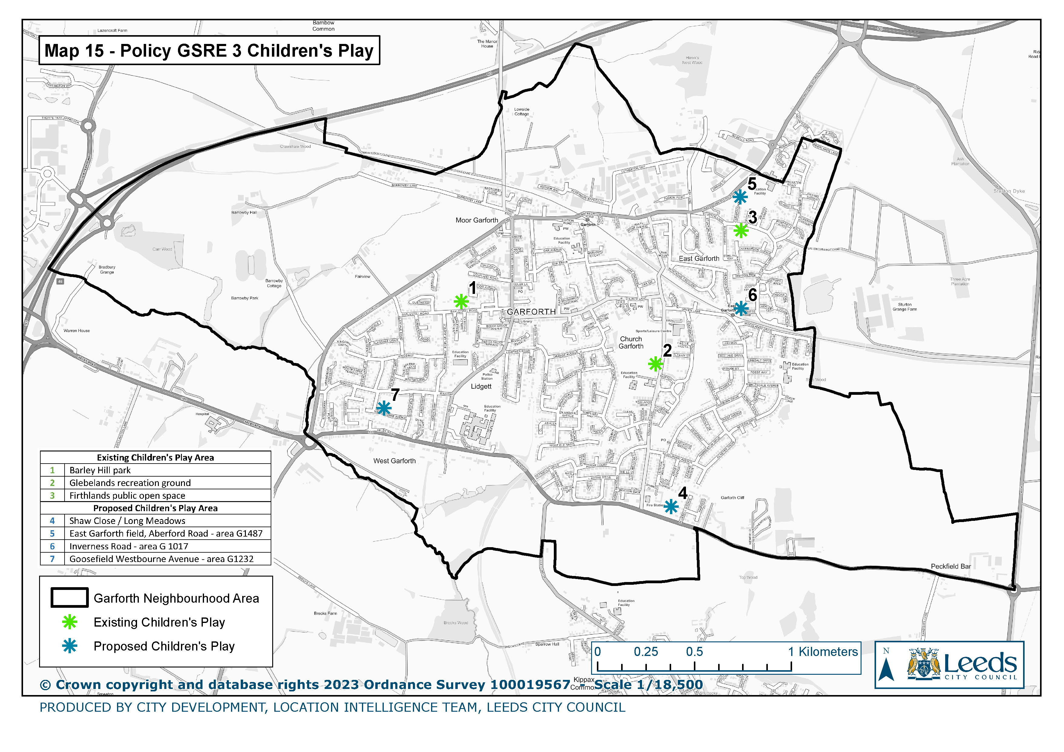
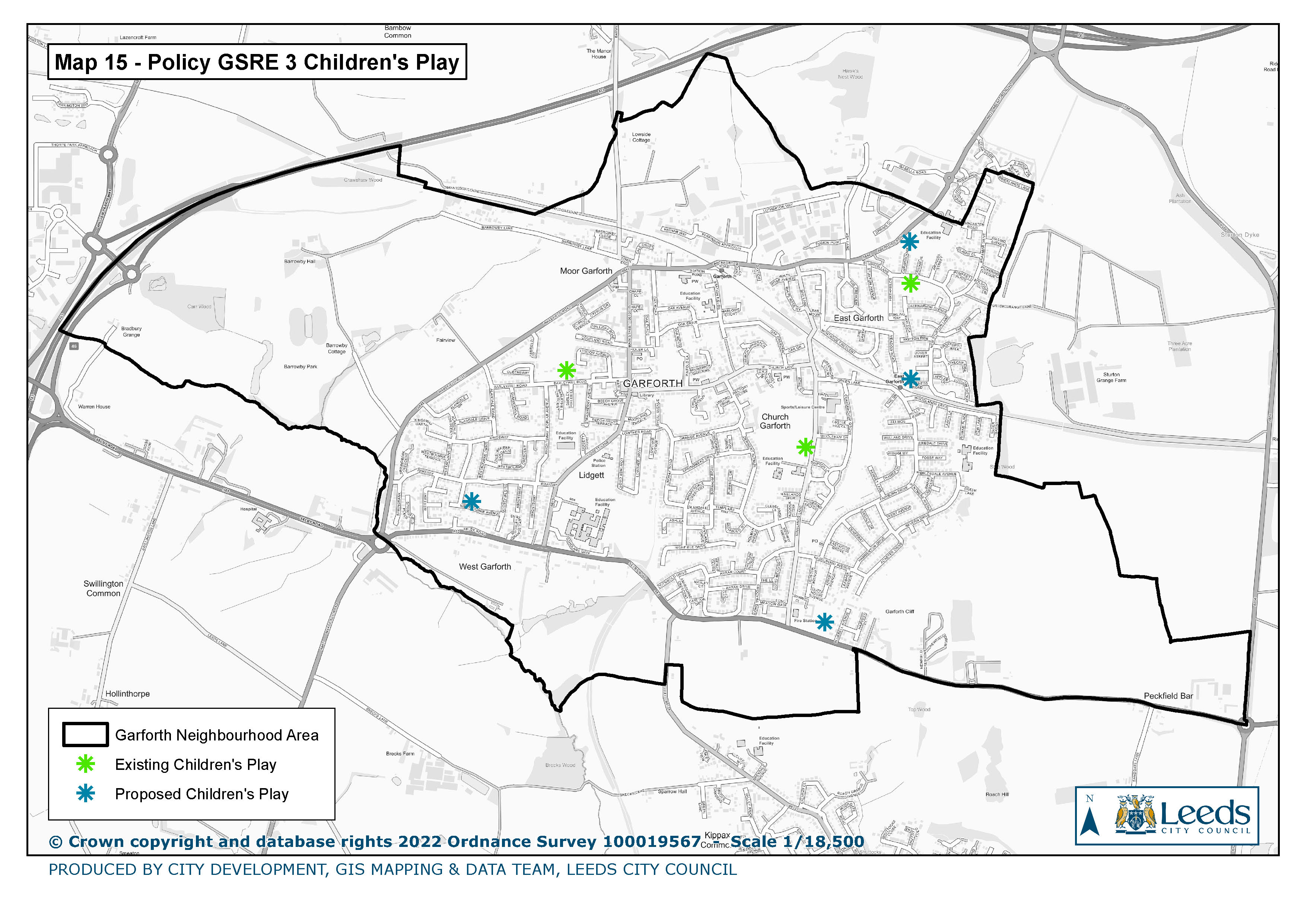
15. Policy GSRE 3 Children's Play
|
|
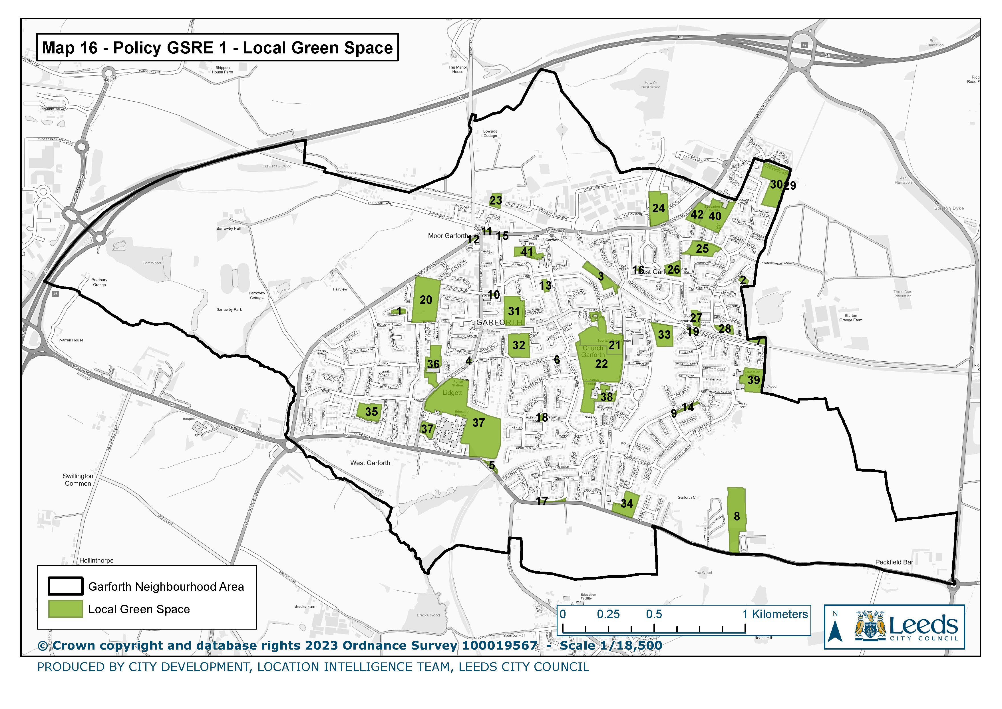
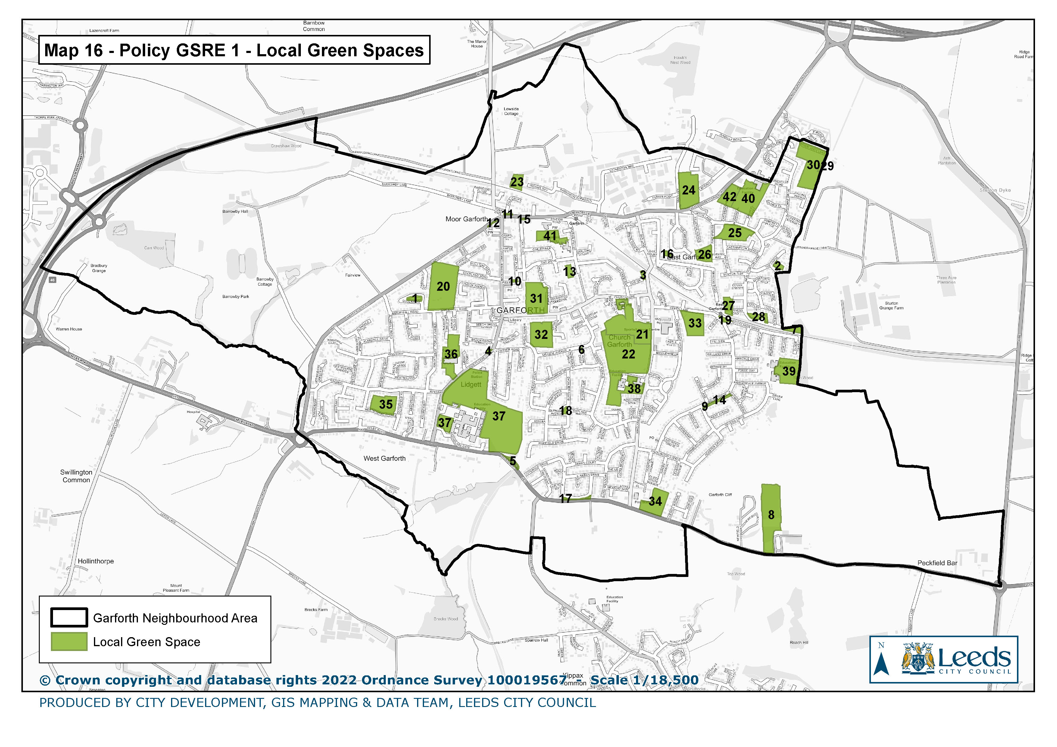
16. Policy GSRE 1 Local Green Spaces
|
|
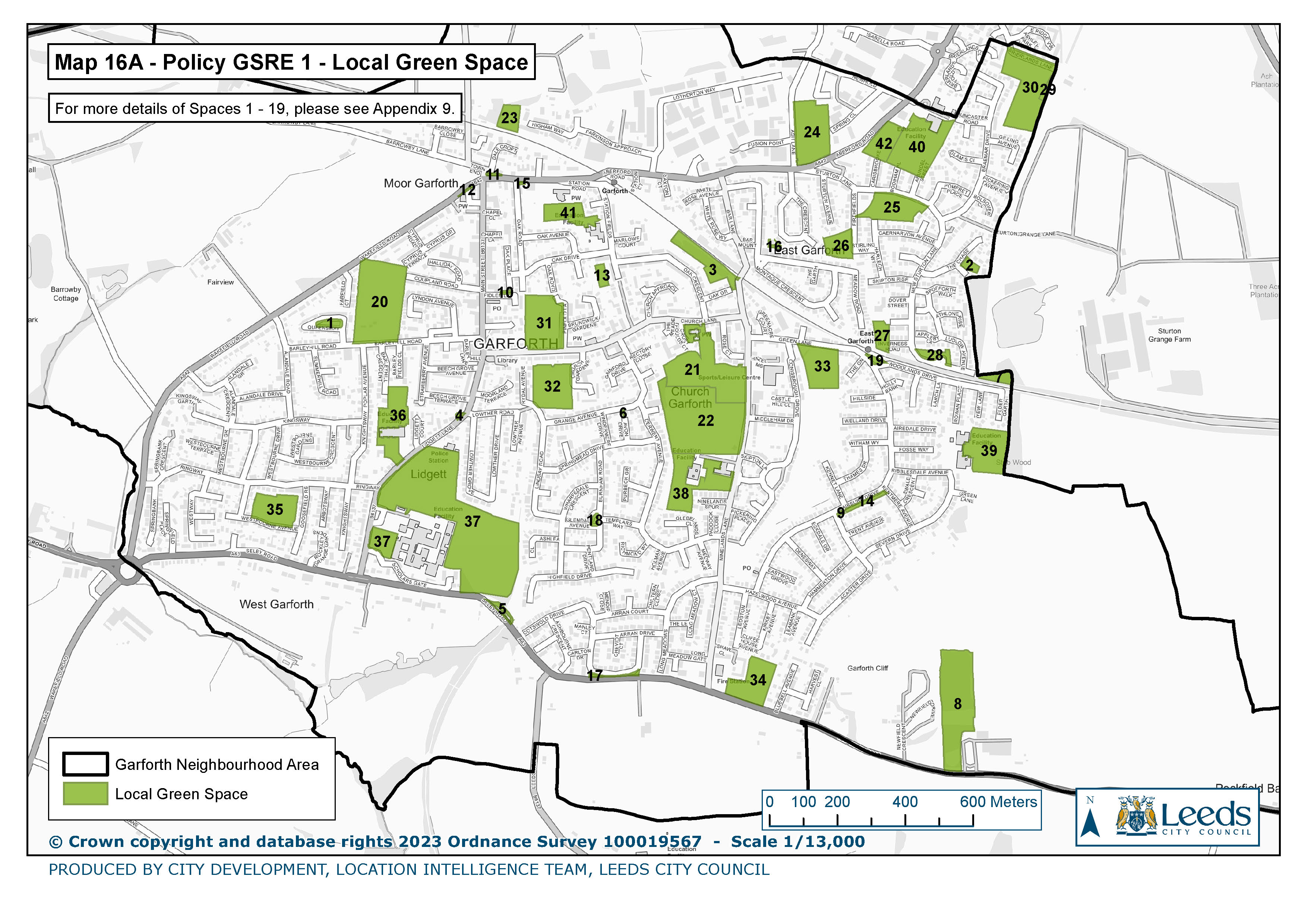
16a. Policy GSRE 1 Local Green Spaces
|
|
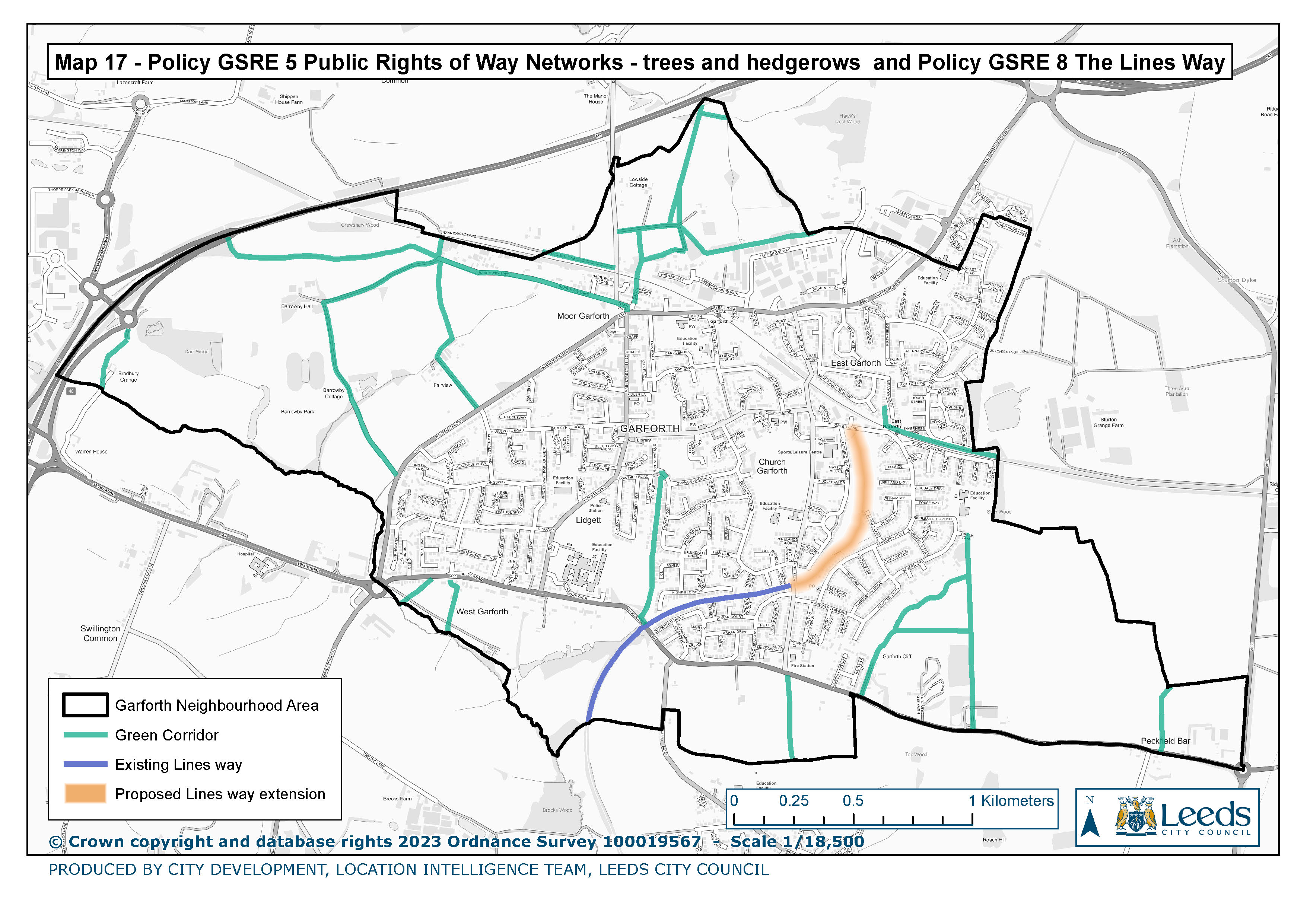
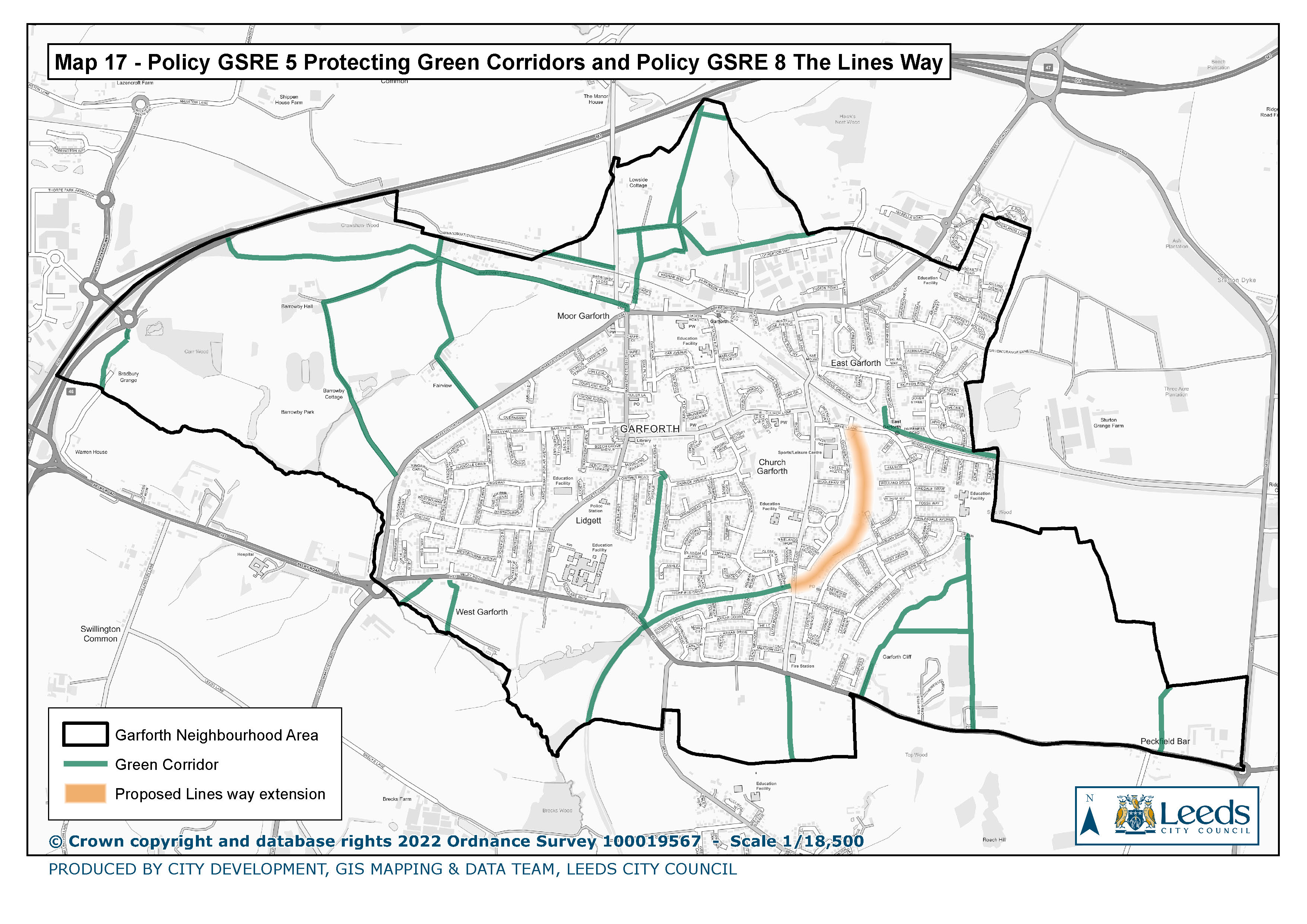
17. Policy GSRE 5 Protecting Green Corridors and Policy GSRE 8 The Lines Way
|
|
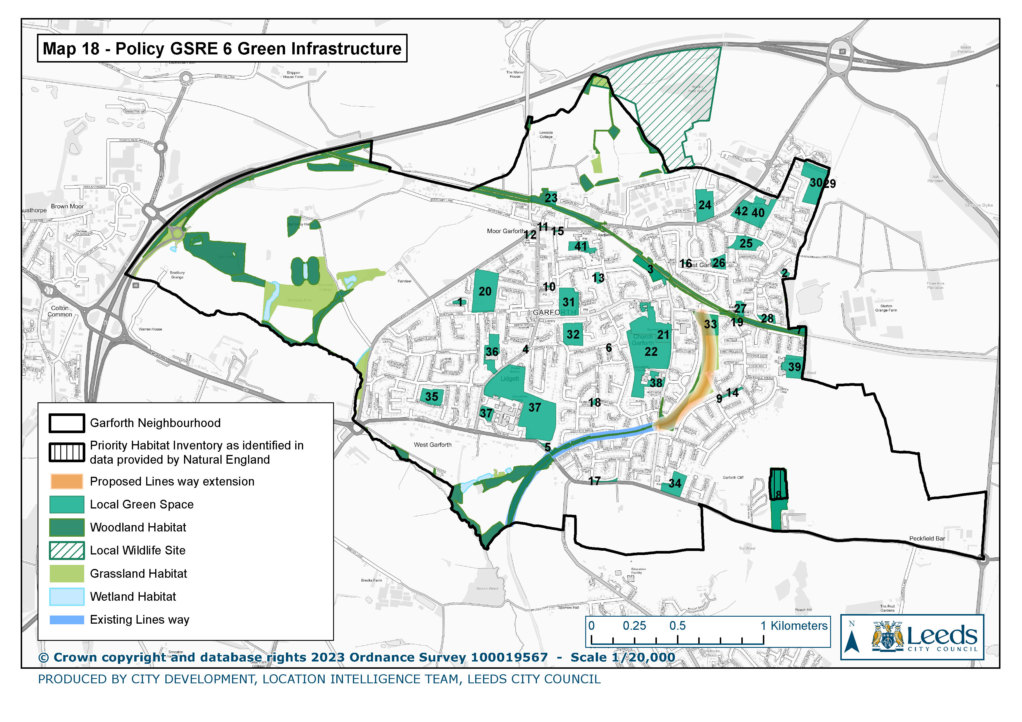
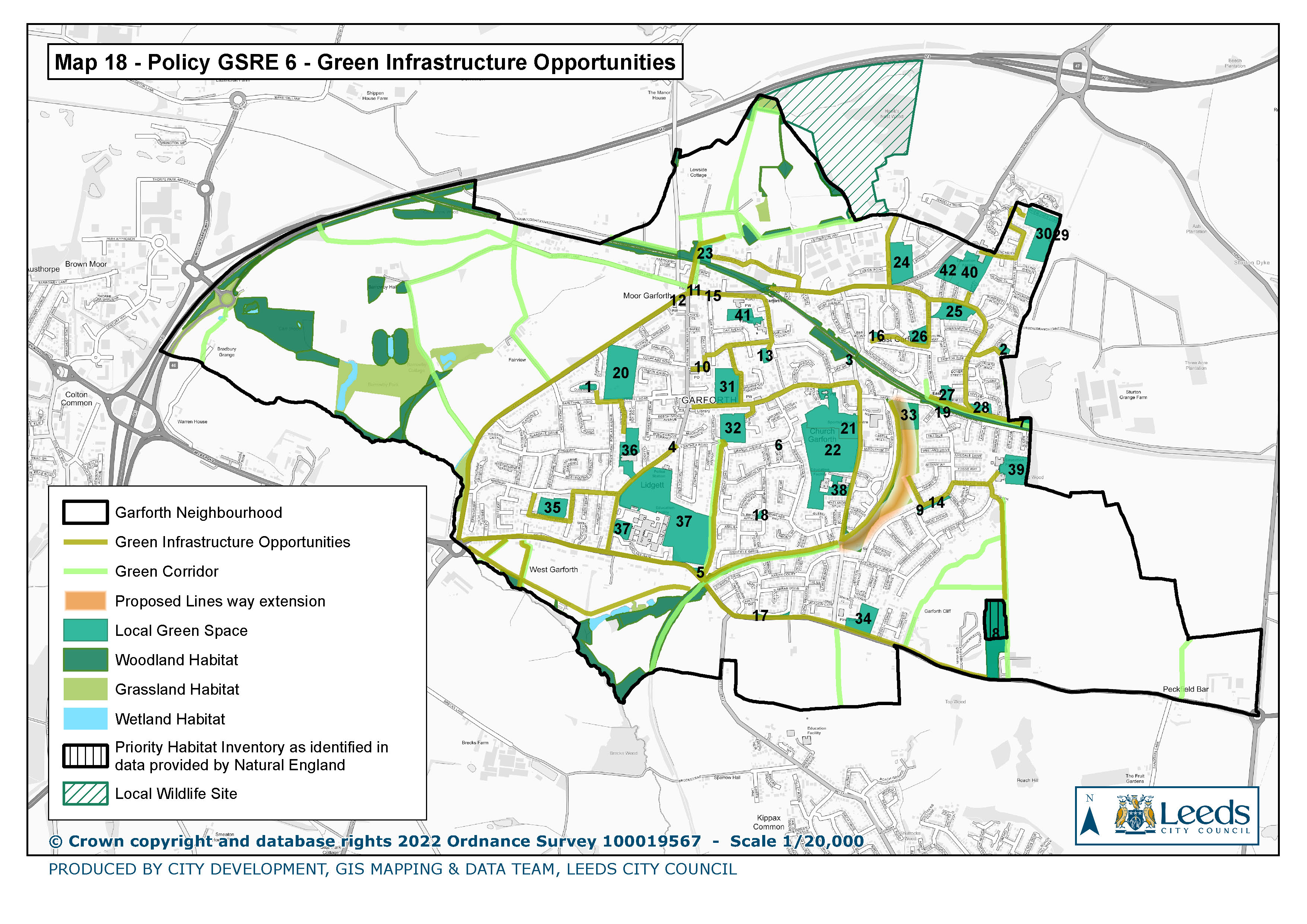
18. Policy GSRE 6 Green Infrastructure Opportunities
|
|
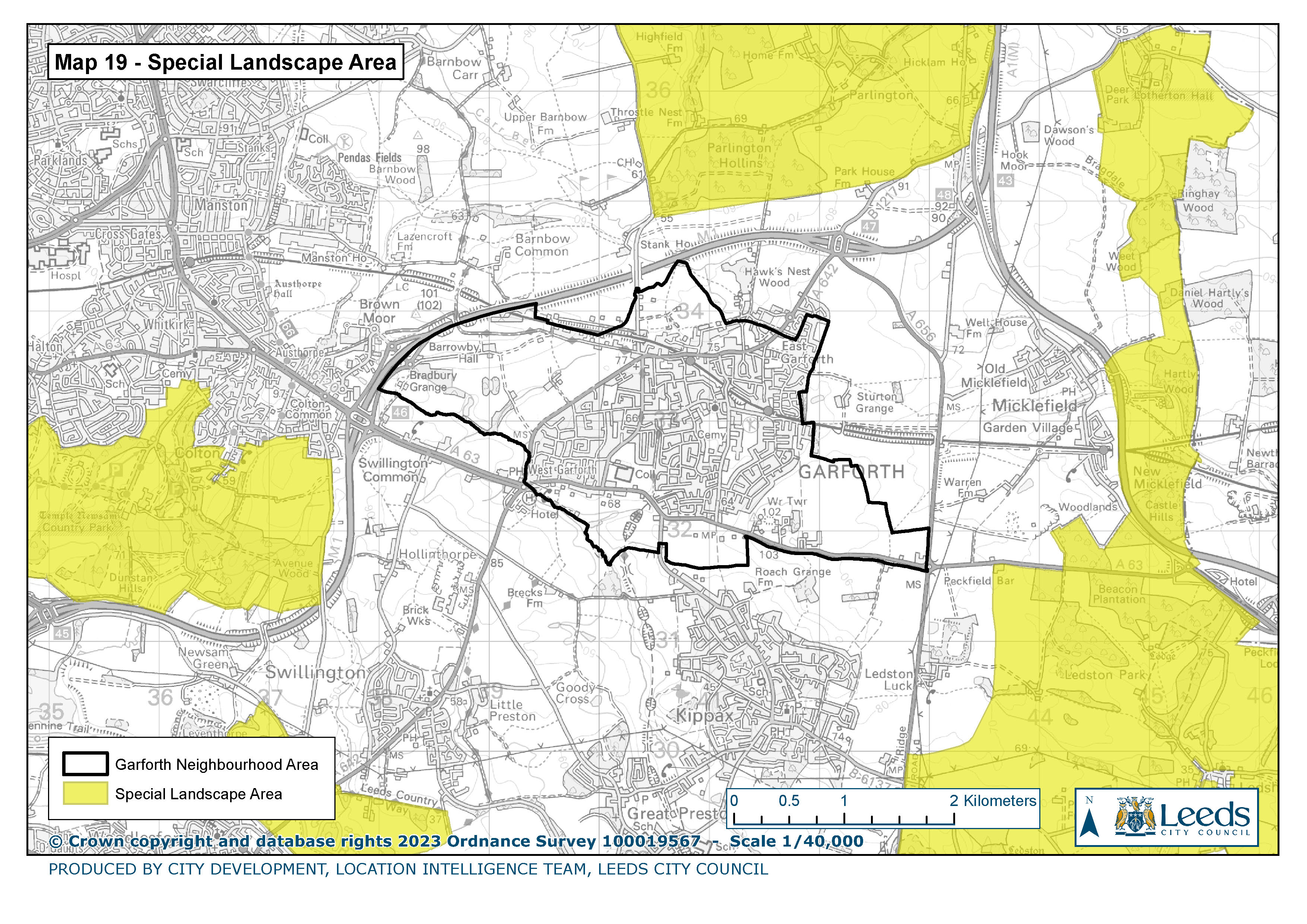
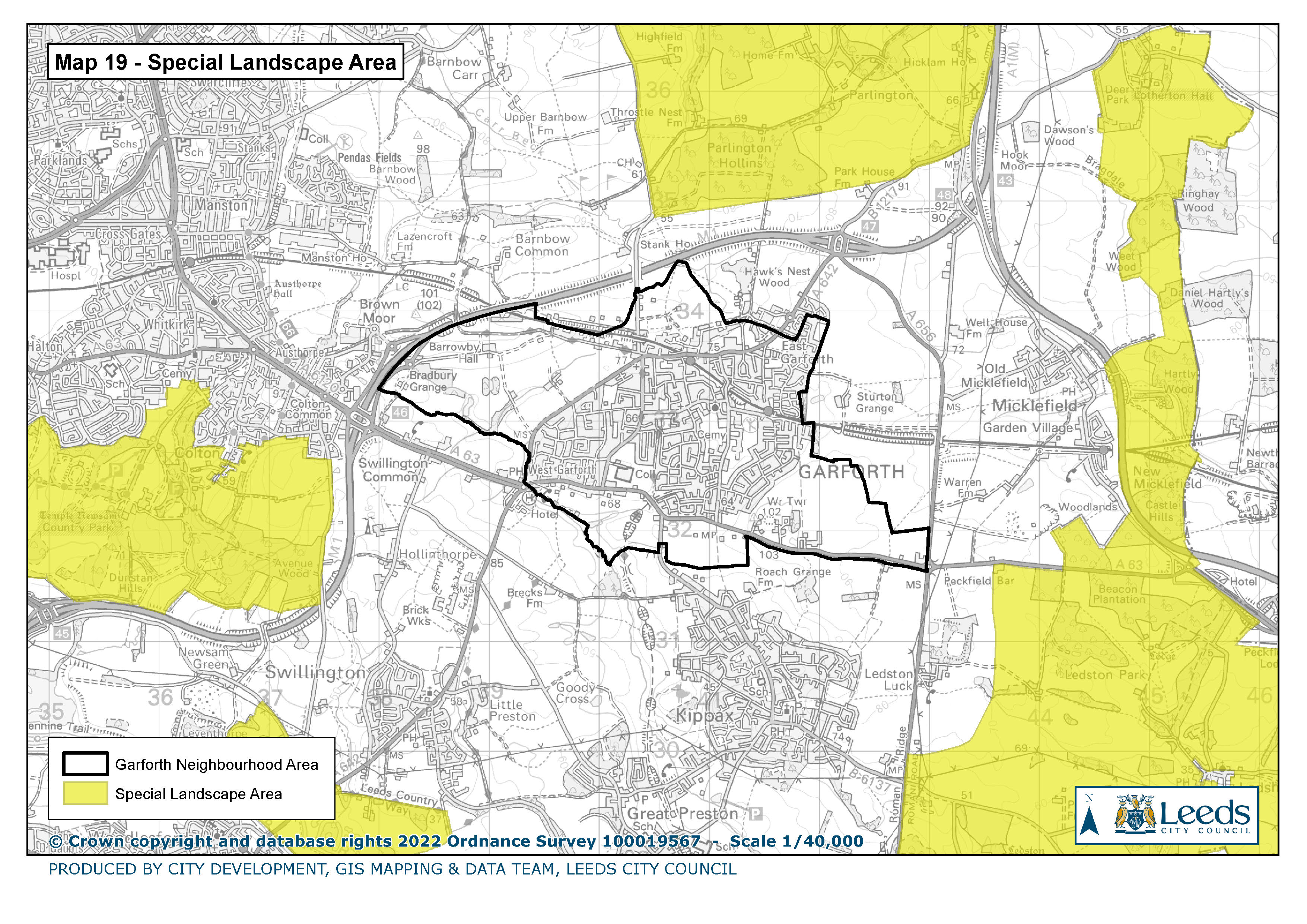
19. Special Landscape Area
|
|
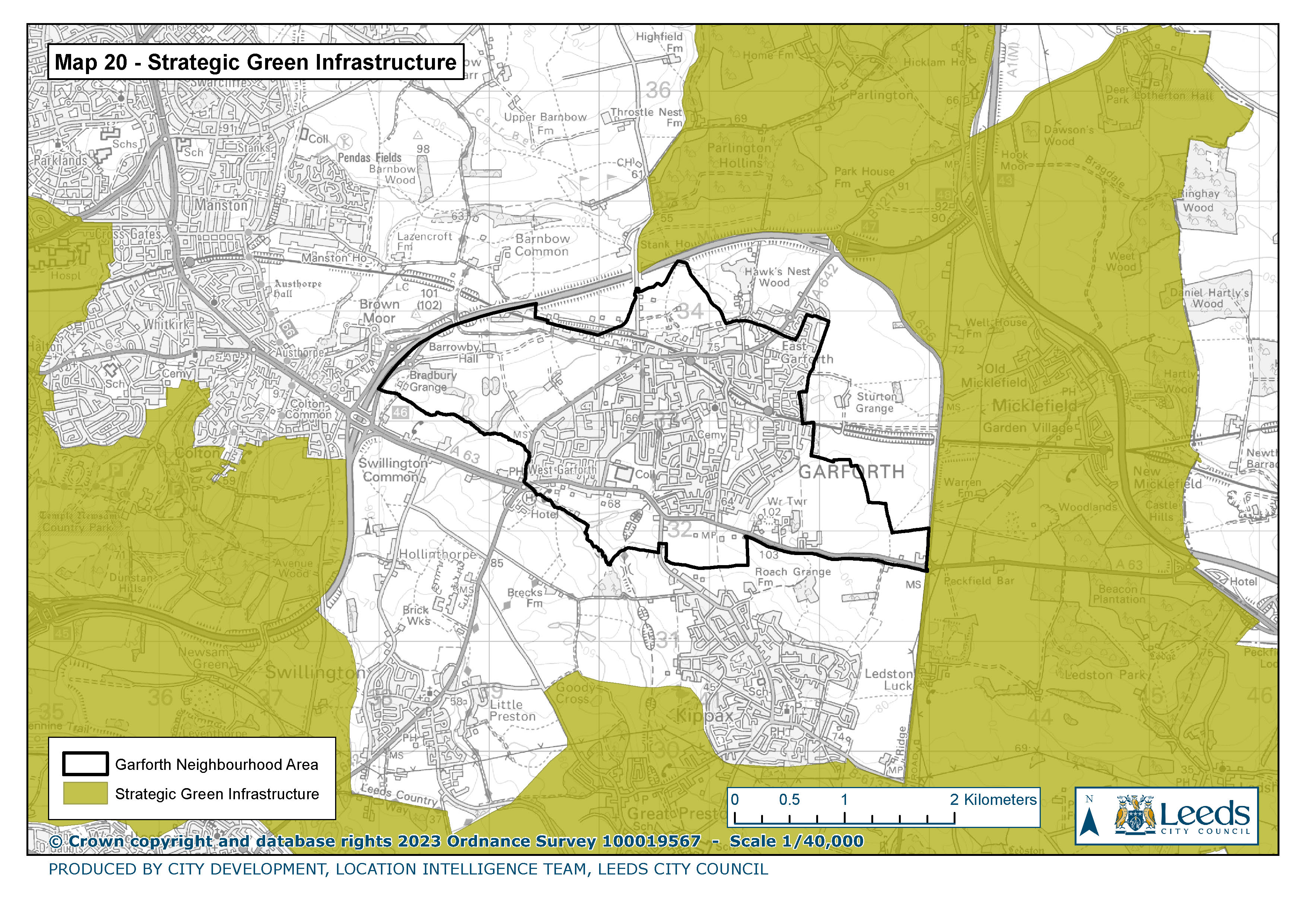
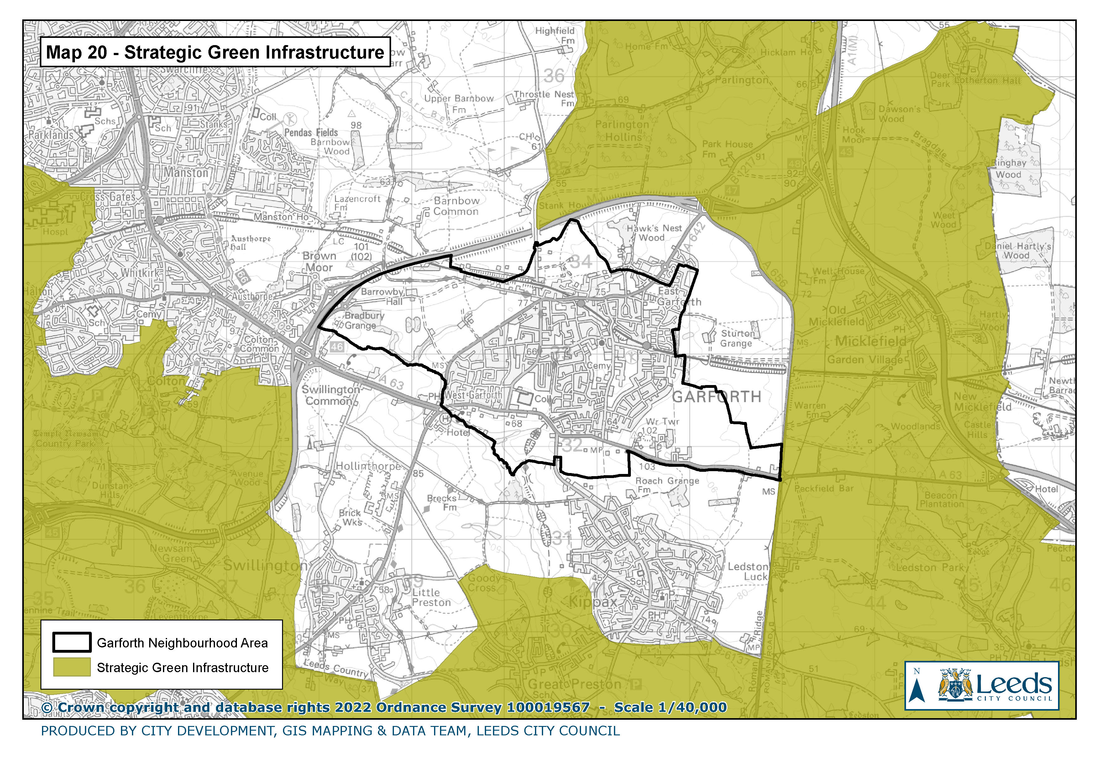
20. Strategic Green Infrastructure
|
|
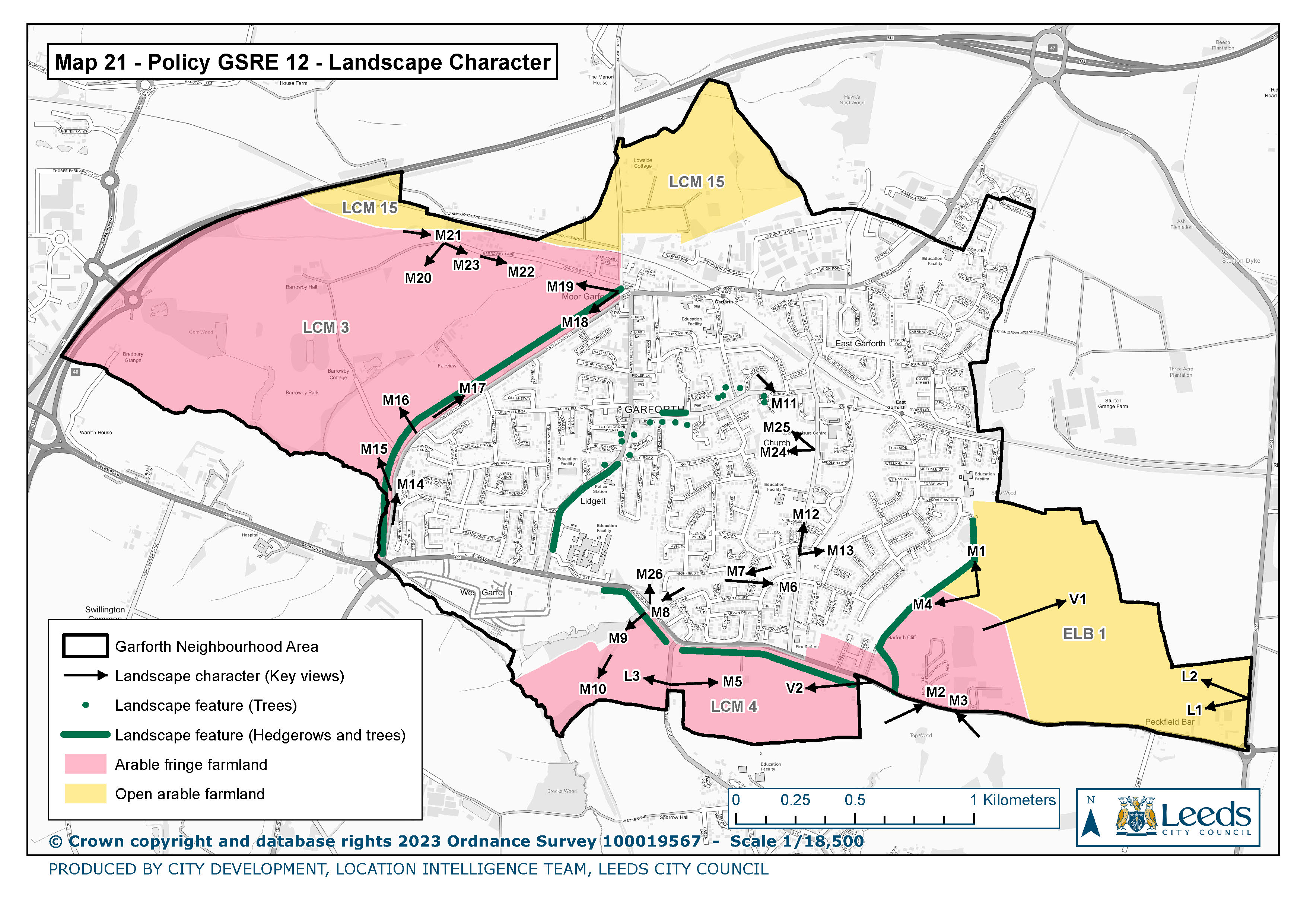
21. Policy GSRE 13 Landscape Character
|
|
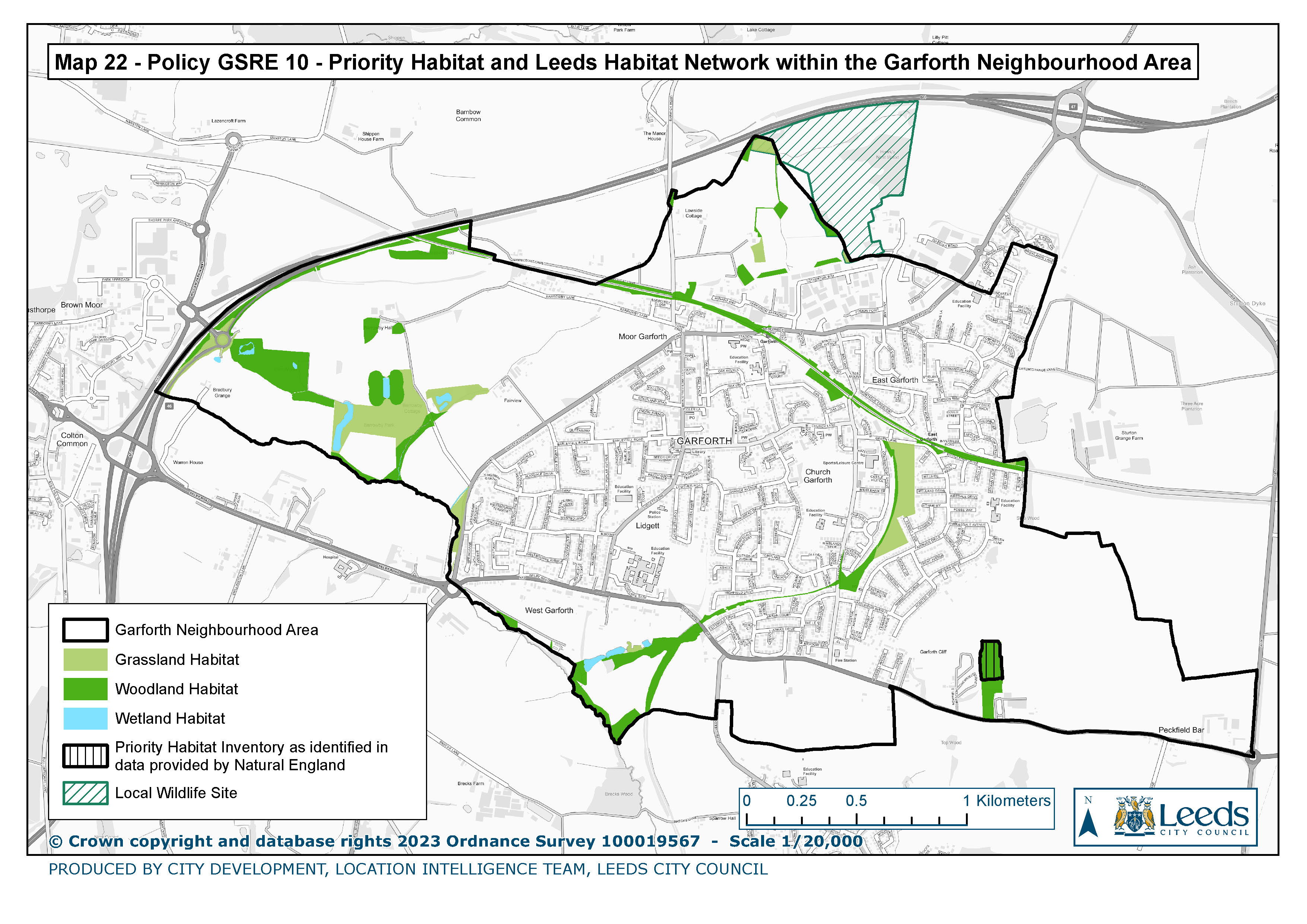
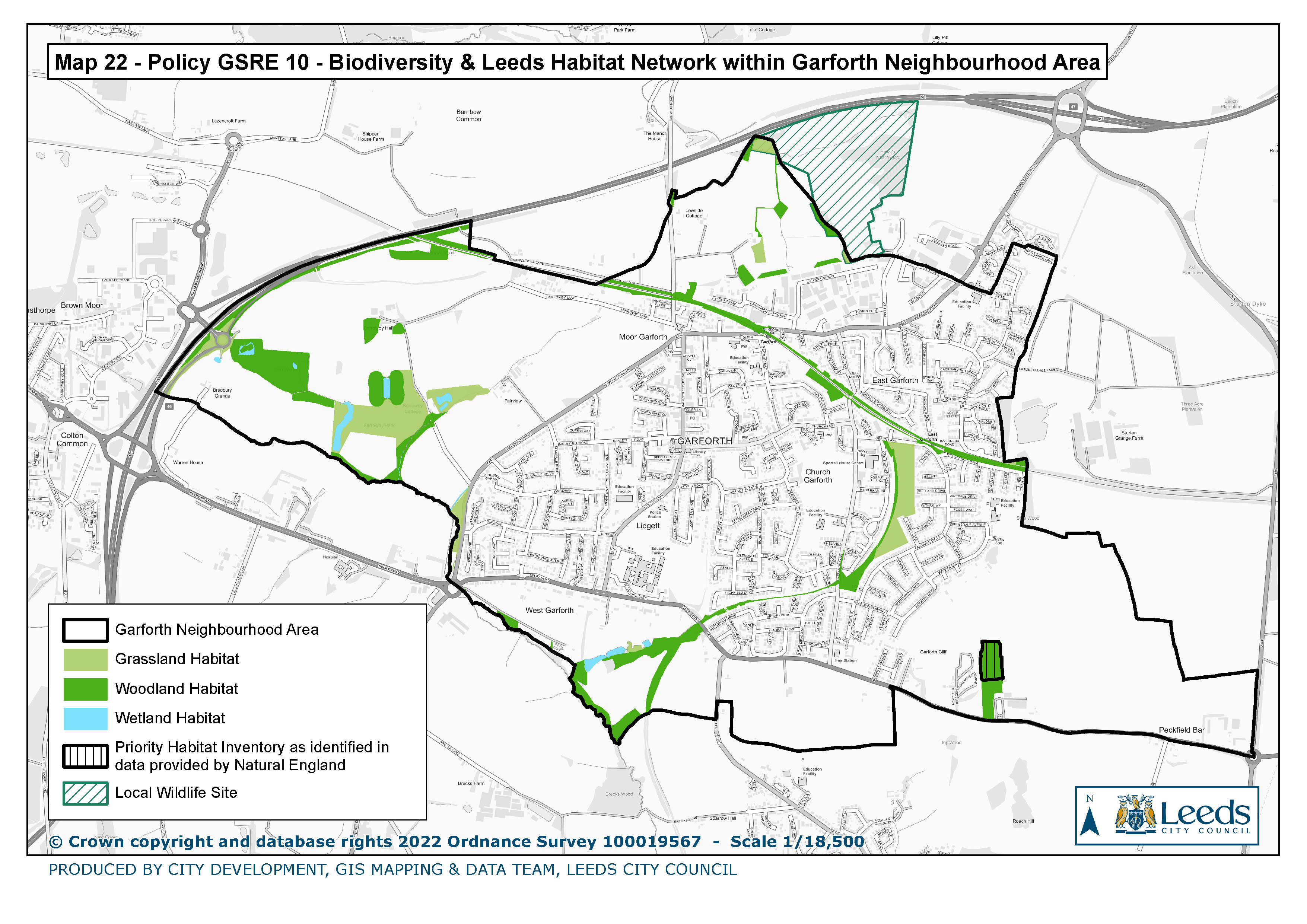
22. Policy GSRE 10 Priority Habitat & Leeds Habitat Network within Garforth Neighbourhood area
|
|
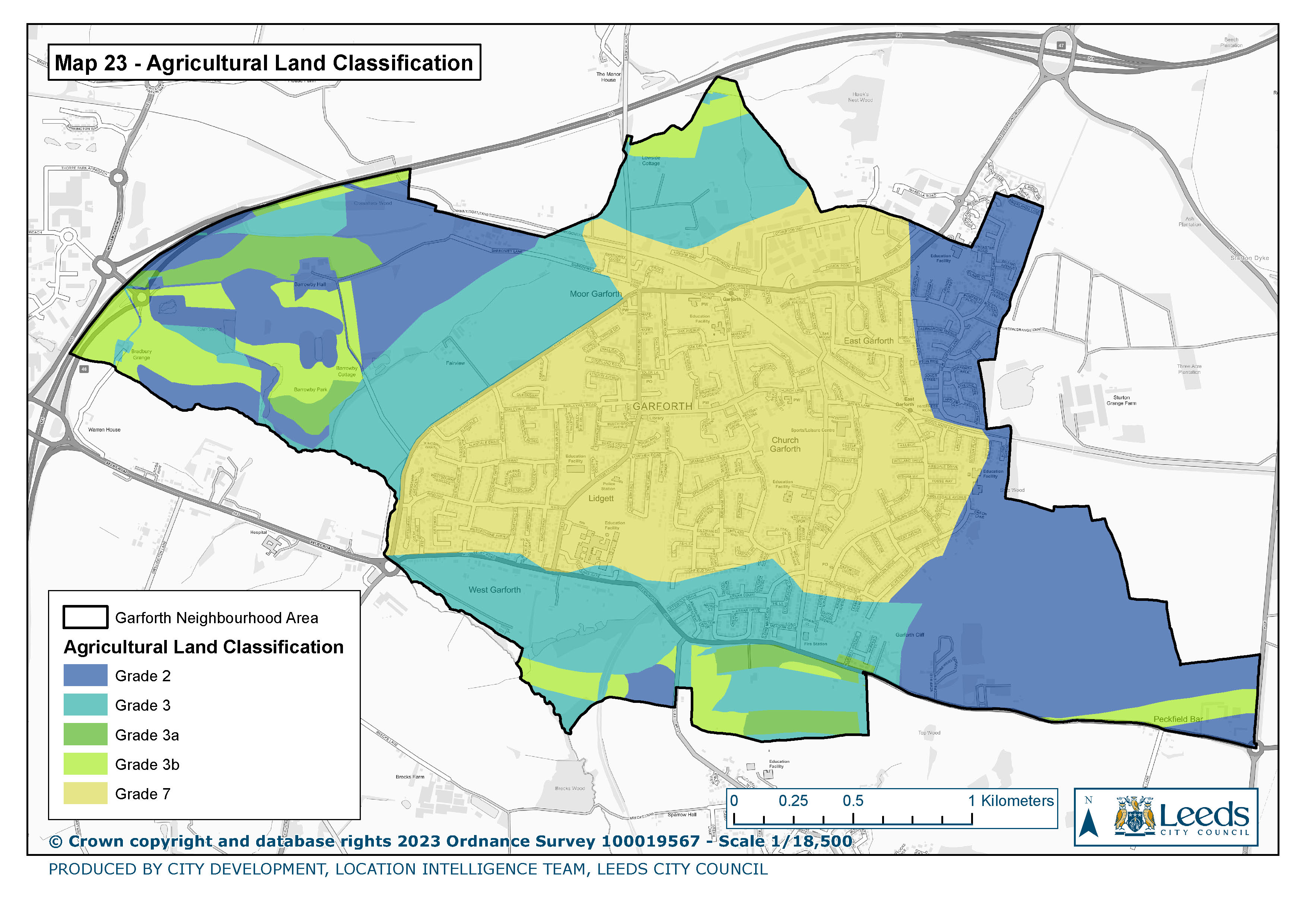
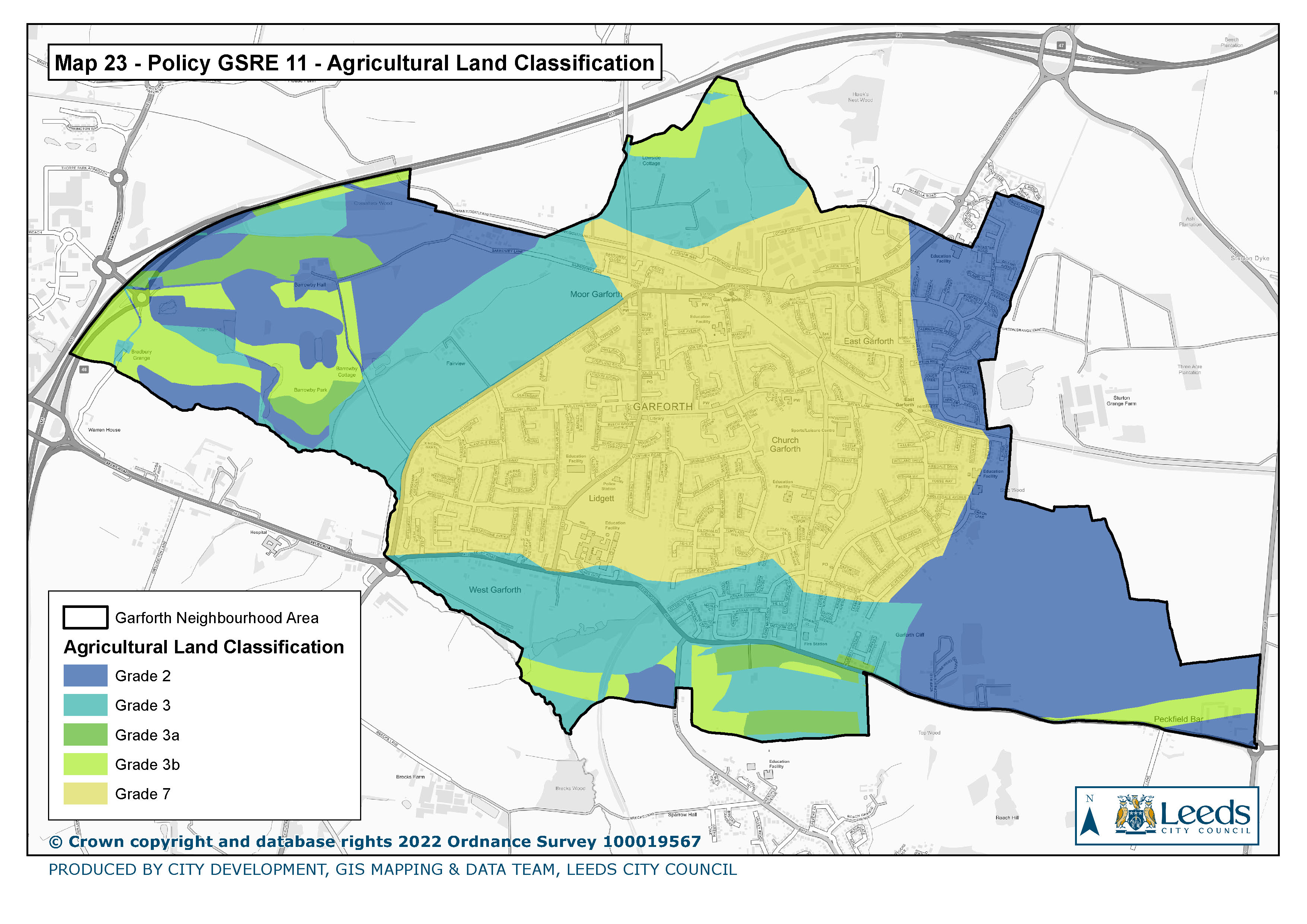
23. Agricultural Land Classification
|
|
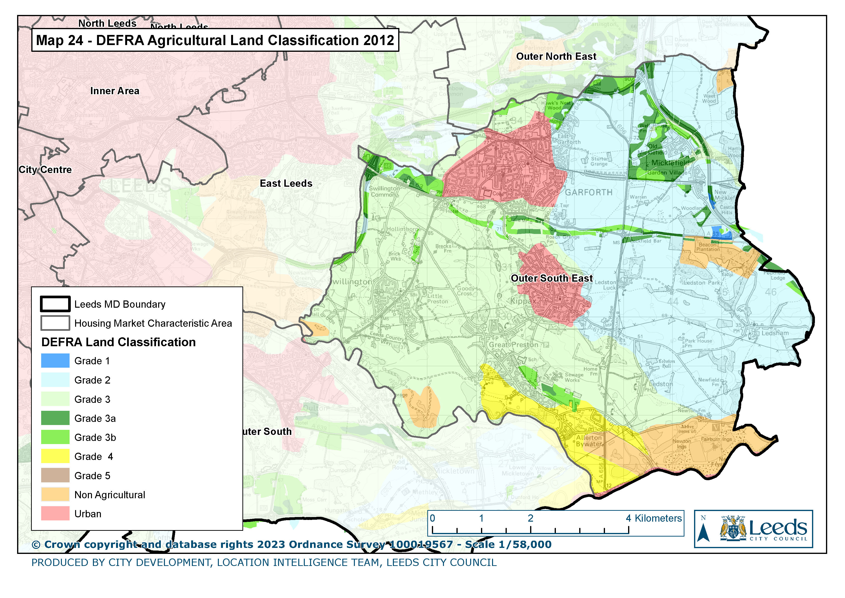
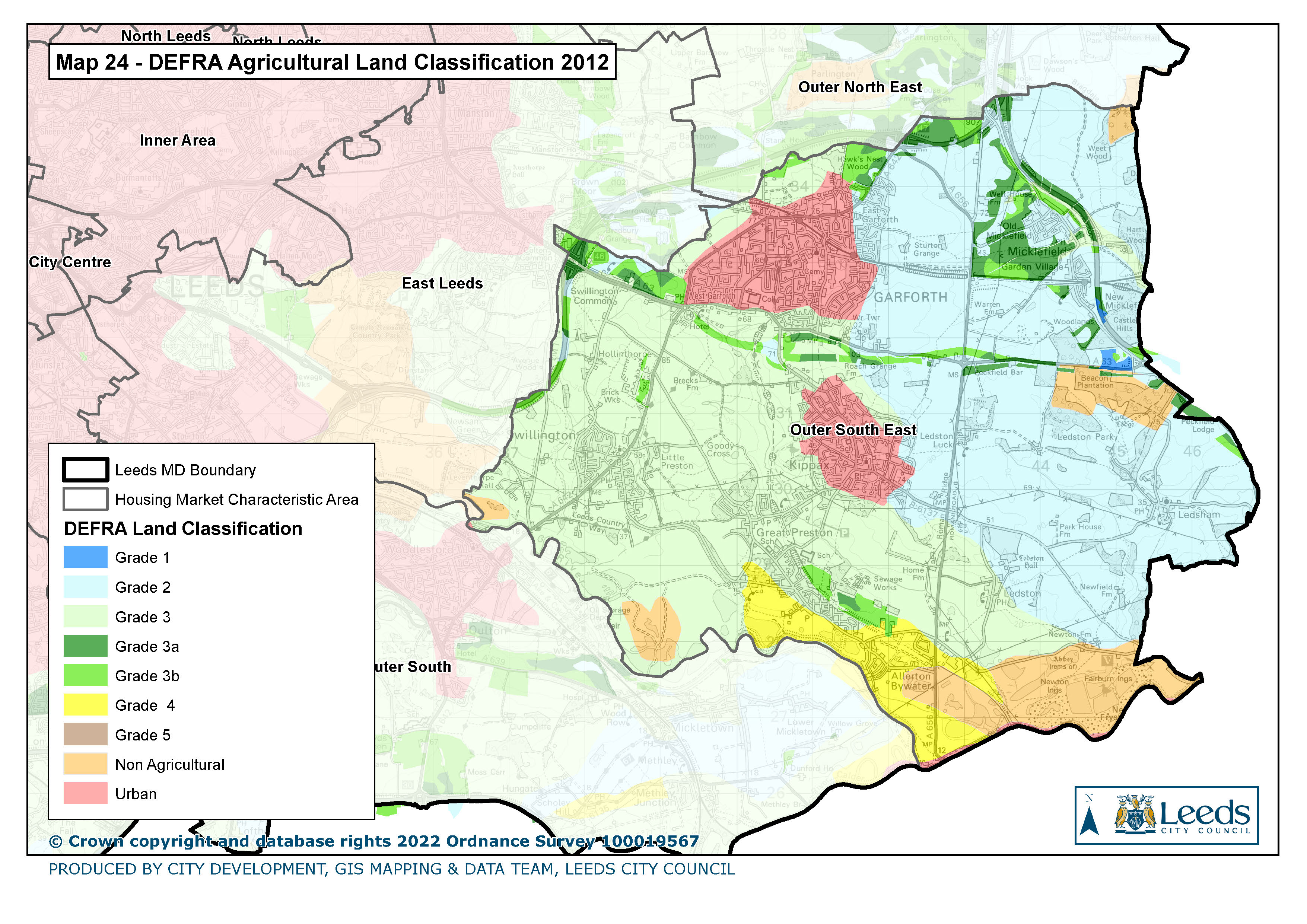
24. DEFRA Agricultural Land Classification 2012
|
|
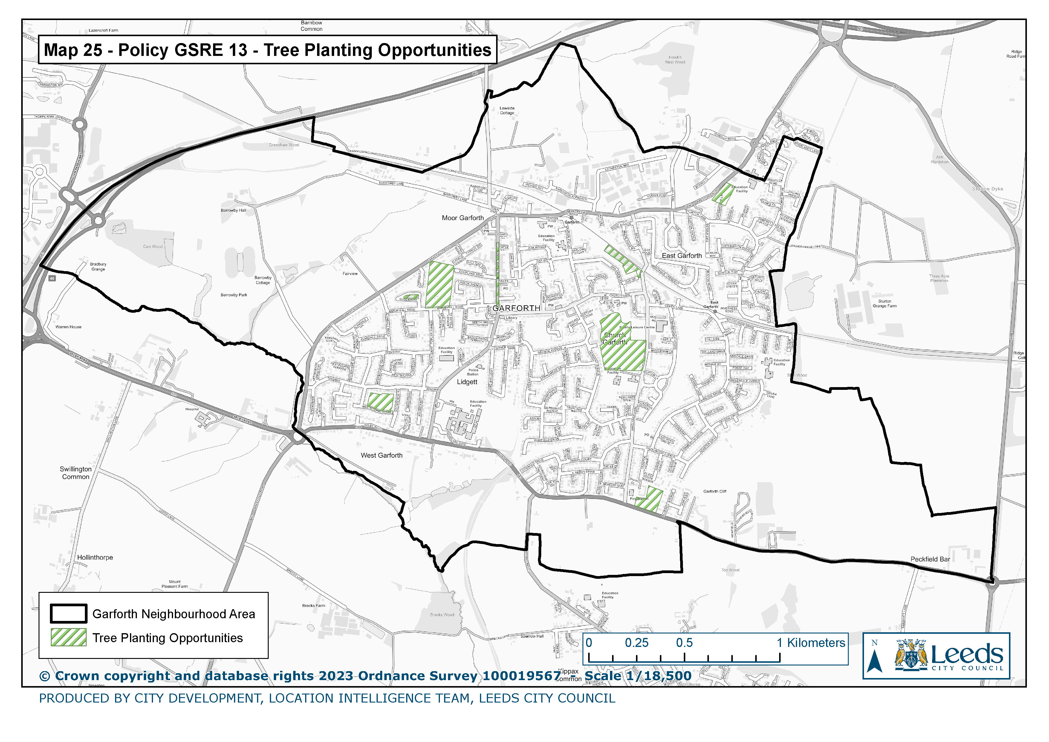
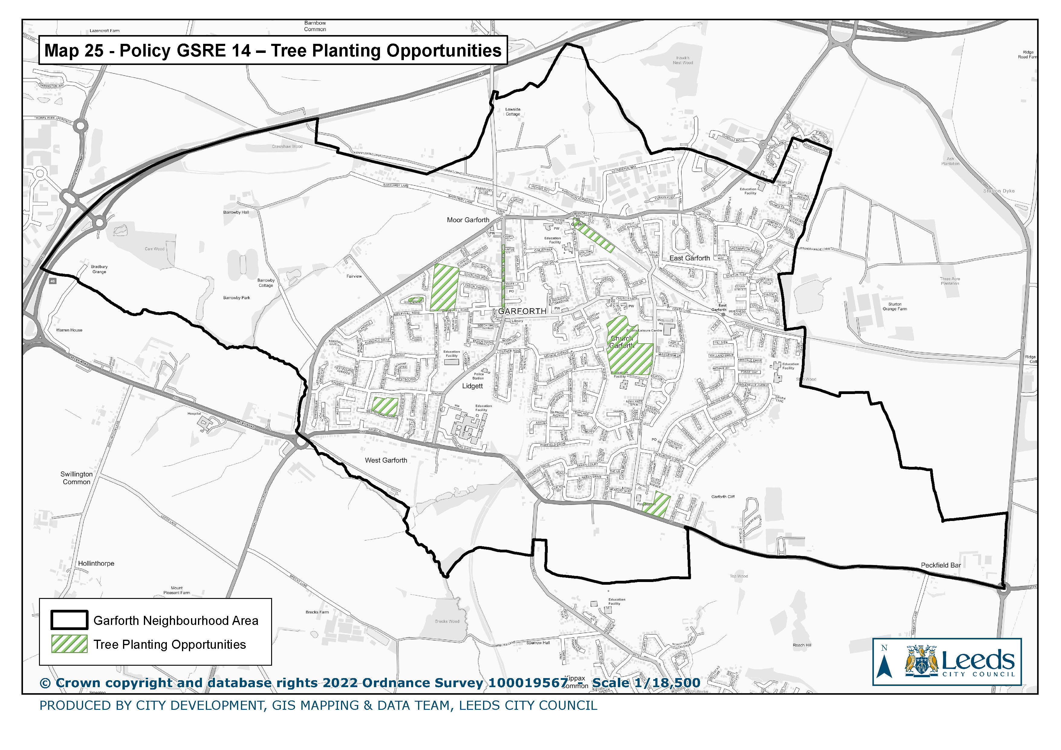
25. Policy GSRE 14 Tree Planting Opportunities
|
|
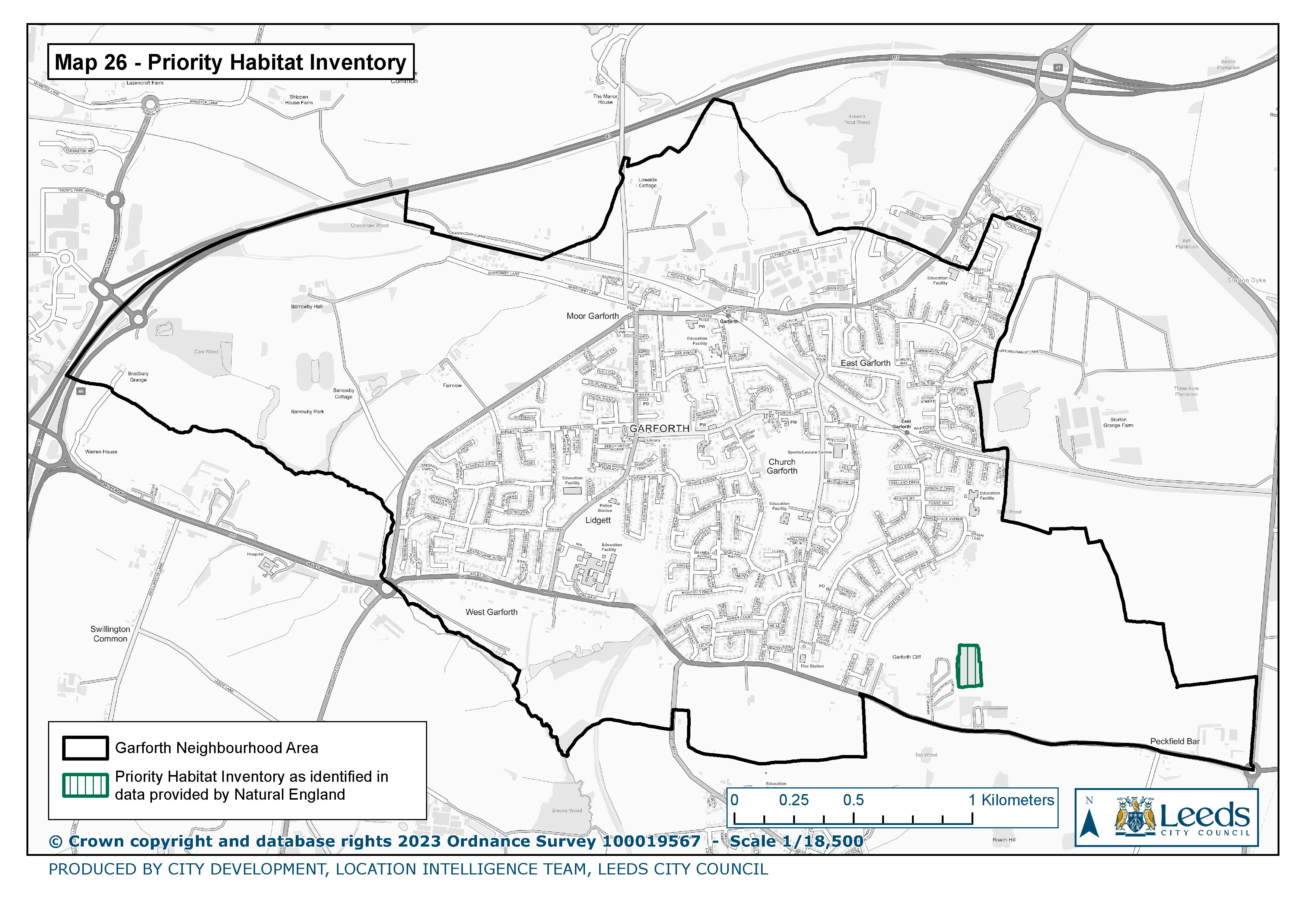
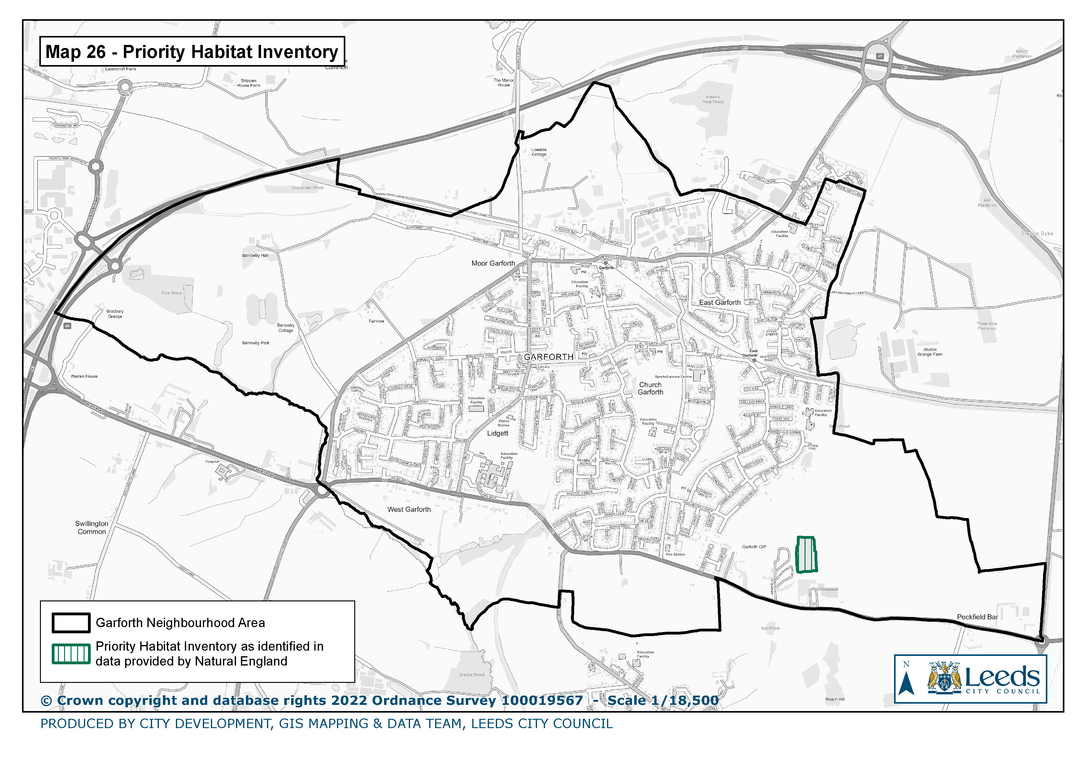
26. Priority Habitat Inventory
|
|
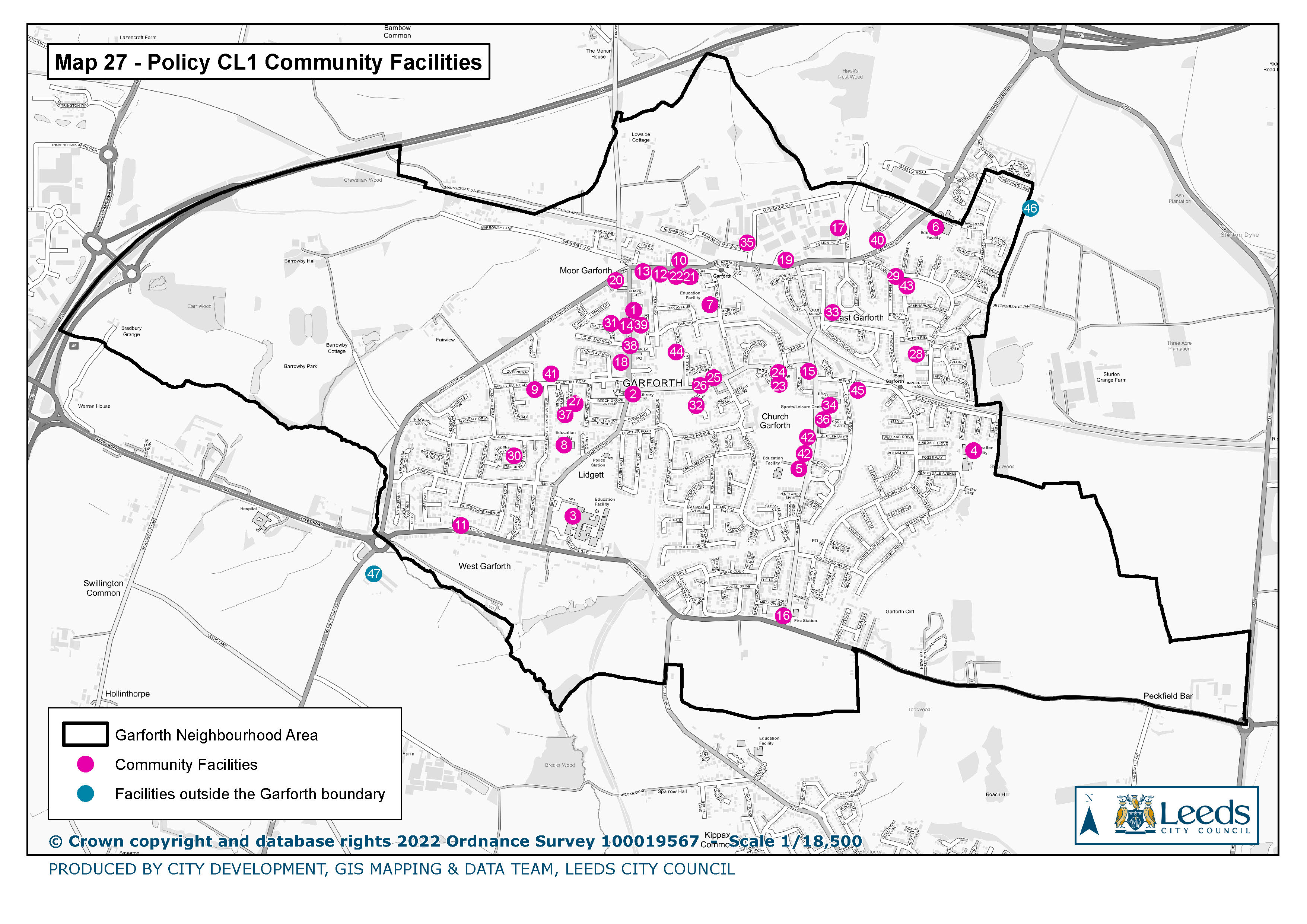
27. Policy CL1 Community and Leisure Facilities
|
|
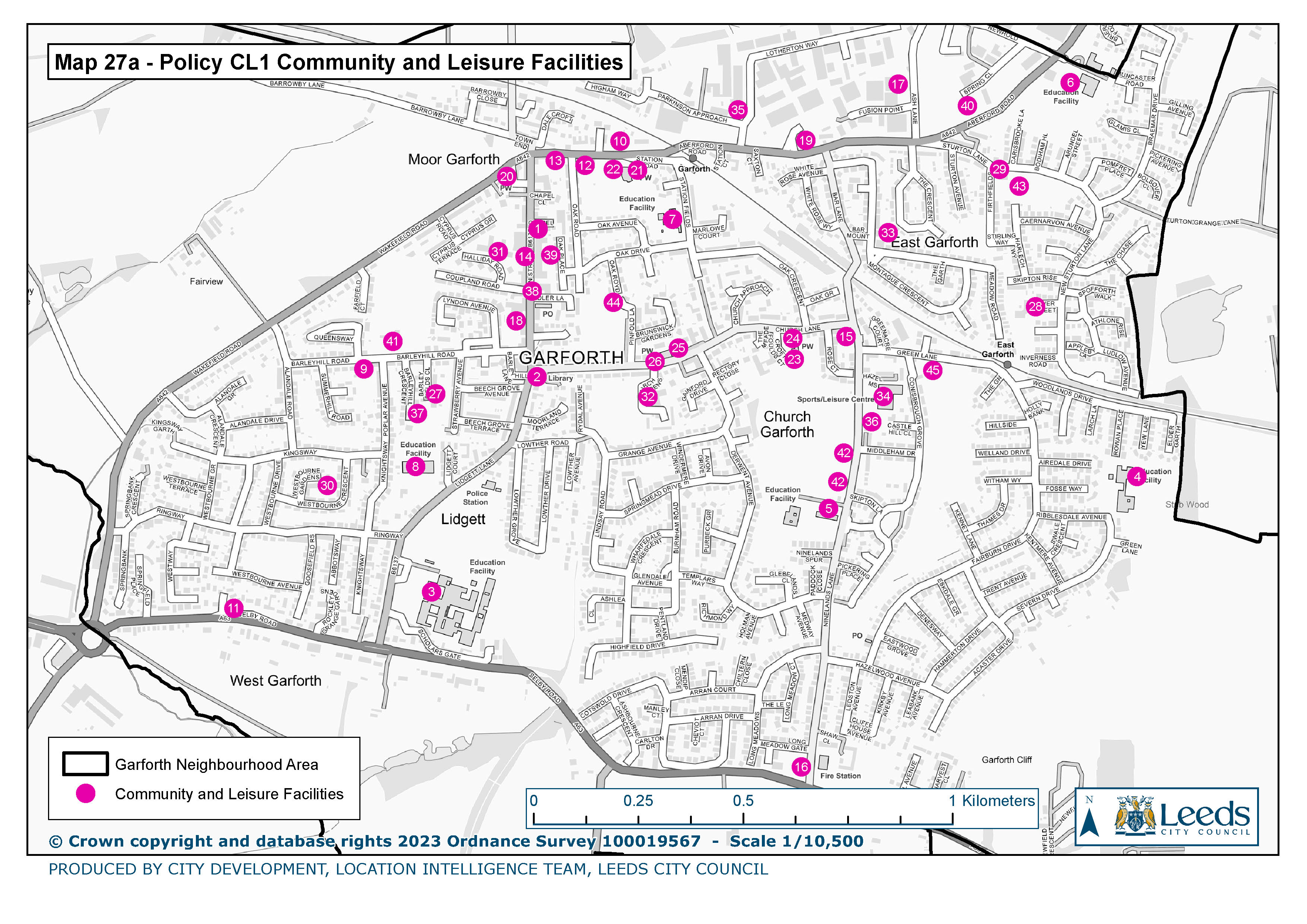
27a. Policy CL1 Community and Leisure Facilities
|
|
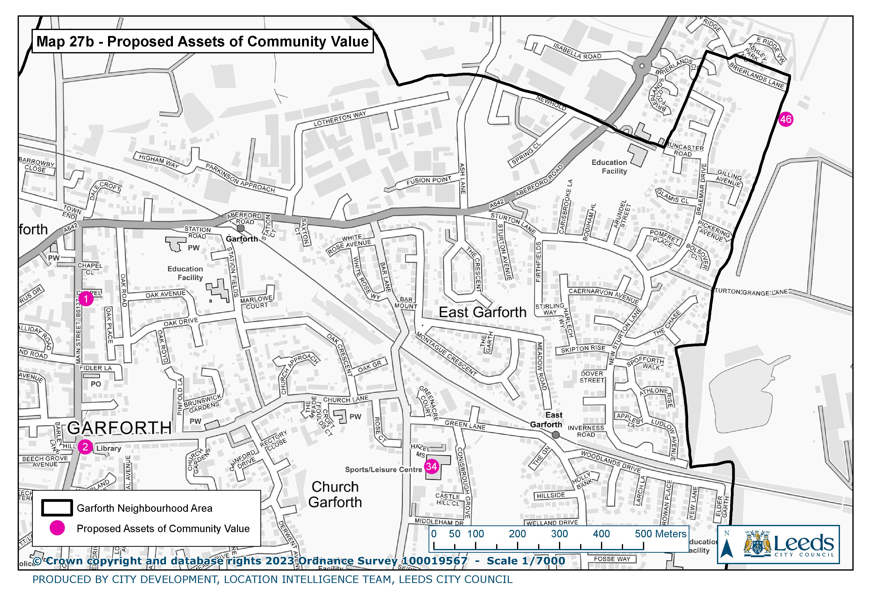
27b Proposed Assets of Community Value
|
|
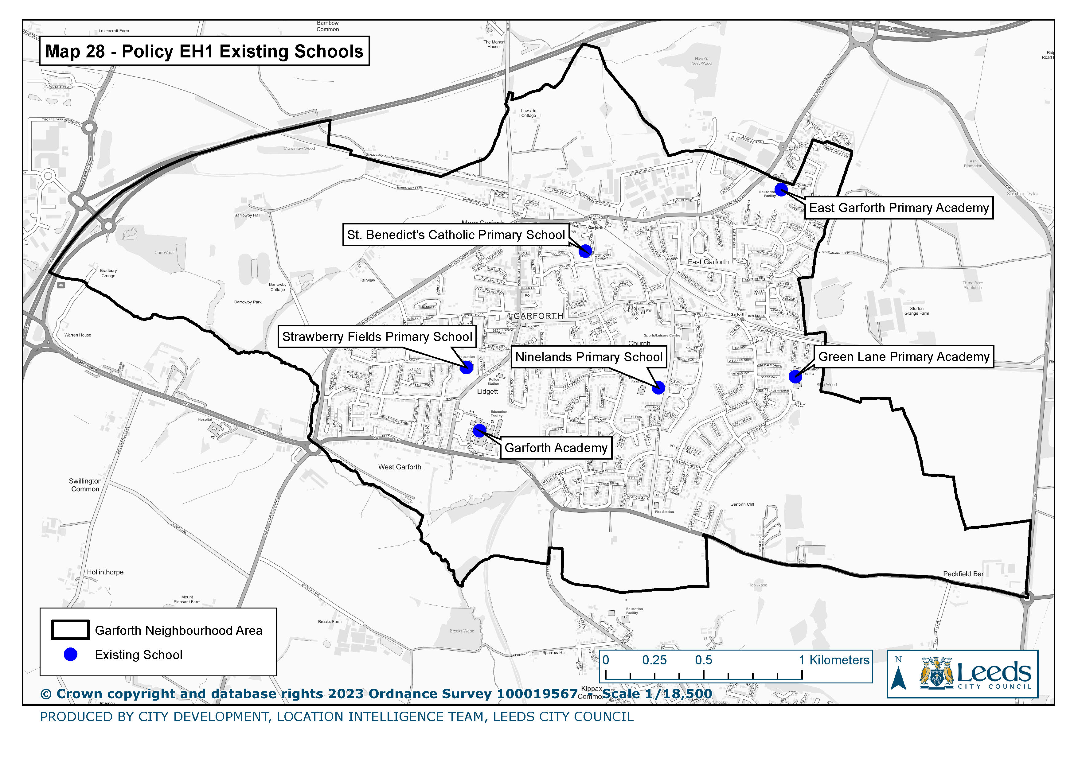
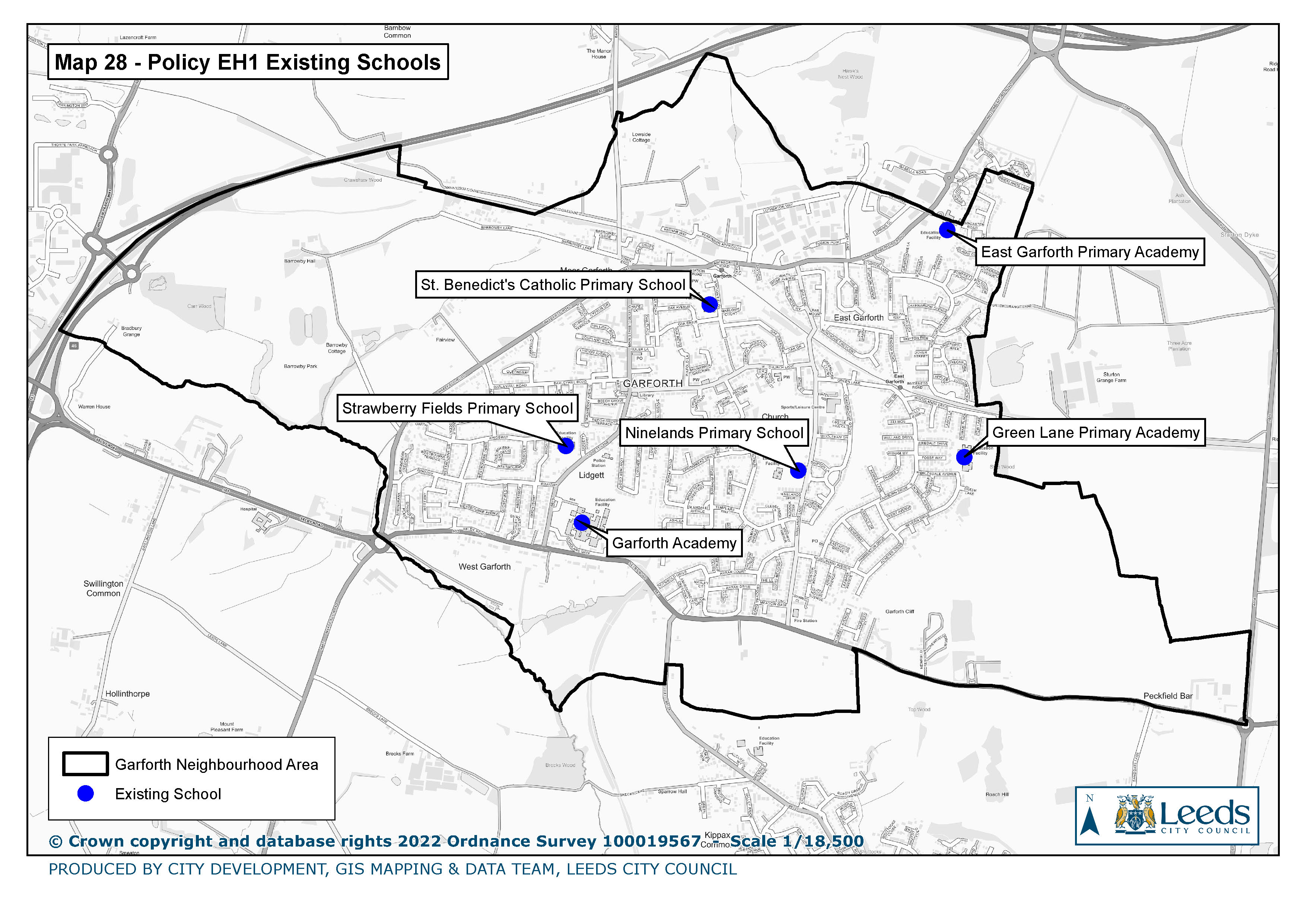
28. Policy EH 1 Existing Schools
|
|
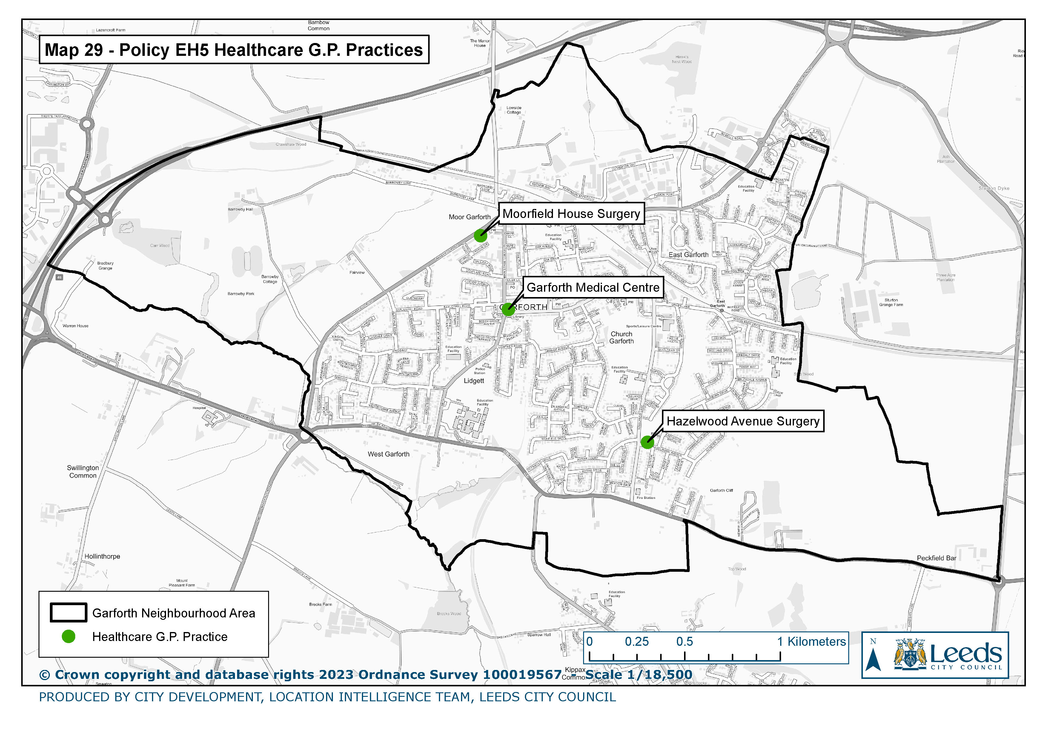
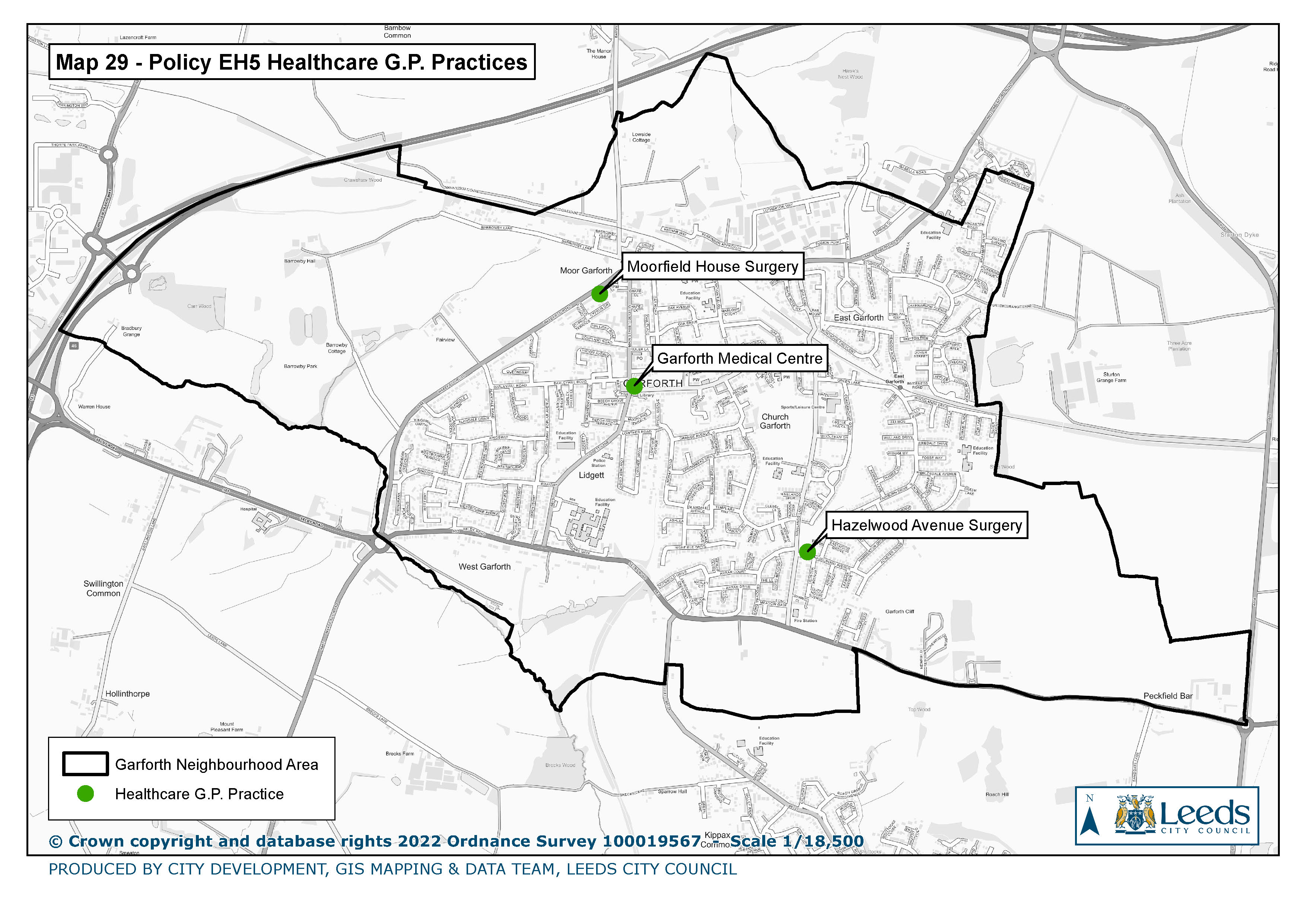
29. Policy EH 5 Healthcare GP Practices
|
|
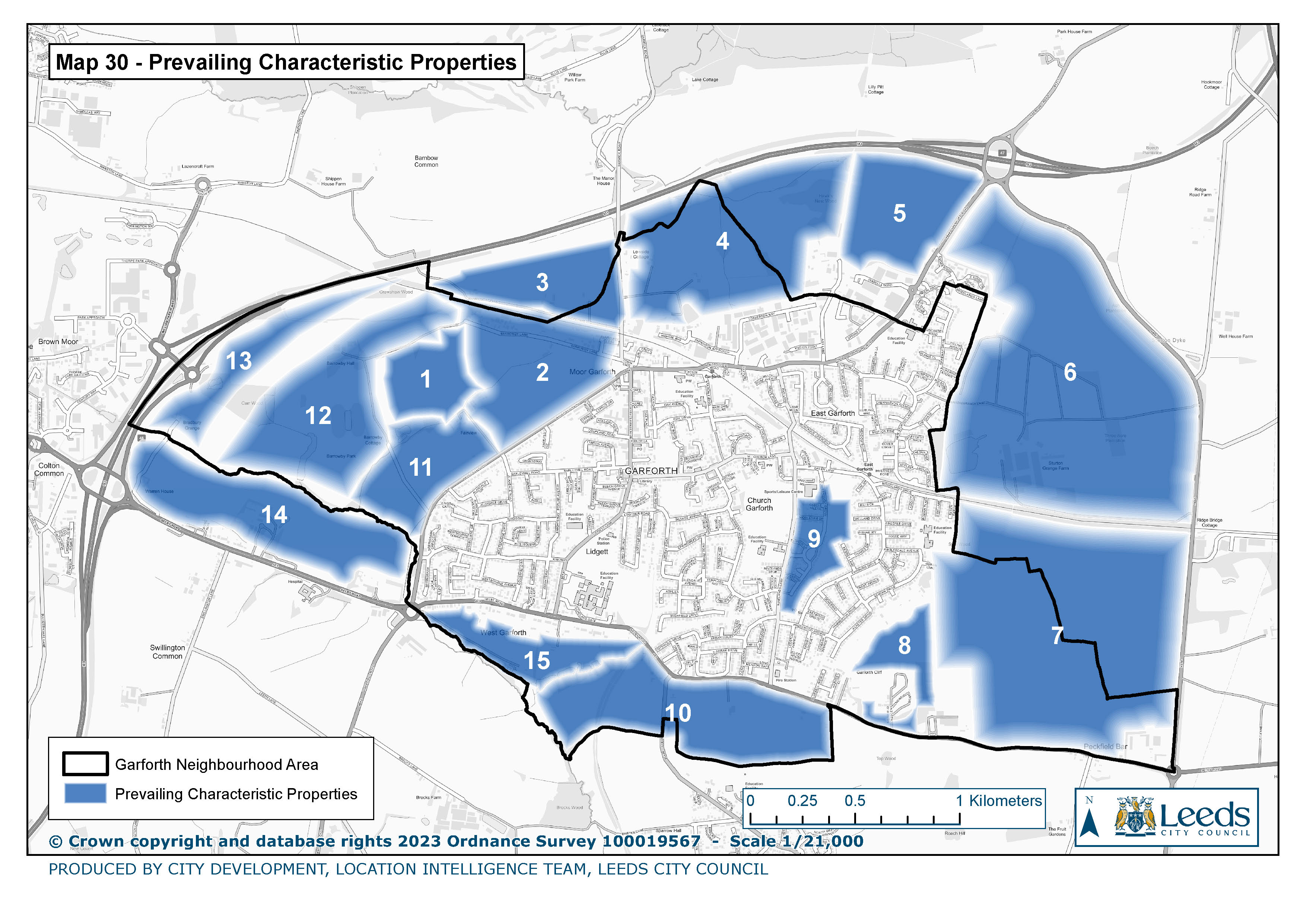
30. Prevailing characteristic properties
|
|
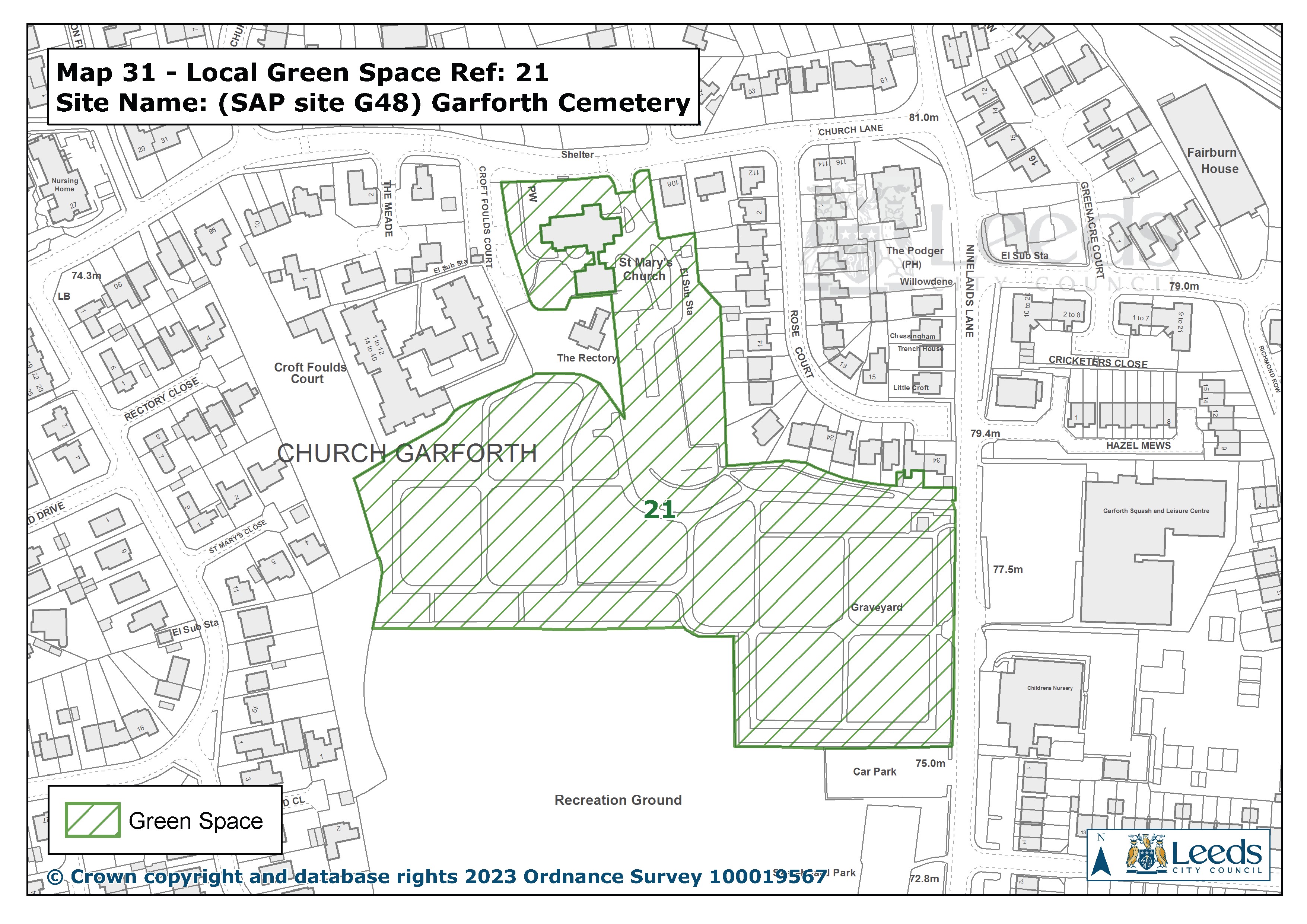
31.SAP site G48 Garforth Cemetery
|
|
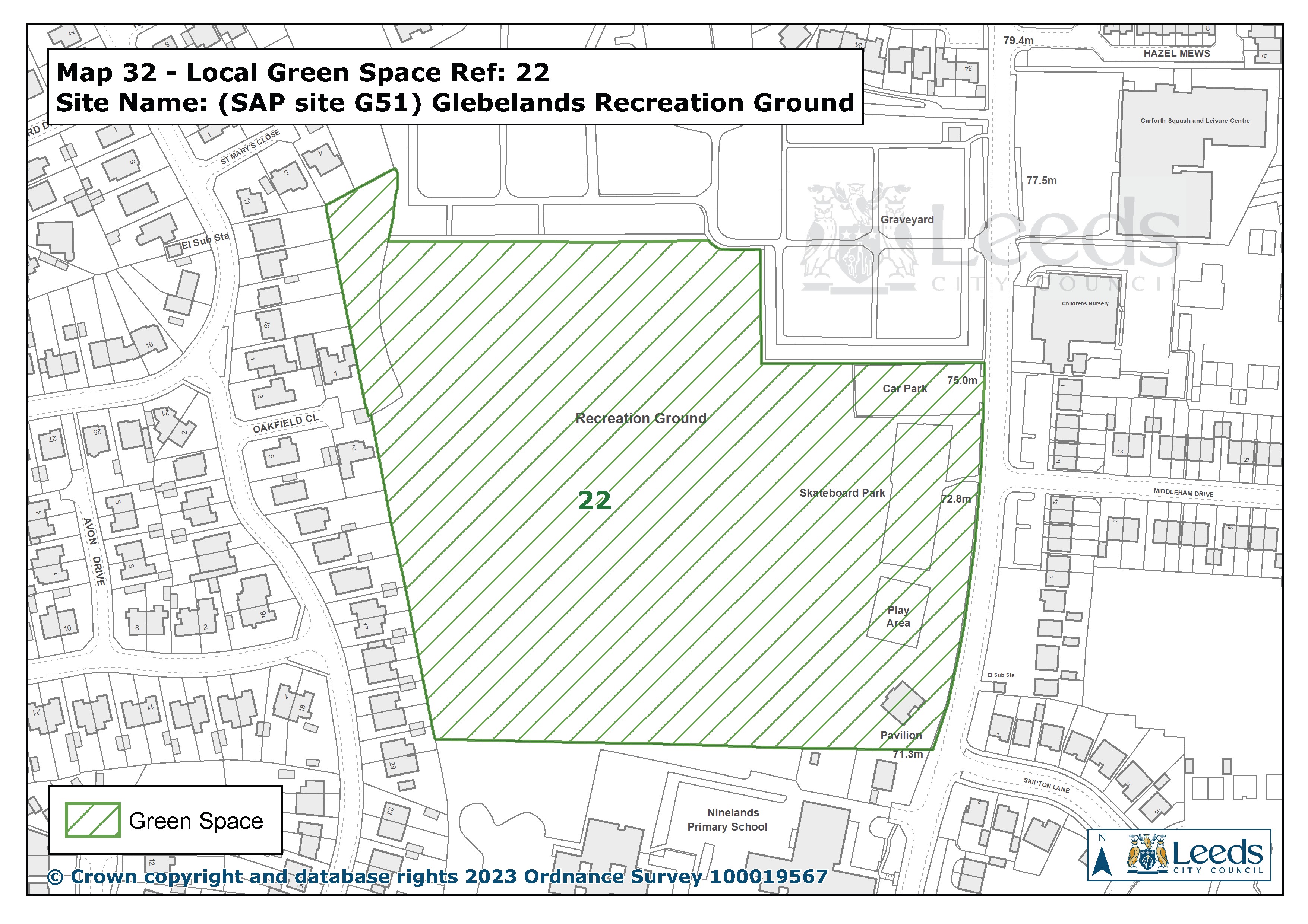
32.SAP site G51 Glebelands Recreation Ground
|
|
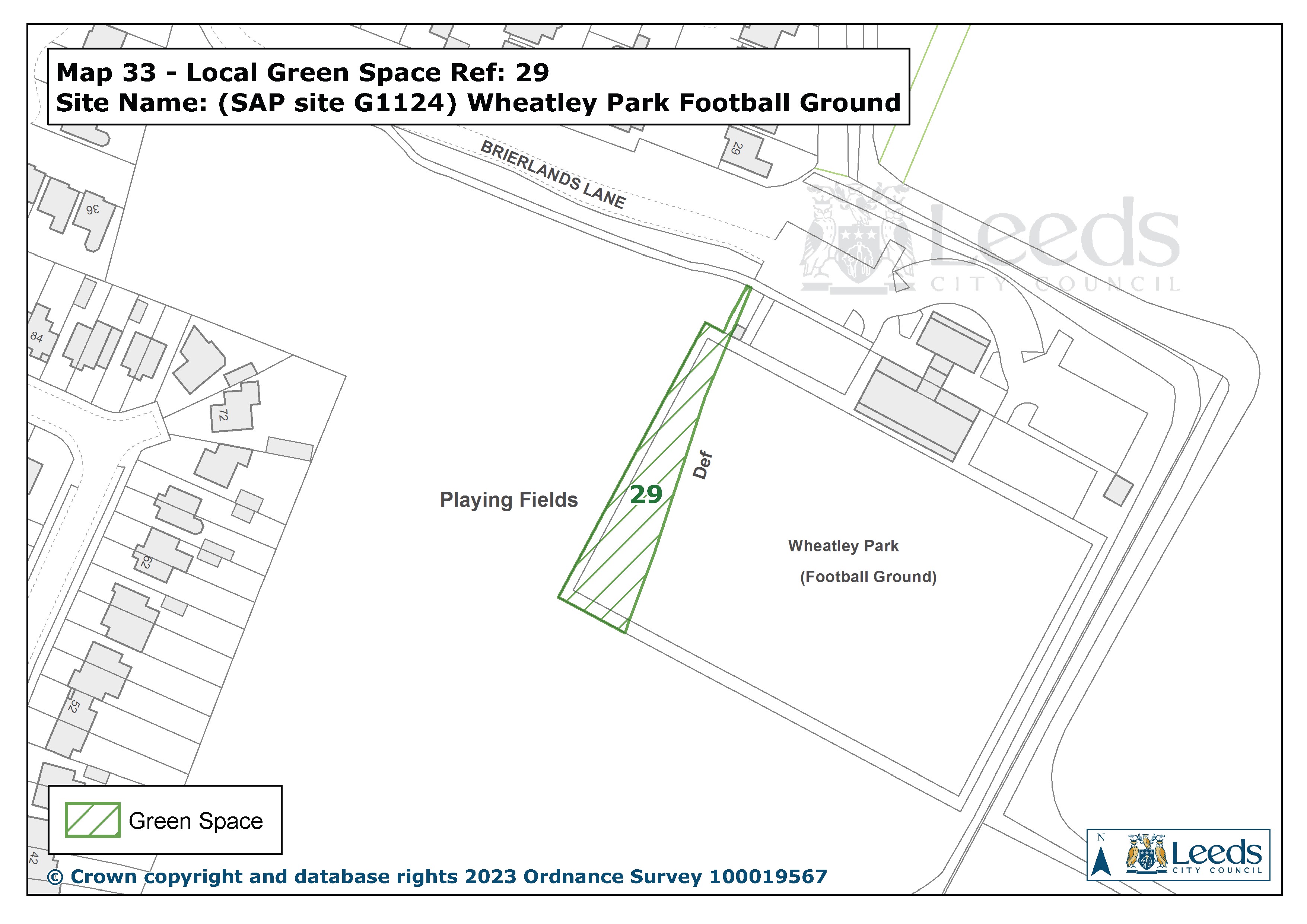
33.SAP site G1124 Wheatley Park Football Ground
|
|
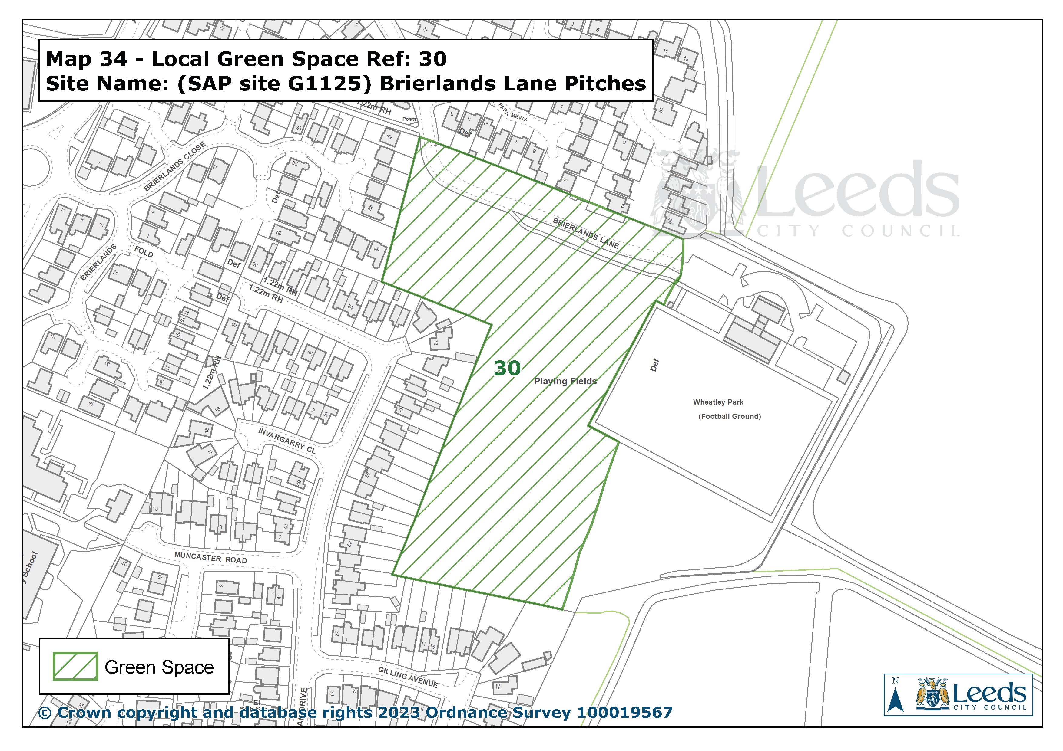
34.SAP site G1125 Briarlands Lane Pitches
|
|
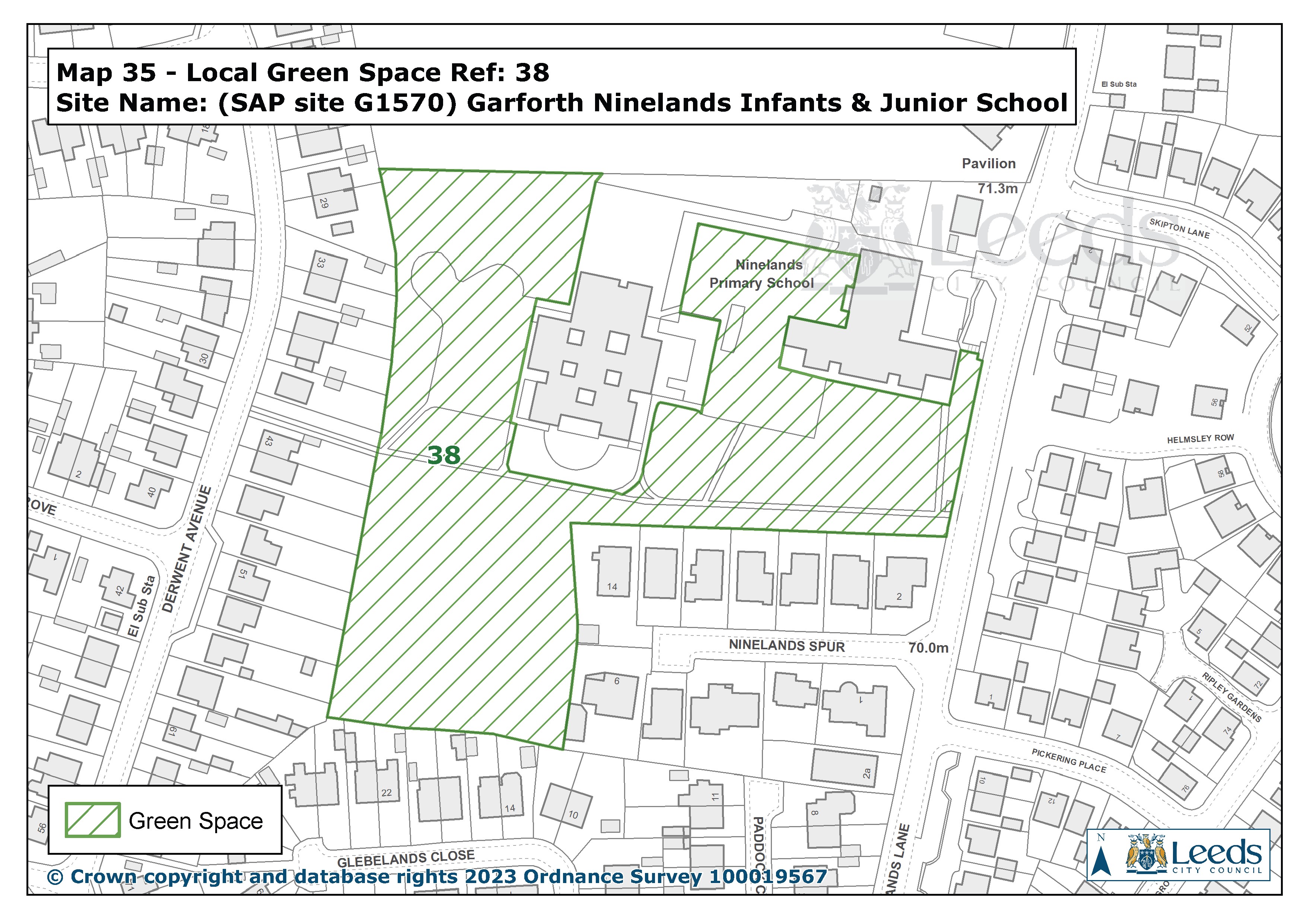
35.SAP site G1570 Garforth Ninelands Infants Junior School
|
|
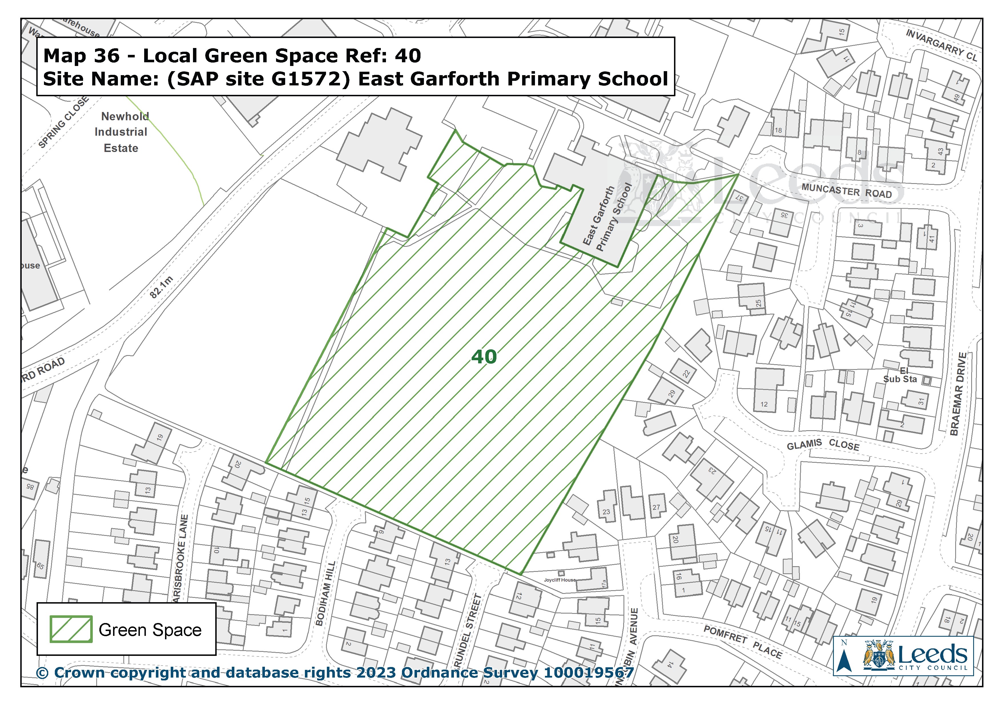
36.SAP site G1572 East Garforth Primary School
|
|
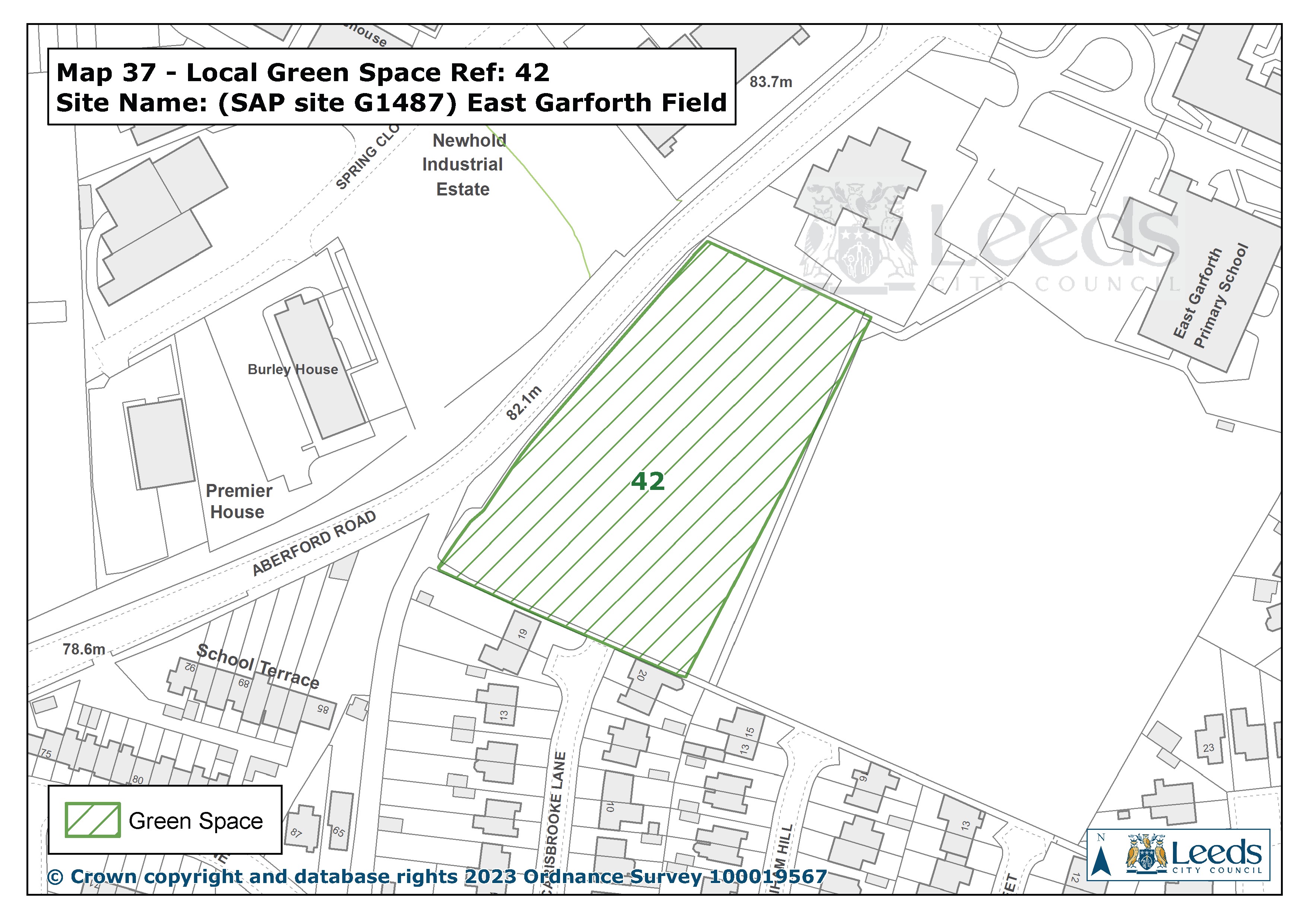
37.SAP site G1487 East Garforth Field
|
Previous Maps
Map1 Garforth A4 NA Boundary
Map2 Policy HBE 7 Lin Dyke Catchment Area
Map3 SAP Employment and Housing Sites
Map4 Policy HBE 9 Garforth Character Areas
Map5 Listed Heritage Assets
Map6 Policy HBE 13 Non-Listed Heritage Assets
Map7 Policies BETC 1 - Employment Land and BETC2 Employment Opportunities
Map8 Policies BETC 4, 5, 6, 7 and 9 Town Centre
Map9 Policy BETC 8 Town End
Map10 Policies BETC 4, 5, 6, 7 and 9 Town Centre Parking
Map11 Policy GSRE 7 and 8 Public Rights of Way
Map12 Green Belt in the Garforth Area
Map13 SAP Designated Green Spaces
Map14 GSRE 4 Improvements to Green Spaces
Map15 Policy GSRE 3 Children’s Play
Map16 Policy GSRE 1 Local Green Space
Map17 Policy GSRE 5 Protecting Green Corridors and Policy GSRE 8 The Lines Way
Map18 Policy GSRE 6 Green Infrastructure Opportunities
Map19 Special Landscape Area
Map20 Strategic Green Infrastructure
Map21 Policy GSRE 13 Landscape Character Key Views
Map22 Policy GSRE 10 Biodiversity and Leeds Habitat Network
Map23 Policy GSRE 11 Agricultural Land Classification
Map24 DEFRA Agricultural Land Classification 2012
Map25 Policy GSRE 14 Tree Planting Opportunities
Map26 Priority Habitat Inventory
Map27 Policy CL 1 Community Facilities
Map28 Policy EH 1 Existing Schools
Map29 Policy EH 5 Healthcare GP Practices
Map30 Prevailing Characteristic Properties
Email - garforthplan@gmail.com Telephone 07769 819906
